
Zirkel Circle Trail: The Unmatchable Colorado Hike
This page contains affiliate links. If you make a purchase via a link on this page, we make a small commission at absolutely no extra charge to you. Thank you for your support of this small women-led business.
Experience the BEST of nearby Steamboat Springs hikes - Zirkel Circle
The Zirkel Circle near Steamboat Springs is one of the most beautiful loop hikes in the Mount Zirkel Wilderness. Learn how to tackle this 11-mile trail with our complete hiking guide.
Hiking in Steamboat Springs and surrounding areas is always a treat - especially in the Mount Zirkel Wilderness.
Hiking near Steamboat Springs in the Mount Zirkel Wilderness is just about perfect. With over 159,935 acres of protected land to explore, there is such pristine mountain land to discover.
One of the best “secret” trails is Zirkel Circle. The Steamboat Spring locals have hiked this nearly 11 mile loop throughout the years.
Known for its stunning views of the Park Range mountains including Mount Zirkel, the highest peak in Routt County and Big Agnes, Zirkel Circle is part of favorite Steamboat Springs hikes.
We found ourselves at the Slavonia trailhead one rainy September morning, prepared to head out for a great Colorado hike.
Little did we know what awaited!
Layered in fog and dripping rain, we started counterclockwise along the Gold River, encountering the best hiking near Steamboat Springs.
Climbing over logs, stopping for waterfall pictures, walking through rocky terrain and seeing the absolute majestic views from Gilpin Lake, hiking Zirkel Circle is at the top of the best Colorado hikes we’ve ever done.
Make time for the many picture taking moments along the Zirkel Circle Loop.
Zirkel Wilderness was named after German-born geologist Ferdinand Zirkel who moved to America looking for more gems in Colorado’s rocks — a name fittingly appropriate for this picturesque hike he would certainly have adored.
Mount Zirkel is the highest peak in the area, proudly showing off at 12,180 feet and namesake for Mr. Zirkel. Nearby Big Agnes mountain sits at 9,852 feet. Some say this bountiful mountain’s name was from a woman of ill repute in a nearby town.
Hiking around Zirkel Circle gave us unforgettable scenic landscape that can only be experienced by exploring this part of Colorado’s wilderness.
Searching out destinations like these are what make hiking some of the most fulfilling moments! We think hiking in Steamboat Springs area must include Zirkel Circle Loop!
This hike is also featured in our 17 Best Hikes in Colorado.

Let’s Talk!
Pick our brains about hiking trails in Colorado. Book a one hour call with us and get knowledgeable advice and tips. We write curated itineraries too.
Table of Contents
Directions
Parking and Permits
Which Direction to Hike Zirkel Circle
Step by Step Trail Details
Gold Creek Lake
Gilpin Lake
Trail Details: Length, Elevation, Zirkel Circle map
Add on Hikes to Zirkel Circle
Hunting in Zirkel wilderness
Camping in Zirkel Wilderness
Steamboat Springs Activities
Where to Stay in Steamboat Springs
Where to eat in Steamboat Springs
What to Wear on Zirkel Circle Hike
What Gear to bring
Beginners hiking tips
Hiking in high Altitudes
Waiting for the fog to pass to see Mount Zirkel, the far right peak.
Zirkel Circle Loop Trail Information
The Zirkel Circle loop is located in the Medicine Bow Wilderness National Forest. Connected to Thunder Basin National Grassland, that’s a combined 2.9 million acres of trails to explore across Colorado and Wyoming.
Just over an hour drive from Steamboat Springs, the Zirkel Circle Loop’s 11 mile trail is some of the best hiking in Steamboat Springs area.
This trail has a lot of names including Gilpin Lake Colorado Loop and the Gilpin Lake Hike. In recent years, it’s become popularized in many outdoor magazines as simply Zirkel Circle.
Join us on this epic Steamboat Springs hike! We give you all the details from where to start, what direction to go and when to take a rest break!
How do I get to Zirkel Circle from Steamboat Springs?
Directions From Steamboat Springs
Go west out of Steamboat Springs on US Hwy 40 to County Road 129 (Elk River Road). Drive 20 miles north to Seedhouse Road, just beyond the town of Clark. Turn northeast onto Seedhouse Road (aka Forest Road 400/County Road 64).
It is about 15 miles to the trailhead from this point. The second half of the drive is on Seedhouse Road, a rough gravel road. Take it for a SLOW 12 miles to the Slavonia Trailhead.
Ample parking at Slavonia Colorado trailhead for Zirkel Circle Hike
These 12 miles to the Zirkel Circle trailhead can be challenging to drive pending weather. We went in September, finding ourselves dodging potholes and large puddles.
In all, plan on at least an hour drive from Steamboat Springs to the Slavonia Trailhead.
Parking and Permits
After jostling and gyrating along Seedhouse Road, park in the large Slavonia Colorado trailhead. Two well maintained long drop toilets and marked signs welcome you to the area.
Grab your hiking gear, making sure to bring those trekking poles and head out.
This is the Zirkel Circle trailhead and some of the best hiking in Steamboat Springs area begins!
One Loop, Two Routes
From the Slavonia trailhead parking lot, you have a quarter mile to decide which route you want to head. There are two trails you’ll take, no matter which way you go: Gold Creek Trail (#1150) and Gilpin Trail (#1161).
Zirkel Circle Maps, trail information, animals to keep an eye out for and more are located at the Slavonia Colorado trailhead
ZIRKEL CIRCLE CLOCKWISE
Perhaps unsure you have the time or fortitude to make the entire loop, consider going clockwise toward Gilpin Alpine Lake. From the Zirkel Circle trailhead, it’s 4.5 miles to the lake, ending at 10,300’ elevation.
Going clockwise has pretty significant elevation gain (2,500’) spread out over 5 miles. The upside is overall this direction has fewer steeper sections.
If out and back is your plan, Gilpin Lake is the best turn around point. Consider doing the Gilpin Lake Colorado Loop for some amazing mountain viewing opportunities.
Our hope and encouragement is try to hike the entire Mount Zirkel Loop Trail!
MOUNT ZIRKEL COLORADO TRAIL COUNTERCLOCKWISE
We think the best way to see the beauty of Zirkel Circle is to hike it counterclockwise. While this route has a few very steep spots, particularly the mile before Gilpin Lake, the best views of alpine lakes, mountains and meadows are in front of you rather than behind you hiking this direction.
We chose to hike counterclockwise and will describe that route below.
Getting ready to begin the the Zirkel Circle Hike!
THE START - ZIRKEL CIRCLE TRAILHEAD
From the porta potties in the Slavonia Trailhead parking lot, start walking toward the large brown informational signs. The trail is very well marked.
About 1/4 mile from the Slavonia Trailhead, arrive at the trail registration station. It’s a small simple wood box with a roster and pen. Mark the date and time you head out. If you are planning on a Zirkel Circle backpacking overnight trip, make mention of that here.
On a super wet fall day, we chose to head counterclockwise toward Gold Lake.
Make the Choice - Right or Left
*1/4 mile
At this point, make the decision to head left or right. The junction is at 9,840’ - a great starting point for the day’s hike. As suggested earlier, heading counterclockwise gives you the best views but also some steep elevation to tackle, particularly between mile 4 1/2 and mile 7.
Continue along the Gold Creek trail. The Gold Creek flows steadily, offering quiet reflective moments and waterfalls. In summer months, this is an exposed trail so lather up with that sunscreen and wear a hat!
A well marked trail for most of the loop, some of the best hiking near Steamboat Springs is on this majestic Mount Zirkel Colorado Loop.
The Zirkel Wilderness begins around the 1 mile point into the hike when you are going counter clockwise.
Making it safely across this makeshift bridge on Zirkel Circle.
Log Crossing
*1.9 miles
At around mile 2, arrive at a creek crossing. Depending on time of year and water fall for that particular season, you might have a torrential river to cross or a small creek to hop over. On our fall hike, we met only a handful of people along this entire loop trail!
As we plotted how to cross this large creek with packs on, we spotted two hunters mildly frustrated with their lack of game caught and super soaked from 24 hours of torrential rain. Hanging out across the creek with triple the gear we had on, we curiously watched them traverse the log.
With some maneuvering across the large log, we made it safely to the other side.
One of many waterfalls along Gold Creek trail on Zirkel Circle Loop hike.
At this point, finding the trail was challenging. We choose to head left after the crossing, thinking we were on the right trail. Ten minutes and a whole lot of bushwhacking later, we looked up and found we were on a game trail just a few feet down from the real trail.
The rain had really picked up at this point and everything was dripping wet. Leaves had completely covered Gold Creek trail and despite having our map up, we had missed it.
Gold Creek Lake
*3.2 miles
Before you reach Gold Creek Lake, you’ll hike along the trail in a pine studded woods. Well sheltered from rain with tall statuesque trees, enjoy the shade this part of the trail offers. In fall, leaves layered the trail, offering cushy comfort to our feet.
We can’t wait to go back in summer months and see the wildflowers many rave about!
Approaching Gold Lake
Gold Creek Lake is stocked with trout. A great place to take a snack break, bring your bug spray for those pesky lake gnats. Once rested, head along the trail taking you north and west.
The Meadows
One of our favorite parts of the Mount Zirkel loop trail was the meadows. This high alpine area around mile 4.5 is simply stunning. You’ll continue to hike alongside water with vast mountain views.
Foggy mornings are simply stunning along the Meadows on the Zirkel Circle trail.
In the fall, the colors pop against the blue sky, bouncing off Flat Top Mountain. The second highest mountain in the Park Range, Flat Top Mountain rises to 12,118’ connecting to Mount Zirkel via Red Dirt Pass Trail.
Many climb Mount Zirkel starting at the Slavonia Trailhead. Pass the meadows and look for Trail #1150 for the trail to the Mount Zirkel peak.
This well marked trail sign marks the intersection of Gold Creek and Gilpin Lake trails.
Gold Creek Trail to Gilpin Lake Colorado Trail
*4.5 miles
Enjoy the meandering ascent through the meadow, preparing for the steep climb that comes a mile and quarter from Gilpin Lake. Once you arrive at the trail sign, intersecting Gold Creek Trail and Gilpin Lake Trail, the steep ascent begins.
Most of this trail is shaded but very rocky. We spent a fair amount of time dodging small boulders, scurrying around trees and relying upon our trekking poles to keep us upright.
A magical forest with switchback trails throughout, this is another lovely, albeit challenging part of the Mount Zirkel Colorado Trail.
The final push to Gilpin Ridge, hiking over large boulders at a steep incline.
Boulder Field
*around 6 miles
The final stretch to Gilpin Ridge is arduous. Completely exposed, we were thankful for the cloud cover. This Gold Creek drainage area is a rough mix of rocks, pebbles and large boulders.
While not a long section to tackle, climbing over large and small boulders is challenging. It’s a steep switchback to the ridge. Keep in mind, your reward is just over the ridge and it’s worth every painful step to get there!
Gilpin Lake Colorado Overlook
*5.95 miles
Views from Gilpin Ridge on Zirkel Circle hike
Cresting Gilpin Lake overlook is like opening a present on Christmas morning. You are expecting something nice but have not idea the absolute delight before you.
The main reason to take on Mount Zirkel Colorado Loop counterclockwise is for this view!
We spent almost 45 minutes in this spot, sitting on a large rock looking at the lake, in awe of the mountains surrounding it. Setting up our camera for a timelapse, we watched the fog roll over the Peak Mountains, wishing to see Mount Zirkel in all her adornment.
Hiking in Steamboat Springs areas like Zirkel Circle are something to exclaim about!
At this point in the hike, we had ascended 2,397’ in almost 6 mile in 3 hours, 15 minutes. While we averaged just under 2 miles/hour, our goal is always enjoy the scenery!
Sure, we could have hiked faster but why?
The Zirkel Circle Loop trail is one to savor, like a fine glass of wine. Stopping to soak in mountain views, take pictures of fall’s fabulous colors on simple leaves and lingering at a waterfall made this hike that much more special.
CoHH Tip! Take time to savor the moments on this hike. As a yoga instructor, I find myself often hiking trails wondering why I’m always in such a hurry. Grounding through the senses clears space in your brain to remember the small moments along the way.
The trail down along Gilpin Lake is lined with scrub oak and rocks.
Lake Gilpin
Hiking through the woods up the scenic drainage, with the gurgling creek, fall colors in the undergrowth, and splendid waterfalls make for an enchanting walk.
However, the star of Mount Zirkel Circle loop trail is Gilpin Lake. This 29 acre alpine lake’s water changes color. When clouds roll in, expect to see deep blues. On fantastic Colorado summer days with the sun shining bright, hues of blues and turquoise radiate.


Trail to Mica Lake Trailhead
The initial descent to the base of Lake Gilpin toward a large meadow is lined by a large slate rock wall. If you’re afraid of heights, don’t worry. You have ample trail space to walk.
Most of this trail is completely exposed to sun. We got caught in a substantial hail storm at this point, desperate to find a tree for cover. Right along the lake shore are several large pine trees.
Between Gilpin Lake and the saddle is around a 500 ft descent in less than a mile. The trail levels out and is mostly downhill from this point.
Enjoy the meandering Gilpin Trail views across the meadow before Mica Lake.
There are many downed trees to navigate around and over. Local volunteer and paid crews have made steady progress in clearing the debris. Wildfires swept over parts of Zirkel Wilderness, taking hold in the already downed trees from the 1997 Routt Divide Blowdown.
According to many local news source, this event happened when insanely fast 120 mph wind blew down trees along a 25 mile corridor, ravaging 20,000 acres. Once the dust settled, it was estimated 6 million trees had been downed.
Vibrant fall colors radiated from the plants along the Mount Zirkel Colorado Trail
The first set of wildfires hit this area just a few years later in 2002, burning about 2/3 of the blowdown.
There is active wildlife on the Zirkel Circle Loop throughout the hiking season. In early September, most of the large scary animals (aka bears in our opinion) had nestled down for their long winter’s nap.
Because of the more open nature of this area, the few groups of hunters we passed were spending a fair amount of time in this area.
Keep an eye out for wildlife in this stretch. While the bears had found their winter homes, elk and deer were roaming in September. Also keep an eye out for the fun river crossing about a mile or so before Mica Lake trailhead.
Parts of this side of the trail needed our full attention and balance. Trekking poles once again came in clutch, keeping us upright.

Mica Lake Trailhead
MICA LAKE TRAILHEAD
*9 miles
You can’t miss this detour hike. Instead of continuing along Gilpin Trail, you can divert to Trail #1162 to Mica Lake. This adds 8 miles total (4 miles one way) so be prepared with water, layers and fuel if you choose this addition.
Aspen Grove
*9.5 miles
The beauty of this part of the trail is especially stunning in the fall. Colorado aspens show off with yellow, red and gold leaves. Unfortunately the day we hiked Zirkel Circle, the rain had gotten to us.
Outracing the rain on Zirkel Circle
We were done!
Tanya sprinted that last mile to the car and I attempted some running pics of my own. We were soaking wet by the time we hit Slavonia trailhead.
While we were ready for a hot cup of coffee and dry clothes, the thrill of completing this epic Steamboat Springs hike was worth all the discomfort! We took over 200 photos throughout our hike. When all was said and done, we logged 11.38 miles, gaining 2,451 feet of in 5 hours.
Our Hike Stats via AllTrails
Zirkel Circle Hike Highpoints
Easily accessible by road
Trail is well marked and maintained
Mountain views are throughout the hike
Wildflowers in summer months, stunning fall colors in autumn
Trout fishing at two alpine lakes
Spur hikes to add more mileage and views
Dispersed camping options


How long does it take to hike Zirkel Circle?
We averaged 2 miles an hour, taking many picture stops and snack breaks.
It rained for almost the entire hike, the mud slowing us a bit. Extended time at both lakes is highly recommended, particularly at Lake Gilpin. An average hiker should plan a day for this hike, including the drive to and from the trailhead.
The hike itself should take 4-7 hours depending on speed of hike, breaks taken and weather conditions,
Rolling fog over Gilpin Lake on Zirkel Circle hike.
How high is Zirkel Circle Hike?
While mileage ranges from 10.4 miles to 11 miles depending on how many detours you take on Zirkel Circle, consider this a moderate to difficult hike.
For a more gentle incline, head clockwise. However, heading this way keeps the best views behind you. Going counterclockwise means some steady incline right before reaching Mt. Gilpin, but in our opinion, it’s 100% the best way to tackle Zirkel Circle.
If you’re wondering how high is Zirkel Circle hike, a good estimate is between 10-11 miles with elevation gains of 2300+ feet.
When can I hike Zirkel Circle?
Mount Zirkel loop trail is open year round. However, access to the Slavonia trailhead is unavailable throughout winter. Most people hike Zirkel Circle between July to October.
Depending on snow melt, the trail is usually accessible by early June. However, with unassisted river crossings required throughout the hike, check with USDA Forest Service before setting out.

Fall beauty blooms on and off Zirkel Circle loop trail.
Add-On Hikes to Zirkel Circle Loop
Zirkel Circle BAckpacking
This epic 153 mile hike requires preparation, training and the right backpacking gear! Open from mid-June to early October pending snow fall, plan a week backpacking Colorado trails and enjoying the Zirkel Wilderness.
Mica Lake
Add 8 extra miles to Zirkel Circle with the Mica Lake detour. Headed counter clockwise, around mile 9 look for Trail #1162 joining from the right. Take this 4 mile, one way, detour to explore Mica Lake. With almost 2,000’ elevation gain, this is a challenging route to add to your day hike. Grab a backcountry camping permit and enjoy the views over a few days.
NOTE! With the rain we encountered for most of our hike, we did not make it to Mica Lake (Mica Basin Trail #1162), but the rangers told us it is an excellent side hike or camping destination (camping is allowed next to Mica Lake).
Mt. Zirkel
Bagging peaks is on many local and visitors hiking lists. Conquering Mt. Zirkel gives you stunning views from the highest peak in Routt County. Begin your hike counter clockwise on Gold Creek Trail #1150. Take a detour at the junction of Gold Creek Trail (#1150) and Gilpin Trail (#1161). STAY ON #1150 to Red Dirt Pass Trail (#1421).
*This hike is on our next summer to do list. We’ll be sure to post pictures and notes once we summit.
Can you hunt in the Zirkel Wilderness?
Yes, however, a Colorado state hunting license is required. We hiked this Gilpin Lake trail in early September and saw two groups of bow hunters. Stopping for conversation, both parties had been out for several days. They had secured one permit each for large game but had not seen anything.
If hiking during hunting season in this area, wear bright colors, tieing orange bandanas onto your backpacks.
Are dogs allowed in Zirkel Wilderness?
Yes, dogs are allowed in Zirkel Wilderness if they are leashed at all times or under voice control. While your little pooch might be the friendliest canine around, other animals and dogs might not be.
When hiking the Mount Zirkel Loop Trail, keep in mind that "dog-friendly" doesn’t mean a free-for-all. Your pup must be leashed or reliably under voice control at all times. Always check local regulations before you go, as rules can vary.
And remember—just because your dog is friendly doesn’t mean every other hiker or dog wants to say hello. It’s important to respect personal space, both human and canine. If your dog is out of sight, they’re not under control.
Keep your pet on a leash and pick up after them. Carry out all waste - human and otherwise!
Let’s keep the trail enjoyable for everyone!

Zirkel Circle Wilderness Trail Map and Disperse Camping Sites. Map public property of FS.USDA.GOV
Can I camp in Zirkel Wilderness?
Yes, dispersed camping is allowed in established areas.
Please review the Zirkel Circle Wilderness Trail map for specific restricted camping areas. Many enjoy adding bonus hikes to Zirkel Circle. While Colorado summers mean long sunlit hours, breaking up the hike into two days is a wonderful way to soak in the profound beauty this trail gives.
Keep in mind wilderness regulations. Campsites must be at least 100 feet from trails, lakes, streams, and any water source. Please use an existing site.
Leave No Trace whenever hiking or backpacking. It’s our job to keep the trails pristine for generations to come.
LOCAL TIP! For specific camping insights and the Zirkel Circle Map for hiking and camping, Friends of Wilderness offer up-to-date trail information.
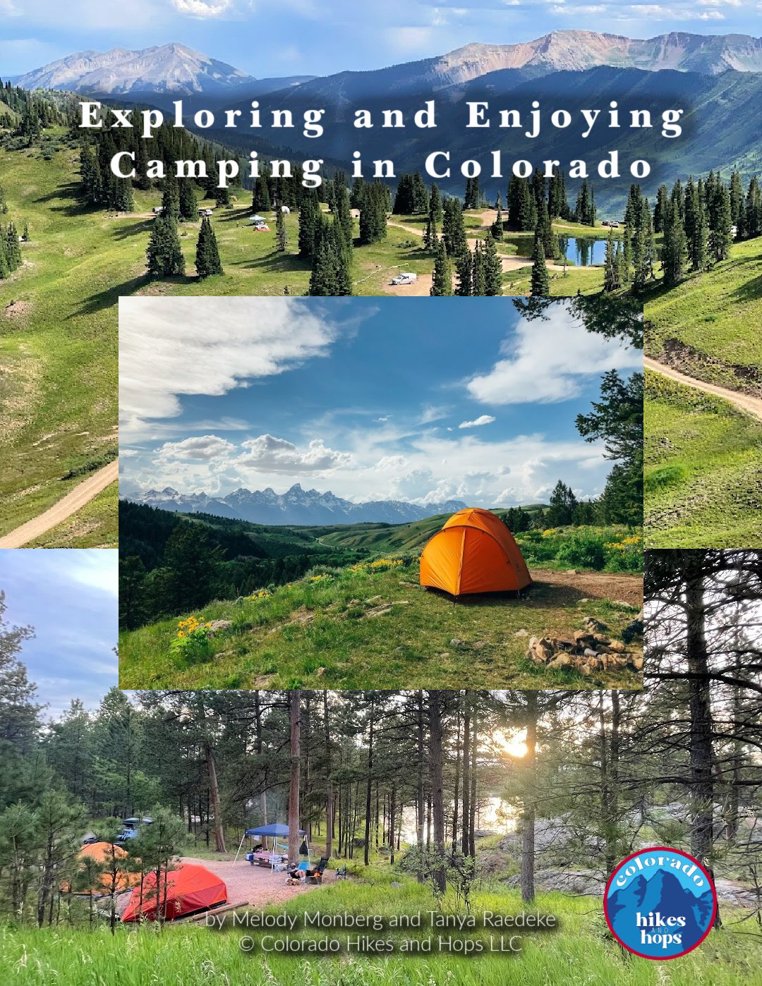
DOWNLOAD THE FULL GUIDE TO CAMPING IN COLORADO (PDF)
Together, we have over 50 years combined camping experience all over the world.
We know camping can be intimidating, especially when it comes to the right gear, finding campsites, cooking over a fire, and making sure everyone's having a blast.
Whether you're a newbie or a seasoned pro, fear not! This detailed ebook is your ultimate guide to Colorado camping. We’re spilling the beans and sharing all our best tips and tricks to make your Colorado camping trip unforgettable.
Our 65 full-page Exploring and Enjoying Camping in Colorado eBook (PDF) covers:
Types of Campgrounds
How to Practice Leave No Trace Principles While Camping (lnt.org/)
How to Book a Campground Online
Tips for Getting Last-Minute Campsites in Colorado
Our Favorite Campgrounds in Colorado
How to Set Up Your Entire Campsite
How to Set Up Your Camp Kitchen
11 Camping Recipes Everyone Loves
Cooking Over a Campfire
Camping Bin Checklists
Personal Camping Pack List
Things to Consider While Off the Grid / In Case of Emergency
And more!
Steamboat Springs Activities
Hot Springs in Steamboat Springs
Take a post hike dip in nature’s own whirlpool. Strawberry Springs is one of many hot springs in Steamboat Springs
After that 11 mile hike, reward yourself with a dip into one of many Steamboat Springs hot springs. In town Old Town Hot Springs is easy to walk from almost any lodging in the area.
36 S Lincoln Ave, Steamboat Springs, CO
We love nearby Strawberry Hot Springs, nestled in a mountain with insanely hot pools. Start at the top for a piping hot dip and work your way down, employing some European hot/cold therapy with the chilly 60 degree water next to the hot springs. This classic hot springs is just 7 miles from downtown Steamboat Springs.
44200 Co Rd 36, Steamboat Springs, Co
Fish Creek Falls in Steamboat Springs, CO
After spending almost two weeks in Steamboat Springs in summer and fall, we fell in love with this beautiful part of Colorado. We highly recommend spending at least 2-3 days in Steamboat Springs for hiking and hot springs.
Make time for Hahn’s Peak, some of the best hiking near Steamboat Springs. It’s a short and VERY STEEP hike up the mountain, giving you vast 360 views of the entire region. Plan a morning for this summer hike.
Along with famed hot springs, Steamboat Springs has Fish Creek Falls, a ginormous series of waterfalls just outside Steamboat Springs city limits.
If your legs and feet are sore, drive to the parking lot (parking fee required) and head to the concrete overlook for a few pictures. We highly suggest working through that muscle soreness with a hike down into the base of Fish Creek Falls.

Enjoy a cozy night at this beautiful cabin in Steamboat Springs.
Where to Stay in Steamboat Springs
A well known ski town, Steamboat Springs has many options for the overnight guest. On one of our trips, we spent a few days at a tiny house in the Steamboat Springs KOA. Located on the outskirts of Steamboat Springs, this tiny two bedroom home had everything we needed for a week.
Vacation rentals are favorite ways to enjoy a Colorado mountain town. With downtown Steamboat Springs easily accessible, there isn’t a good or bad area to book a place to stay.
In summer months, many vacation homes near the Haymaker Golf Course offer gorgeous views of the mountains. You might even catch hot air balloons while standing on the balcony.
Smell that Bread Bakery in Steamboat Springs, CO is a must visit!
Where to Eat in Steamboat Springs
One of the best parts of long arduous Colorado hikes is the reward of food! Steamboat Springs has so many new and legendary restaurants. While there are many opinions about the best restaurants in Steamboat Springs, here’s a few of our favorites.
Breakfasts Fit for Zirkel Circle Hikers
SMELL THAT BREAD BAKERY: Locally owned and run, this bakery is a stand out winner with insanely fresh pastries, sourdough breads, breakfast sandwiches and strong coffee. Smell That Bread has odd hours in off season so check their website. The almond croissants are so good we bought many to go! 135 11th St, Steamboat Springs, CO
COLORADO BAGEL COMPANY: The day we hiked Zirkel Circle, Smell that Bread BAkery was closes. Our disappointment was quickly quelled when we arrived at Colorado Bagel Company. Enormous bagel breakfast sandwiches satisfied our hungry tummies, setting us up for a great hike. 1815 Central Park Drive
Steamboat Springs, Colorado 80487
Clark Store is a great place to stop after hiking in Steamboat Springs area.
Lunch Choices in and nearby Steamboat Springs
SEEDZ CAFE: Known for their locally sourced green menu, Seedz Cafe is destination #1 for healthy and yummy lunch food. It caters to all types: meat lovers, vegan and vegetarian. 1117 Lincoln Ave, Steamboat Springs, CO
CLARK STORE: On your way back from hiking Zirkel Circle, make a stop at Clark Store. This old fashioned mercantile serves up some of the best hot sandwiches in the county. In the summer, head round the side to get a double scoop of locally made ice cream! 54175 RCR 129, Clark, CO
Salt and Lime’s guac and salsa with homemade chips is the perfect post hike food!
Dinner spots for those “I’m starving after hiking Zirkel Circle” moments
SALT AND LIME
A boisterous and exuberant atmosphere with high tops and long tables, Salt and Lime has quickly become one of our favorite must stops every time we are in Steamboat Springs. Happy hour is a great way to sample custom cocktails at a lower price point. 628 Lincoln Ave, Steamboat Springs, CO
MAMBO
Nothing fills an empty hiker’s stomach like a big plate of Italian pasta. Mambo is known for its homemade pastas. Have a big appetite when you head here!
521 Lincoln Ave, Steamboat Springs, CO
LAUNDRY
An upscale restaurant, you can’t go wrong with anything on this menu. Make sure to reserve a table on busy summer nights. With options for small plates, sample many of their quintessential dishes.
127 11th St, Steamboat Springs, CO
STORM PEAK BREWERY
Sample one of the 20 barrel brewed beers at this local brewery. Storm Peak Brewery is a great place to visit for a quick pint.
1885 Elk River Plaza, Steamboat Springs, CO
Sweet Treats
YAMPA ICE CREAM COMPANY
No matter what time of year, a sweet treat after a long hike is the cherry on top! Get a cone of locally made Yampa ice cream! 635 Lincoln Ave Unit U, Steamboat Springs, CO
CAFE DIVA
For a fancy dessert celebration, head to Cafe Diva for fantastic upscale treats. Gingerbread ice cream sandwiches and apple bourbon bread pudding are some local favorites to try. 1855 Ski Time Square Drive Steamboat Springs, CO
Layers are your friend on a fall Zirkel Circle Loop hike.
What to wear on a Colorado hike
Knowing what to wear on a Colorado hike like Zirkle Circle can be a guessing game. On the rainy and very cold September day we hiked the loop, we wore all weather gear. However, at points during the hike, it was hot enough for tank tops and pants.
Take the guesswork out of Colorado hiking with our handy dandy Colorado Hiker’s Capsule Wardrobe checklist.
Knowing what to wear and what to carry in your daypack will ensure a successful and fingers crossed, painfree excursion in Zirkel Wilderness, the best hiking in Steamboat Springs area!
One of the most gorgeous points along the Zirkel Circle Loop trail.
OUR GO-TO GEAR FOR COLORADO HIKING TRAILS IN 2025:
We love the Osprey Sirrus Hiking Daypack for women, or the Osprey Stratos version for men, for carrying water, layers, and snacks on Colorado day hikes
Free Fly’s High Mile Jogger is the perfect hiking pant! Comfy, stylish and durable!
Lightweight, versatile Hiking Poles built for a full day’s send on the trail — hike longer and stronger
2L or 3L Water Reservoir — This affordable reservoir is easy to fill
Patagonia Torrentshell - a true waterproof rain jacket and fantastic layering piece
Nano Puff Jacket - our favorite for 3 seasons in Colorado
Smartwool Glove Liners - the best all season gloves for those high altitude hikes
Salomon hiking shoes - waterproof, comfy and hard working for any type of hike
What gear do I need for the Zirkel Circle trail?
If we could recommend one piece of hiking gear in Colorado that will help your legs and knees go longer and give you more steadiness on rocky terrain, it would be trekking poles.
Caught in a hailstorm on Zirkel Circle
You can say goodbye to knee discomfort on the trails with hiking poles, enjoying a whole-body workout and reducing pressure by 25%.
Tanya invested in Black Diamond Distance Carbon Z Trekking Poles from Backcountry and they have made a huge difference navigating steeper terrain and enduring longer hikes. Melody uses the Black Diamond Trail Ergo Cork Trekking Poles.
Prefer earning REI dividends? Click the button below for our CoHH favorites!
Beginners Hiking Tips for Long Colorado Hikes
There are all sorts of guides out there for how to hike Colorado trails. Steamboat Springs hikes involve a fair amount of altitude, elevation gains and rocky terrain.
The final mile toward Gilpin Lake Colorado can be a doozy. Make it easier with essential hiking gear and a good daypack!
For those wanting to tackle Zirkel Circle backpacking, download our free guide to packing for a backpacking trip.
Essential gear for long day hiking near Steamboat Springs should include a few things. 90% of Search and Rescue incidents happen because of poor planning. Don't be caught unprepared on the trails!
Read our guide and find out what to bring when hiking Colorado for the perfect outdoor experience.
tips for tackling Steamboat Springs hikes like Zirkel Circle
CARRY A COMFY DAYPACK. Long Colorado hikes can get pretty dicey. Add an ill fitting pack to your back and you’ll want 24 hours in the hot springs! Assume you’ll be carrying at least 10 lbs with layers, water and snacks. We love Osprey’s Packfinder tool. It’s how we found our favorite packs - the Osprey Sirrus 24L. This little pack goes on every long and short hike with us!

Carrying an SOS until like the Garmin inReach mini brings peace of mind on long hikes like Zirkel Circle Loop.
BRING THE ESSENTIAL 10. Navigation, headlamp, sun protection, first aid, knife, fire, shelter, emergency blanket, extra food, water and clothes.
Hiking Rocky Mountain National Forest, a ranger shared with me that even on his off days, he never heads on a hike without these 10 items in his daypack.
HIKING SOLO? Consider a few extra steps to stay safe on the trail.
PERSONAL LOCATOR BEACON like the Garmin inReach mini creates peace of mind for you and your loved ones. Check out these top 11 options in the market. You never know when a rolled ankle or sudden snow storm might throw a wrench in your hike.
Having a way to get help FAST is important on long Colorado hikes and backpacking treks.
RELATED LINKS:
Layers are key for this Zirkel Circle Loop hike!
Do people get altitude sickness at Steamboat Springs?
Steamboat sits at 6,900’ above sea level. Parts of the town are over 10,000 feet’. All that height gives you some fantastic views but the air is thin and less oxygen is available.
If you’re visiting from sea level, expect to experience some altitude sickness symptoms. A headache, dizziness, shortness of breath and heavy legs are quite common.
These typically go away within 48 hours of arriving. Hiking in Steamboat Springs and nearby Zirkel Wilderness puts you at even more altitude.
Here’s the GREAT NEWS! You don’t need to suffer.
Altitude tips and tricks
Prehydrate: 2-3 days before your Steamboat Springs arrival, start hydrating, adding electrolytes.
Upon arrival, plan an easy day of rest and walking. Explore downtown Steamboat Springs, brush up on Wild West history at the Tread of Pioneers Museum or buy some great outdoor gear at local Ski Haus.
Keep your caffeine and alcohol consumption to a minimum. Hydration is your biggest tool to fight altitude.
While it might have rained the entire time, we enjoyed the best hiking in Steamboat Springs area - ZIRKEL CIRCLE!
As our smiles show, hiking in Steamboat Springs and taking on Zirkel Circle Loop was one of the BEST fall hiking days we had!
Have you done circled the Zirkel? If so, let us know what you liked best about the hike!
