
Hikes Along Guanella Pass 2026
Guanella Pass Scenic Byway is a 23-mile paved road connecting Georgetown and Grant, open late May through November. It's just over an hour from Denver and offers incredible hiking through the Mount Blue Sky Wilderness. We love Abyss Trail to Helms Lake—hike as far as you want, from 2 easy miles to the full 12.6-mile trek with epic fall colors. Mount Bierstadt is the classic fourteener here. Silver Dollar Lake and Square Top Lakes are shorter options with killer views. Get there early or go midweek—parking's brutal on weekends, especially during fall leaf-peeping season. Park only in designated spots.
This page contains affiliate links. If you make a purchase via a link on this page, we make a small commission at absolutely no extra charge to you.
Guanella Pass Hikes We Love
Guanella Pass is found in the Mount Blue Sky Wilderness (formerly called Mount Evans Wilderness) between the towns of Georgetown at the north end and the town of Grant at the south end, where US Hwy 285 intersects.
The Guanella Pass Scenic Byway totals 23 miles and follows an old wagon route that connected the mining towns of Georgetown and Grant, Colorado.
You’ll love exploring Colorado nature and wildlife in the heart of the Mount Blue Sky Wilderness, just outside of Denver.
We watched moose bathe in a small lake the morning we started on the trail leading to Mount Bierstadt (covered below).
For Fall 2026 Leaf Peepers, Guanella Pass’s location along the southern Front Range means peak colors will likely happen between mid-September and early October this year.
A moose bathes in the middle of the lake at the start of the trail to Mount Bierstadt
Guanella Pass begins from the historic silver mining town of Georgetown and snakes up the mountainside. This smooth, paved road is easy to travel by vehicle from end of May through the later half of November.
Drive from Georgetown to Grant, where you can hop on US Hwy 285 and check out Kenosha Pass as well.
Keep your eyes peeled for mule deer feeding in meadows — and big horn sheep too — as you cut through spruce, lodgepole pine and aspen forests.
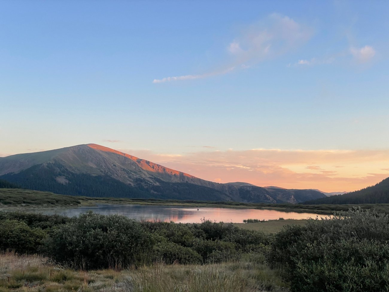
This scenic road hugs a beautiful creek and hits an apex of 11,700 feet. Enjoy the willows and Colorado wildflowers.
Numerous aspen groves combined with stunning views of Mount Bierstadt and Mount Blue Sky make Guanella Pass a top leaf-peeping destination.
In fact, there are several great hiking trails for summer, fall, and early winter. Only foot traffic is allowed on the pass in winter, as winter weather shuts the road down in late November.
While this post is all about Guanella Pass hikes, know that cross country skiers and snowshoers love this area too.
Parking on Guanella Pass in 2026
Camping and parking on Guanella Pass is only allowed in designated spots marked with "Parking" and "Tent" symbols. Please only park in these designated parking areas. Have a plan B personal shuttle arrangement or a plan B hike if you show up and cannot find parking.
When you park where you are not supposed to along the pass, it makes traffic even worse and could result in causing a crash. Please think of others!
In fact, for 2026, you’ll find newer “No Parking” signs have been installed along Guanella Pass to prevent illegal parking and ensure emergency access. According to Summit Daily, checkpoints will be set up on both sides of scenic highway if conditions become too crowded

The Gold Rush on Guanella Pass in Colorado
How close is Guanella Pass to Denver?
Guanella Pass is an excellent day trip from Denver as it is only 1 hour 15 minutes away. From Denver hop on I-70 W from Denver to the Georgetown exit #228. Follow the signs for Guanella Pass through Georgetown.
How close is Guanella Pass to Colorado Springs?
This Colorado scenic byway is approximately 2 hours 15 minutes from Colorado Springs by taking US-24 W and a windy, scenic CO-67 N to Deckers Rd in Douglas County. Then continue on Deckers Rd to Jefferson County, where you will turn left onto US Hwy 285 S. Finally, hop on on Geneva Rd. until you reach Guanella Pass Rd in Clear Creek County.
When is Guanella Pass open?
Guanella Pass Scenic Byway usually opens up the Friday before Memorial Day Weekend at the end of May and typically remains open through late November, depending on the weather and road conditions. Check road conditions here.
NOTE: You can download a map of Clear Creek County’s Guanella Pass.
Here, we’ll cover our favorite Guanella Pass hikes, as well as delicious local places to hop to after your hike for a cold beer and a tasty meal.
But first, let’s dish about some great places to lay your head in fun mountain towns near Guanella Pass.

Where to Stay Near Guanella Pass
Near the south entrance of Guanella Pass, the small mountain towns of Bailey and Jefferson are ideal spots for adventure bases. They are along Kenosha Pass.
Georgetown and Idaho Springs, Colorado sit neary I-70 at the north entrance of the scenic byway.
All are great locations for abundant Colorado hiking trails. Here are some 5 star examples:
Bailey
This cozy mountain lodge in Bailey awaits only minutes from Guanella Pass hiking. A spacious living room opens to high ceilings and large panoramic windows for wonderful mountain views! Enjoy the wrap-around deck and six-person hot tub for star gazing year round.
Jefferson
Between Guanella Pass hikes, relax in this 3 bedroom Jefferson, Colorado vacation home set on 100 acres of land with grazing pastures and spectacular views. Hike the famous Colorado Trail and cast your line in nearby Jefferson Lake. Jefferson is just fifteen minutes from the start of Guanella Pass in Grant.
Georgetown
Stay in historic Georgetown just a few miles from Guanella Pass hikes and all sorts of outdoor adventures in the Rocky Mountains year-round. Walking around this cozy old town is a real treat.
Idaho Springs
Idaho Springs is another historic Colorado mountain town offering remodeled historic vacation homes and fun local places for food and drink.
Indian Hot Springs in Idaho Springs is a sweet spot for families to enjoy hot springs in Colorado,

We know what to wear year round on Colorado hiking trails — tap on us above to see our list!
WHAT TO WEAR AND PACK FOR YOUR HIKE
How do you know what to wear and pack for Colorado hiking trails? Spend any time in Colorado and you’ll quickly learn to be prepared for any type of weather, no matter the season.
Here’s what keeps us going on our adventures while hiking in Colorado:
We love the Osprey Sirrus Hiking Daypack for women, or the Stratos version for men, for carrying water, layers, and snacks on Colorado day hikes
2L or 3L Water Reservoir — This affordable reservoir is easy to fill
Lightweight, versatile Hiking Poles built for a full day’s send on the trail — hike longer and stronger — these are especially great for middle aged adults like me!
Sun hoodie - a must have in Colorado
Med kit
Patagonia Nano Puff jacket great for layering and 3 seasons
Be prepared for afternoon storms with the waterproof Torrentshell
We’ve got your full checklist of daypack essentials here.
Guanella Pass Hikes We Love for 2026
Hiking along Guanella Scenic Byway is popular since it’s not far from Denver. June through October are the best months, and remember the road is only open late May through late November, depending on weather.
Let me be frank - these trails and this byway is POPULAR. It’s best if you can go during the week and get to trailhead parking lots early (6 am!) in summer.
Hiking with your kids? Pull them out of school, and go during the week to miss the crowds. You’ll be glad you did!
While many of the trails below are long, challenging hikes, you don’t have to hike the entire route.

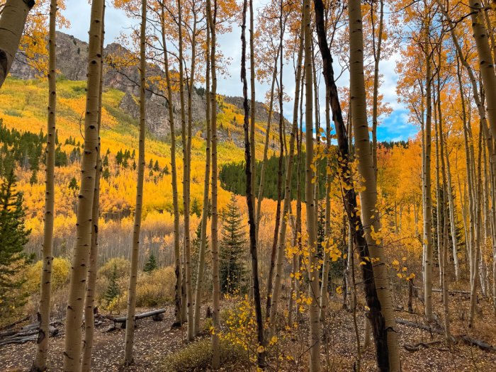
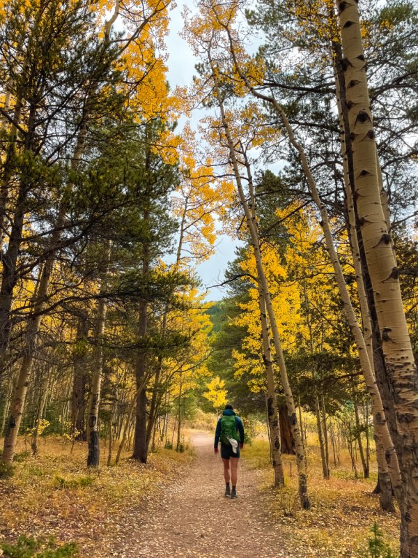
Abyss Trail in fall
Abyss Trail to Helms Lake
Distance: 12.6 miles Elevation Gain: 2,395’ Type: Out and back
Near Grant, Colorado, this Guanella Pass hike is popular and for good reason!
Now it might seem funny that we are sharing the longest, hardest hike first, BUT here’s why: For an easy hike, choose to wander just 2 miles in and turn around once you’ve had your fill OR hike nearly 2,400 feet all the way up to Helms Lake above treeline. Or, hike to treeline for amazing far-off views in so many directions.
Basically, you can choose between making this an easy, moderate, or hard hike, depending on how long you make your trek.
We hiked all the way to Helms Lake in mid-September for some of the best aspen leaf peeping in Colorado. The far-off views of large golden aspen groves are tough to beat in the Mount Blue Sky Wilderness.
This hike starts off on an easy enough path winding through aspen groves and forest. Eventually you’ll hug a stream for a while, with some fun crossovers.
In summer, the wildflowers are popping, and in fall, the leaf peeping is phenomenal within the groves and at tree-line.
Burning Bear Trail is another easy Guanella pass hike to check out.
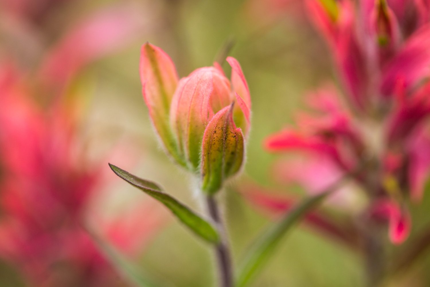
Wildflowers like Indian Paintbrush are plentiful on Guanella Pass
This is a popular backpacking trail and dogs are allowed on leash. In the fall, save this Guanella Pass hike for a week day to avoid the crowds. Leaf peeping is at it’s peak here around the end of September to early October.
How to reach the trailhead: From south Denver, take I-25 North to 470 West towards Grand Junction. Hop on US Hwy 285 South towards Fairplay. Drive 39 miles then turn right on Co Rd 62. The trailhead parking lot will be 5.1 up on the right hand side.
Where to hop to after the hike: The Shaggy Sheep in nearby Grant, Colorado came highly recommended by locals. Serving up a small menu of Mexican inspired dishes, they also make great cocktails. Grab a mimosa and then take a hand pie to go! NOTE: Check their hours (7am-3pm in the summer) and they do not serve breakfast in the winter. 50455 US Hwy 285 in Grant, Colorado.
Or drive a bit further to Bailey for a treat at Aspen Peak Cellars Winery - a lovely restaurant with indoor and outdoor seating right on the North Fork South Platte River. Local wine paired with shareable charcuterie boards, plus to-die-for made-from scratch entrees served in a European atmosphere. They often have live local music too. 60750 US Hwy 285, Bailey CO 80421

Guanella Pass hikes are tough to beat in Fall
Clear Branch Trail
Distance: 2.3 miles Elevation Gain: 550 feet Type: Out and back
A favorite trail for hiking, mountain biking and cross-country skiing, this one hike in Guanella Pass is great for families too.
It’s a short hike, but gains some elevation, giving your heart rate a boost.
The trail takes you through aspen groves, great for a short fall hike. Plus, you’ll see a waterfall along the trail.
Enjoy crossing over and hugging the South Fork Clear Creek here and there.
How to reach the trailhead: From Denver hop on I-70 W from Denver to the Georgetown exit #228. Follow the signs for Guanella Pass through Georgetown. Drive 3 miles to the designated parking spots for the Silver Dale Recreation Area. Take the Sporting Times trail for a short distance take your first possible right to follow the trail for Clear Branch Trail.
Where to hop to after the hike: Try the Dirty Chai at Georgetown Coffee & Tea. Or go for a breakfast burrito or authentic, homemade ramen. Two locations: 612 Sixth Street or 1200 Argentine Street in Georgetown, Colorado.
Looking for a Colorado beer? Try Guanella Pass Brewery or Cabin Creek Brewing.

Guanella Pass Brewery in Georgetown near the Guanella Pass Scenic Byway
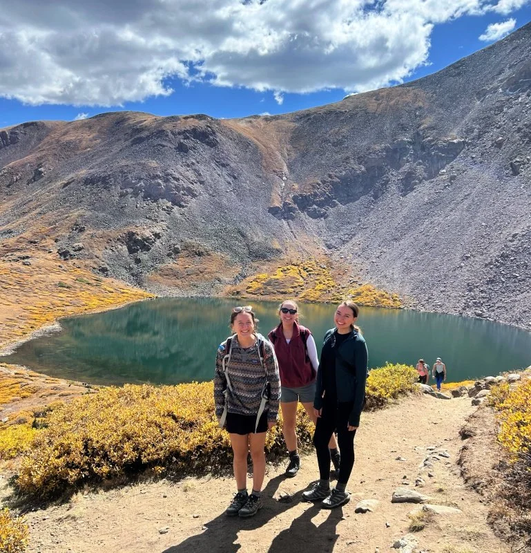
Hike to Silver Dollar Lake on Guanella Pass
Silver Dollar Lake and Murray Lake Trail
Distance: 4.2 miles Elevation gain: 1,080 feet Type: Out and back
This moderate Guanella Pass hike is an excellent choice close to Denver.
At the start, you can take the 0.4 mile walk on Naylor Lake Rd. to Naylor Lake if you want to add some extra mileage before you head off to see Silver Dollar Lake and Murray Reservoir.
Look up to see Square Top Mountain, looming 13,783 feet tall.
Fantastic views just before you aim downhill to Murray Reservoir. This hike is popular in summer, in fall for leaf peeping, and in winter for snowshoeing.
Hike through a forest filled with aspen, fir, pine and spruce before you reach treeline.
Enjoy the lakes and the waterfall at Silver Dollar Lake. It’s worth it to go all the way!

Head here on a week day for less crowds, especially in fall. Or get here early in the morning to score a parking space in the upper lot.
Allow yourself about 2.5 hours for this hike and bring layers in addition to your water and snacks.
How to reach the trailhead: From Georgetown, at I-70 exit #228, follow the signs for Guanella Pass through Georgetown. Nine miles in, turn right and head up the dirt road to the upper parking lot.
There are two parking lots; aim for the upper one if you can score a spot early in the day. Otherwise, park in the lower lot and hike up the dirt road to the trailhead. Four wheel drive is best for reaching the upper parking lot.
Guanella Pass Campground is just 1/4 mile from the trailhead.
Where to hop to after the hike: Head to Cooper's on the Creek in Georgetown, a casual gastropub serving high quality food in a warm and cozy diner. Try one of their 10 rotating craft beers and hand crafted artisan cocktails. 1500 Argentine St, Georgetown, CO 80444
South Park 600 to Square Top Lakes
Distance: 4.9 miles Elevation gain: 935 feet Type: Out and back
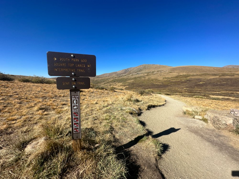
South Park 600 connects with the trail to Square Top Mountain
This short, hard hike along Guanella Pass Scenic Byway pays off in gorgeous views of Mount Bierstadt and Mount Blue Sky Wilderness.
Hiking boots are recommended, as it may be muddy and you could cross over water, depending on the season.
Pack a picnic for the lakes and enjoy the views. Consider going further and summiting Square Top Mountain, covered below.
How to reach the trailhead: Coming from Denver, take exit 228 off of I-70 W, then drive about 11 miles to the trailhead. The parking lot for Square Top Mountain trailhead is called Guanella Summit.
Where to hop to after the hike: We loved highly rated Guanella Pass Brewery for their brown ales, porters, IPAS, Saisons, and more. Two locations: 501 Rose St, Georgetown, CO 80444 and 18 Park Ave, Empire, CO 80438.
Square Top Mountain
Distance: 7.0 miles Elevation gain: 2,450 feet Type: Out and back

An amazing 360 view awaits at the top of Square Top Mountain in Colorado
For a bit of a longer, even harder hike than just going to Square Top Lakes, continue your climb, albeit a steep one to reach the top of Square Top Mountain, 13,785 feet.
A mix of forest and exposed hiking, this challenging hike pays off in fabulous views and three lakes.
The wildflowers are insane in summer. Can be windy, so pack layers accordingly.
Enjoy fantastic views of Mount Bierstadt and the Sawtooth Ridge.
Allow yourself about 4 hours to complete this hike. Make sure you are ready for hiking in high elevation.
How to reach the trailhead: Coming from Denver, take exit 228 off of I-70 W, then drive about 11 miles to the trailhead. The parking lot for Square Top Mountain trailhead is called Guanella Summit.
Where to hop to after the hike: Relax and soak your weary bones at Indian Hot Springs in Idaho Springs after your hike. 302 Soda Creek Rd, Idaho Springs, CO 80452
Safety Precautions while hiking any Colorado Trail
Plan Ahead: Always tell someone know where you’re going and when you think you’ll return. Leave a note on your car seat with the information as well.
Pack Essentials: Carry plenty of water, food, warm clothing, a map, a compass, a first-aid kit, a flashlight or headlamp, and a whistle for eveyone in your group
Stay on Designated Trails: Heading out on your own can lead to getting lost and can damage the natural environment.
Check the Weather: Weather in mountainous regions can change rapidly. Make sure to check the forecast before hitting the trail and be prepared for all types of weather. Be ready to ditch your plans and choose another adventure for the day.
Know Your Limits: You know you. You know your physical limitations and when it’s time to turn around. Speak up when hiking with your friends and turn back if conditions are too challenging.
Stay Alert: Be aware of your surroundings, including wildlife, changes in the weather, trail conditions, and your own health.
17 Colorado Hot Springs Calling for a Dip in 2026
Mount Bierstadt
Distance: 7.2 miles Elevation gain: 2,736 feet Type: Out and back

Summit of Mount Bierstadt in August
This challenging hike takes you up one of Colorado’s favorite fourteeners for newbies.
We spied moose bathing in the lake (0.6 miles in) before we began our ascent. The beginning of the hike includes sweet wooden bridges to carry you above the swampy places. But soon enough, you will be crossing the stream via a log. You’ve got this!
Don’t forget to stop and look up and enjoy the views as you make the climb! At about 1.7 miles in, the steep switchbacks begin. Then at 2.1 miles, the slope, or headwall, begins. At 2.6 miles in, you will begin to see the Sawtooth Ridge that connects Bierstadt to Mount Blue Sky.
The final quarter mile or so, you’ll begin to navigate boulders and make your way to the summit. Once at the top, enjoy the 360 views and snap some photos!

Climbing up Mount Bierstadt. The trail is easy to follow.
On a clear day, in addition to seeing Mount Blue Sky to the northeast, you can also make out two more fourteeners to the west: Grays and Torreys.
Don’t forget to pack your layers, a hat, plenty of water, snacks, and sunscreen.
Make sure you are ready for hiking in high elevation.
NOTE: A mandatory free self-issuing permit is required here in the Mount Blue Sky Wilderness. Free permits are available at each trailhead or entry point into the wilderness. Just be sure to fill it out before you begin your hike.
NOTE: We have mentioned views of Mount Sky, and Mount Blue Sky Highway is about an hour’s drive from Guanella Pass. Know that Mount Blue Sky Highway (formerly Mt. Evans) is closed to all travel (motorized and foot) through all of 2026.
How to reach the trailhead:
Guanella Pass Trailhead
The Guanella Pass Trailhead is located on the Guanella Pass Road and offers a variety of summer and winter activities. This trail provides access to the South Park Trail, the Rosalie Trail, and the Mount Bierstadt Trail (#711).
Easy to reach by car, you will park in a paved lot with a bathroom off Guanella Pass. Coming from Denver, take exit 228 off of I-70 W, then drive about 11.6 miles to the trailhead.
Where to hop to after the hike in Idaho Springs: Creators of the best mountain pie, head to Beau Jo’s in Idaho Springs for authentically delicious Colorado-style pizza. Can be busy, so be ready to wait - but you can walk along Main Street with your buzzer. 1517 Miner St, Idaho Springs, CO 80452
Or try the pizza at Sasha’s Alpine in Georgetown. 1106 Rose St, Georgetown, CO 80444
Rosalie Trail
Worth mentioning for those looking for another challenging hike along Guanella Pass is the point-to-point hike called Rosalie Trail. The Rosalie Trail* follows Deer Creek up to the saddle between Rosalie and Logan and ends at Guanella Pass.
Some choose to hike Rosalie Trail down by dropping a car at the Deer Creek parking lot then driving to the top of Guanella Pass to begin.
Starting at the Deer Creek trailhead near Bailey, you'll see a sign for one trail taking you on both Rosalie and Tanglewood. Hike on Tanglewood for one mile, and then you’ll see the new connection for the Rosalie on your left, well-marked.
Here are more hikes near Denver, besides the ones we’ve mentioned here along Guanella Pass.
RELATED: Tackling Majestic 13ers in Colorado: With towering peaks, breathtaking vistas, and a sense of accomplishment like no other, conquering majestic 13ers in Colorado is a thrilling adventure.
Facilities include parking, vault toilets and interpretive information.
Note: Due to high elevation, the area is not generally snow-free until late June or early July.
View a COTREX map here.
Guanella Pass Campgrounds
There are four campgrounds on Guanella Pass that are worth checking out. These are listed from north to south, coming from Georgetown down to Grant on US Hwy 285:
Clear Lake Campground - Clear Lake is a first-come, first-served campground. Reservations are not accepted.
Guanella Pass Campground - Open around June 4 - September 11. Reservations recommended.
Geneva Park Campground - Open around May 26 through October 1. Reservations recommended.
Burning Bear Campground - Open around May 27 - December 31. Reservations recommended.
If you plan on hiking and exploring Kenosha Pass, we mention several campgrounds there as well.
Be fully prepared for Camping in Colorado. We wrote a downloadable (PDF) guide that covers everything we’ve learned about camping under the stars in the Rocky Mountains.

The views of aspen groves on Guanella Pass along the Abyss Trail to Helms Lake are stunning in fall
Rv Rentals in Colorado
Driving an campervan or other RV through Colorado in summer and fall is simply dreamy!
Outdoorsy’s huge RV selection and delivery options are the real deal — owners will set up their RVs for you at the campground whenever possible!
Outdoorsy makes it easy to enjoy RVing while relieving you from the headache of maintaining and storing one on your own.
Get closer to the outdoors by booking the perfect RV, camper van, or travel trailer rental for your next Colorado adventure.
Save $50 OFF your next Outdoorsy RV Rental using our promo code: “COHH50".
ULTIMATE GUIDE TO CAMPING IN COLORADO
Our 75 full page Ultimate Guide to Camping in Colorado (PDF download) covers the following 23 items with practical checklists and how-tos:
What You Should Know About Camping in Colorado:
Types of Camping in Colorado
Three Types of Campgrounds
When You’d Rather Sleep Off the Ground
Practicing Leave No Trace
What to Do if You See a Bear, Bear Awareness and Safety Tips
Quick Tips for Camping

Where to Camp in Colorado:
How to Book a Campground
Apps to Upgrade Your Camping Game
Our Favorite Scenic Campgrounds with Nearby Hikes
Campsite Set Up and Camp Meals:
Setting up Your Campsite
Setting Up Your Camp Kitchen for Success
Additional Gear Needed for Dispersed Camping
Favorite Camping Recipes - Breakfast, Lunch, Dinner
How to Build a Proper Campfire
Cooking Over a Campfire
Camp Coffee Tips
Extras:
Camping Gear Essential Checklist
Camp Bin Checklists
In Case of Emergency & Plan B
Your Personal Packlist
Know the Signs of Altitude Sickness
Building and Putting Out Campfires
DIY First Aid Medical Kit