
Hiking Phoenix Arizona in Winter
This page contains affiliate links. If you make a purchase via a link on this page, we make a small commission at absolutely no extra charge to you. Thank you for your support of this small women-led business.
Elevate Your Exploration: Hiking Phoenix Wonders in Winter
Here are the top things to do when hiking Phoenix in winter including the best trails, what to wear, where to stay, and my favorite places to eat.
Hiking Phoenix in Winter
Planning a trip to Phoenix in the winter? Wondering where to lace up those hiking boots?
Well, let me spill the beans! COHH on the Go recently took on Phoenix, and I've got the inside scoop on the coolest trails handpicked by the locals.
Picture yourself tackling two hikes a day, rain or shine, soaking in all the hiking goodness Phoenix has to offer. Navigating the trails of Phoenix, Arizona and Scottsdale like a seasoned explorer, uncovering hidden gems in that vibrant city was the name of the game.
So, before you wrap up your winter trip, dive into my top six favorite hikes Phoenix, Arizona has.
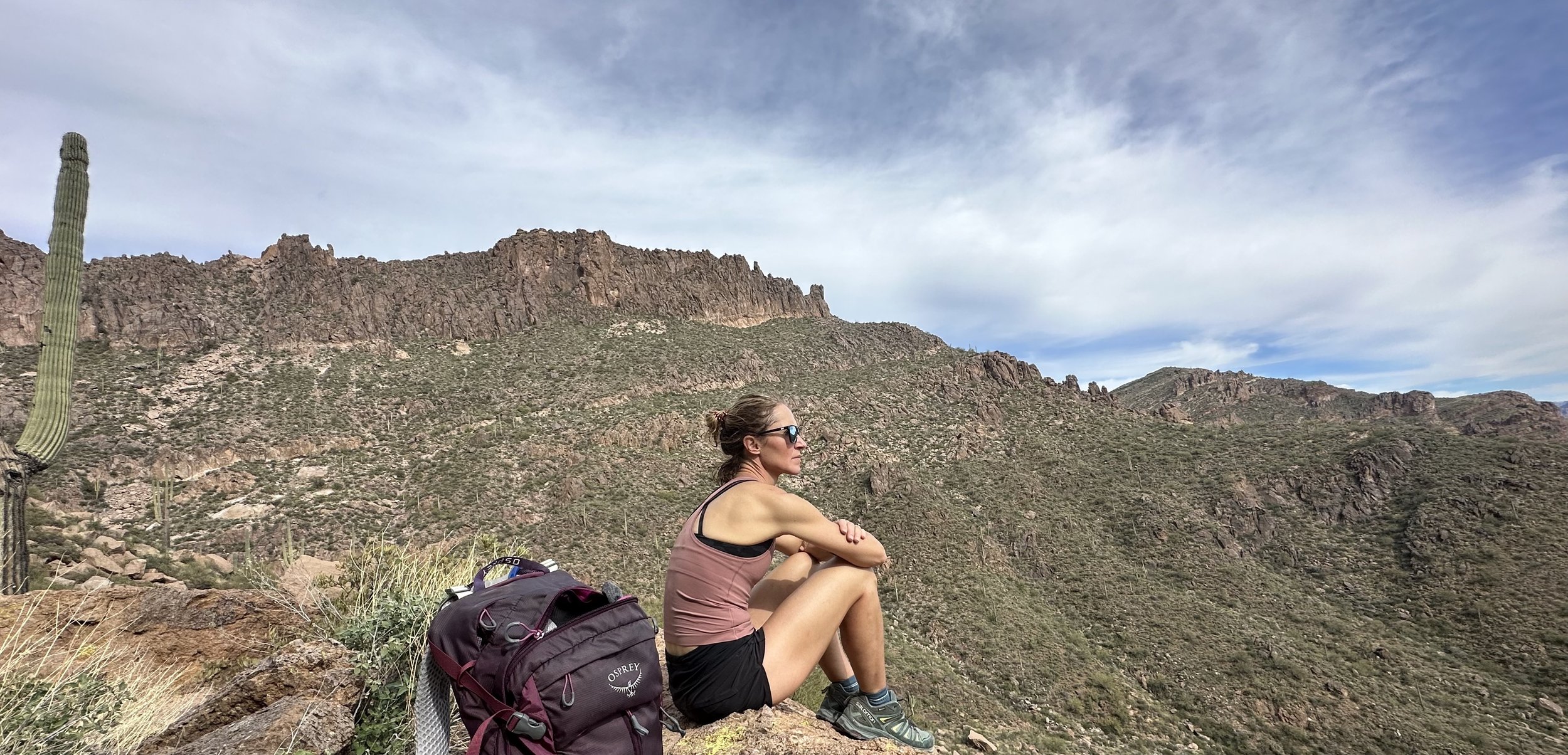
Solo hiking Picketpost Trail in the Tonto National Forest
As a relative newcomer to hiking in Phoenix and nearby Scottsdale, it was so refreshing to meet up with the nicest hikers along the trails. Not only did I get the best local hiking intel, but I also managed to secure some amazing homemade chocolate chip cookies.
The Tonto National Forest is a great place to begin your Phoenix hikes adventures, especially with nearby Lost Dutchman Park. Only about a 40-minute drive from downtown Scottsdale, these two areas boast some of the best hikes in Phoenix.
Shout out to Dorothy, Tom from Amazon and Helen for the best local hiking Phoenix recs!
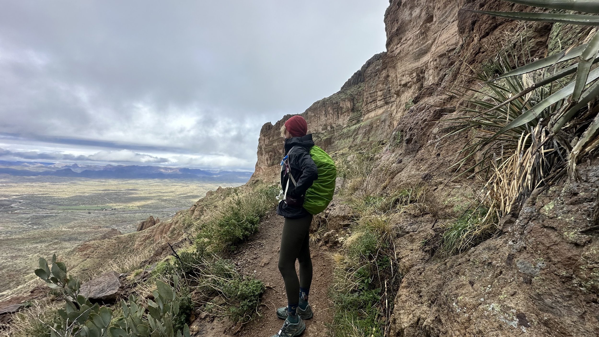
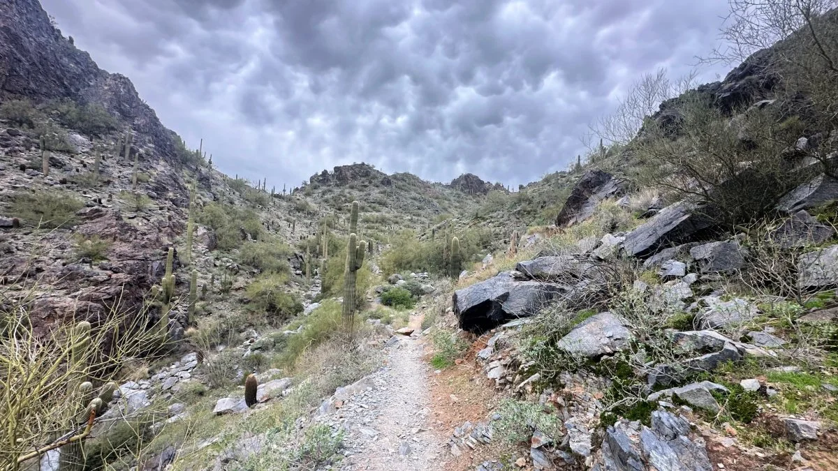
Large cliffs dominate the Tonto National Forest
For the best places to hike Phoenix and surrounding areas, head to Tonto National Forest.
Located just an hour from Phoenix, Apache Junction, Arizona, offers a rugged yet captivating landscape for hiking enthusiasts. With iconic trails like Massacre Falls Trail boasting almost 6 miles and an elevation gain of 1,109', it's a haven for adventure seekers.
The area's diverse terrain, including the challenging Wave Cave Trail, offers hikers a mix of stunning scenery. Apache Junction is a go-to spot for those seeking unique Phoenix hikes, ensuring a memorable outdoor experience.

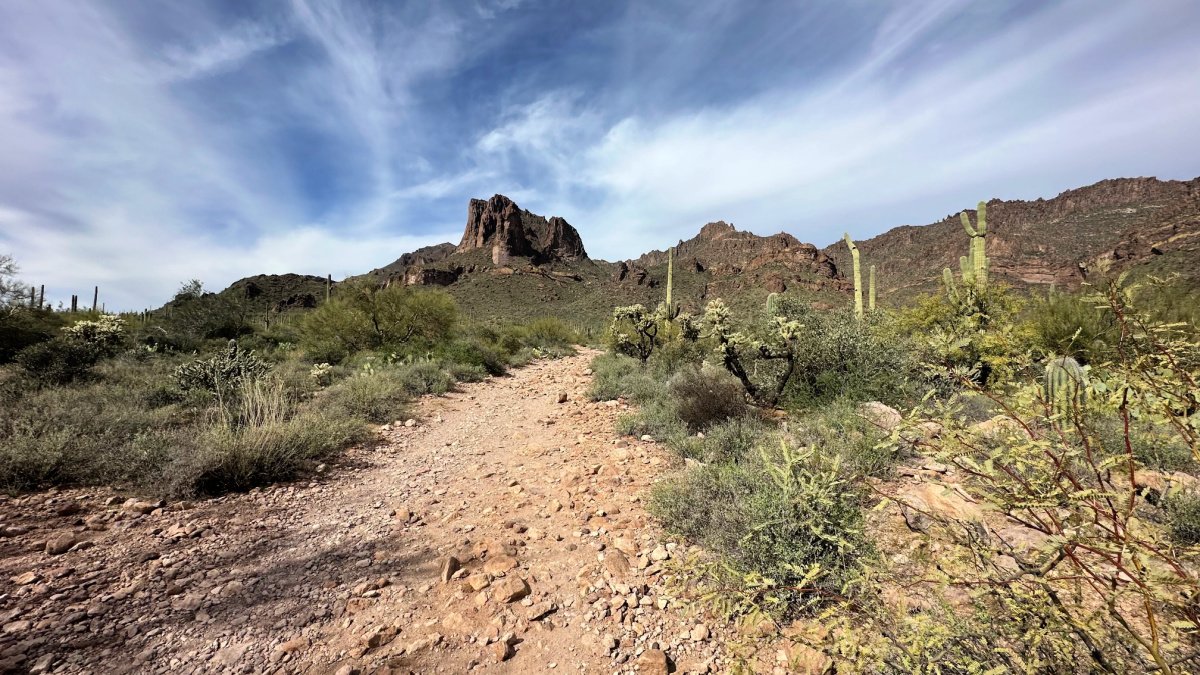
Massacre Falls in Tonto National Forest
Massacre Falls Trail
Mileage: 5.77 miles Elevation Gain: 1,109’ Route: Out and Back
*For all directions and hiking map, head to Massacre Falls All Trails Link
Hiking one of Phoenix best trails, Massacre Falls trail near Apache Junction, is a must. In winter months after a few rainy days, expect to see flowing falls and lush greenery on the trail.
I rolled into the lot at 10 am on a Monday with only one service bar—then, radio silence. The parking space was massive, impossible to miss. As a solo hiker all week, I carried the Garmin inReach mini with me, messaging my husband along the way. We both had peace of mind.
From this sign, head LEFT toward the large cement platform to begin your hike to Massacre Falls.
To find the trail, from the parking lot look for the big cement platform, veer left, and head over the dry creek. The trail pops up on the right, way easier to see on the way back.
About 0.9 miles in, climb that hill and look to your right for a tiny fenced gate. Once at the gate, you’ll see easy entrance through. A very well marked trail, there were many hikers along the way. But also so many moments of solo hiking, allowing you the chance to soak in nature, mountain views and valleys.
It’s a bit of an ascent to the waterfall. You’re close when the trail heads downhill through bushes. On this Monday morning, the waterfall was doing its thing—pretty epic!
It's a moderate hike, rocks scattered everywhere. Hiking shoes? Absolute lifesavers. I bumped into some spirited hiking crews with a busy vibe, but caught serene moments with cactus and mountain views.


On my journey, I encountered the most fantastic group of fellow hikers relishing the trail. Dorothy graciously snapped my photo at the falls and treated me to her delectable homemade chocolate chip cookies—yum! I heard rumors that the nearby Salt River was home to wild horses.
For fellow hikers, expect a mix of bustling trails, hidden gems, and a breathtaking waterfall showstopper.
The iconic wave
Wave Cave Trail
Mileage: 3.18 miles Elevation Gain: 896’ Route: Out and Back
*For all directions and hiking map, head to Wave Cave All Trails Link
I ventured out for a Monday midday hike on the exhilarating Wave Cave Trail—3.18 miles of pure joy with an 896-foot elevation gain on this out-and-back journey. The parking lot was buzzing, filled to the brim with around 25 cars, setting the tone for a lively adventure.
The initial 3/4 mile was a breeze—easygoing and perfect for warming up. Along the way are large cactus groves, massive and looming over the trail. Take moments to stop and look behind you, the mountain views are awe inspiring.
Most of the Wave Cave trail is rocky and well exposed to the sun.
As the hill climb begins, so does the rock scrambling. Some recommend wearing gloves to help lift yourself up and over these boulders.
Brace yourself for the grand finale—a challenging uphill climb, rocky and straight, demanding a bit of hand-and-feet coordination. The cave, a behemoth, offers a fantastic vista for you to soak in. The descent, albeit tricky for the first 1/4 mile, is a small price to pay for the thrilling ascent.


Hiking poles would have been a game-changer here! No shade to seek refuge under on this journey, but the short and steady hike packs a powerful workout punch. As you traverse, be greeted by vast cactus fields, adding to the unique charm of this trail. Get ready for an adventure that's short, sweet, and undeniably invigorating!
On my way down, I had the pleasure of stopping and chatting with an 83-year-old hiker who frequents this trail. What an inspiration, witnessing people of all ages and levels conquering these Phoenix hiking trails!
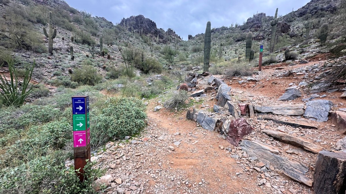
The very rocky start on Freedom Trail to Piestewa Peak
Freedom Trail and Piestewa Peak
Mileage: 4.8 miles Elevation Gain: 1,748’ Route: Loop
*For all directions and hiking map, head to Freedom Trail and PIestewa Peak All Trails Link
As soon as I pulled into the parking lot, I knew this is a weekly hike for many. Much like Manitou Springs Incline hike draws people far and wide, Piestewa Peak had the same feeling.
Most people hit up Piestewa Peak, knocking out a grueling but rewarding 1.3 or so mile hike to the top of this peak.
But don’t let that be the only time spent on this mountain. Freedom Trail is worth your time! This 4.8-mile loop was a blast with an elevation gain of 1,748 feet.
Picture this: an overcast day in the high 60s, just perfect for a 2-hour hike. I chose to hit the summit first, covering about 2.3 miles up and back. I met Helen on the way, an awesome Arizona hiker sharing local insights. I tell ya, Arizona hikers are a special breed!


As you head down the peak trail, look for Freedom Trail to the right. The descent got real right way with its switchbacks—rocky, wild, and oh-so scenic. Along the way are many trails veering off the beaten path. I’d love to come back and explore this area more. Nearly 6 miles and 1600 feet later, it was a mix of exercise and soaking in the views.
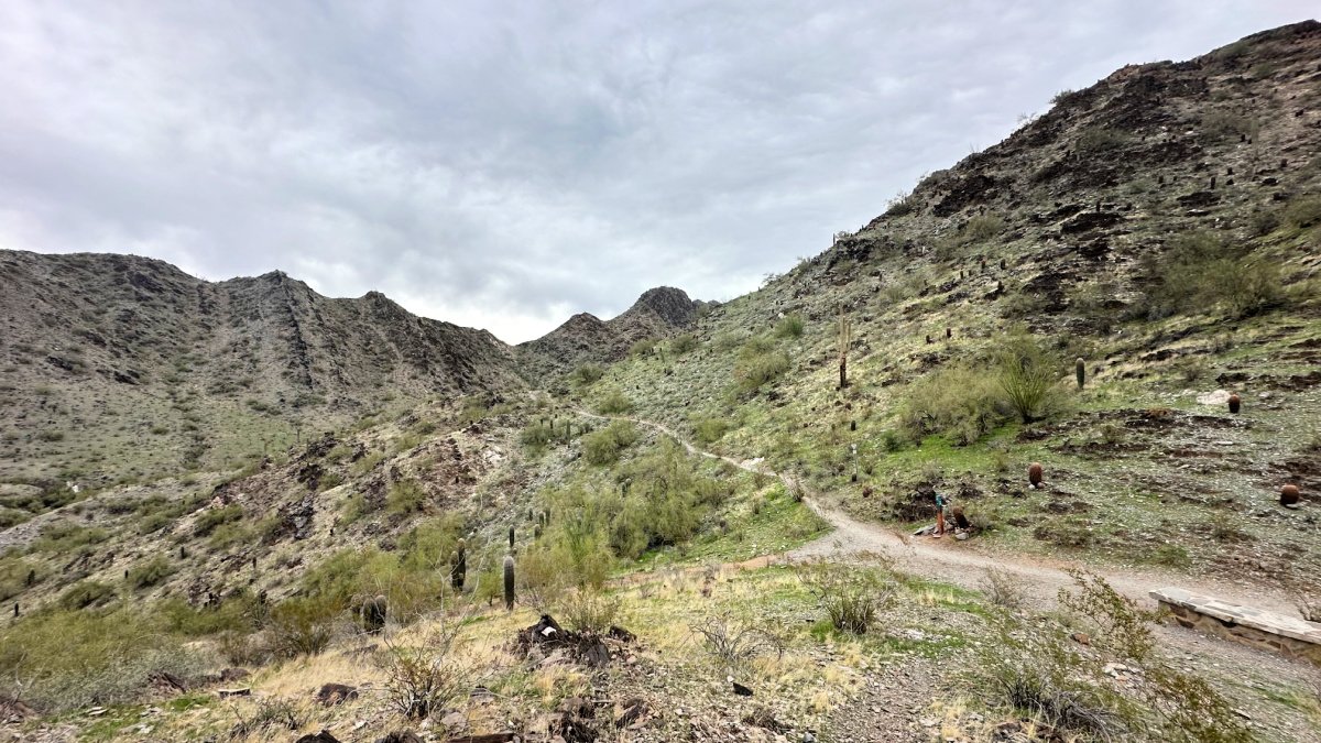
Freedom trail circles Piestewa Peak, treating you to a Phoenix city view at first and then immersing you in pure nature, away from the city buzz. Cactus flowers, desert trees, and peaceful vibes dominated this quiet stretch. On a chill weekday winter hike, I only crossed paths with a handful of fellow hikers, adding to the tranquility.
As the loop wrapped up, the final mile gave me not one, but two bathroom options. Plus, there were big parking lots and covered picnic spots right off the trail—perfect chill spots. This hike in Phoenix, Arizona, is a must-try for a mix of fun trails, scenic spots, and convenient pit stops.
Large boulders flank the Mormon Trail
Fat Man’s Pass via Mormon Trail
Mileage: 4 miles Elevation Gain: 900’ Route: Out and Back
*For all directions and hiking map, head to Fat Man’s Pass via Mormon Trail All Trails Link (NOTE: I recorded two maps after my unfortunate run in with some not so nice hikers.)
Earlier in the week, fellow hikers raved about this Phoenix gem nestled in one of the USA's largest city parks. Intrigued after tackling Piestewa Peak and Freedom Trail, I set out midday to discover what the hype was all about.
The hike kicked off on a positive note, navigating a rocky trail amidst retirees and moms with kids, all against the backdrop of the city's heart, offering enjoyable views. The transition on Mormon Trail to the National trailhead was delightful, culminating in a summit of almost 1000 feet in just over a mile.
Basking in city views on the Mormon Trail.
As I hit the National Trail loop, solitude embraced me. While I relish solo hikes, safety is always a priority. Unfortunately, a concerning encounter with another couple prompted me to backtrack, leaving the hike incomplete.
PRO TIP! Hiking alone is a wonderful way to nature soak. Keep safe and happy with our top 10 tips for solo hiking.


Perhaps in the morning bustle, this trail transforms into a fun and inviting experience. My recommendation: opt for the Mormon Trail, turning around at the National Trail Loop. It dishes out a solid uphill workout with stellar views, complemented by the presence of large pancake-like rocks that lend a Dune-esque vibe to the area.
Rock scrambling is the name of the game for Camelback Mountain
Camelback Mountain
Mileage: 2.41 miles Elevation Gain: 1,483’ Route: Out and Back
*For all directions and hiking map, head to Camelback Mountain All Trails Link
When you venture to Phoenix, Arizona, hiking Camelback Mountain becomes an essential experience. Much like Colorado Springs' Garden of the Gods, Camelback Mountain is a well-visited area, boasting two expansive parking lots that clearly indicate its popularity.
With Echo Canyon Trail and Cholla Trail as the main pathways, the hiking theme on Camelback Mountain revolves around navigating rocks, requiring you to scramble up small and large boulders.
The 2-mile hike provides a unique adventure, and on Echo Canyon Trail, I couldn't help but giggle, feeling like a carefree kid summiting this distinctive Phoenix trail.


Starting at Echo Canyon Trail brings you numerous parking options, flushable toilets at the trailhead, well-marked trail signs, and a large summit with breathtaking panoramic views.
However, keep in mind that this trail is extremely popular, particularly during peak times. My personal experience on a rainy Thursday around 3 pm meant being surrounded by dozens of fellow hikers.
Considerations for hiking Camelback Mountain include its steep incline and substantial bouldering sections. To navigate this mountain successfully, sturdy hiking shoes are a must. That said, I saw everything from rain boots to flip flops on the trail. They were having a hard time navigating the rocks.
Midweek hikes are recommended to enjoy a less crowded trail. Don't forget to bring sufficient water; once you reach the summit, take a moment to hydrate while soaking in the stunning views of Phoenix city.
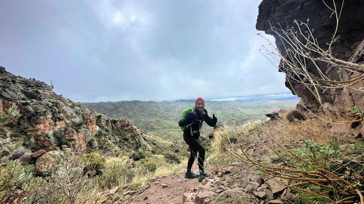
Celebrating a safe journey down from summit
Picketpost Mountain Trail
Mileage: 3.27 miles Elevation Gain: 1,093’ Route: Out and Back
*For all directions and hiking map, head to Picketpost Mountain All Trails Link
Venturing onto the Picketpost Mountain Trail, a 3.27-mile rock-climbing escapade, was like stepping into a hiker's wonderland, highly recommended by three fellow enthusiasts. Despite the ominous forecast of rain and cold, I eagerly embraced the challenge on a weekday, anticipating a memorable adventure on this shorter 4-mile out-and-back trail.


However, a noteworthy disclaimer – this trail is less of a traditional hike and more of a rock climb. As I reached the isolated parking lot with no cell reception, I activated my Garmin inReach to stay connected with my husband before venturing forth. The trail immediately captured my heart with its awe-inspiring rock formations ahead.
The initial mile unfolded as a winding uphill journey, offering captivating mountain vistas. The dilemma of choosing between the stunning views behind and the beckoning rocks ahead kept me pausing in awe.
Upon encountering the first challenge – a sizable rock wall – the trail's route became elusive. A downloaded map proved indispensable, given the sparse painted arrows on rocks.
Picketpost Mountain Trail demands substantial rock climbing, with constant phone-checking for trail guidance. The terrain's steep drop-offs on the right side necessitated a cautious pace.
As rain intensified, prudence prevailed, and I opted out of the final quarter-mile rock climb due to slippery surfaces and precarious drop-offs.
While I missed the potential summit views, the experience left an indelible mark on my soul. I envision returning one day to conquer the trail in its entirety. Until then, I'll relish the joy this solo hike infused into my spirit.
What should I wear hiking Phoenix in winter?
In a typical Phoenix, Arizona winter, one can expect sunny skies and mild temperatures. However, during the week I spent hiking in Phoenix, there was unseasonable rain and cold weather. Being accustomed to Colorado's climate, I came prepared with layers to stay warm and dry.
The initial two days of hiking reflected what locals described as typical Phoenix weather. I would start the trail around 8 am, wearing shorts, a tank top, and a long-sleeved layer. Soon after, I would shed the long layer, and the rest of the day would be quite comfortable.
When the unexpected rain hit, I relied on my Colorado-inspired capsule wardrobe, layering up to stay dry and warm.
The Patagonia Torrentshell proved to be the perfect gear for the Picketpost Trail, ensuring I remained dry throughout all the hiking, scrambling, and bouldering. A definite win!
Here's a breakdown of what I wore and brought with me on my winter hikes in Phoenix.


What I Wore:
shorts*first two days
leggings *last two days
tank top
long sleeve shirt
What I brought on my day hikes:
Osprey Sirrus Backpack *Learn why this is our go to absolute favorite daypack!
Patagonia Torrentshell Rain Jacket
Melly beanie
3 Liter water *in Camelback water bladder
Fruit and protein bars
Electrolytes and gummies
Tripod and external battery *This one is under $15 and works great!
Garmin inReach mini *even in the city, I had very little cell reception
Where should I stay in Phoenix?
When you travel, finding lodging with a kitchen can enhance your experience. On my recent trip, I joined my husband on his work trip and opted for a hotel stay.
Fortunately, they provided free breakfast every morning with an omelet bar! Loading up with a solid breakfast helped keep my appetite at bay while hiking.
Scottsdale is a fantastic place to stay. You will appreciate the many wonderful restaurant options nearby, along with easily accessible grocery stores and a Trader Joe's.
These amenities place you within minutes of Camelback Mountain and just an hour away from the scenic Tonto National Forest.

Where are the best places to eat in Phoenix?
Savor the good eats in Phoenix, Arizona, and Scottsdale! In Phoenix, you've got everything from cool gastropubs to down-home southwestern joints.
And Scottsdale? Well, it's a mix of fancy steakhouses and chill farm-to-table spots. Whether you're into upscale vibes or casual hangs, these places dish out flavors that'll stick with you.
Get ready for a down-to-earth culinary adventure in the heart of the Southwest!
Los Sombreros
2534 N Scottsdale Rd, Scottsdale, AZ 85257
This is the perfect post-hike feasting spot. With plenty of TexMex options to choose from, we devoured the elote and homemade guacamole. Known for their agave margaritas, get ready to enjoy a plethora of Southwest food. Shrimp tacos and mole poblano were favorites in our group.
Culinary Dropout
7135 E Camelback Rd #125, Scottsdale, AZ 85251
Show up with an appetite because the portions are huge. Don't skip out on the homemade pretzels and cheese dip – a standout favorite for us. From simple tomato soup and kale salad to extravagant steak frites, this restaurant caters to every palate. The drink menu is gigantic, offering homemade cocktails for all types of drinkers.
Kyoto Scottsdale
7170 E Stetson Dr, Scottsdale, AZ 85251
Get ready for a boisterous good time in Kyoto. Seated at the hibachi grill, we thoroughly enjoyed our evening of entertainment. A group of fun-loving folks engaged in sake bombs, with rousing renditions of “sake” “bomb” back-and-forth chants. It's truly a one-of-a-kind experience that serves as the perfect exclamation mark to a day of hiking in Phoenix. Sushi options, along with some of the best garlic edamame I’ve had, created the perfect setting for the hibachi feast that followed.
Paul Martins American Grill
6186 N Scottsdale Rd, Scottsdale, AZ 85253
Indulge in great American fare at Paul Martin's, offering choices for every appetite. The quinoa bowl is loaded with veggies, served warm with a tasty sauce. If you're craving a classic post-hike burger and fries, Paul Martin's has you covered with their satisfying option.
Moxies
7014 E Camelback Rd Suite B120, Scottsdale, AZ 85251
Moxies offers an extensive vegetarian menu alongside traditional favorites like poutine fries, making it the perfect spot for groups with diverse taste buds. From pasta bowls to sandwiches, soup, and salads, Moxies has a wide array of choices to satisfy every craving.
Massacre Falls
In the realm of Phoenix hikes, these top six aren't your run-of-the-mill trails; they're the rockstars of the outdoor scene. From the towering Camelback Mountain to the local vibes of Piestewa Peak, each hike is a plot twist waiting to happen in your personal adventure story.
Let Phoenix's best hikes be your backstage pass to a journey that's equal parts wild, wonderful, and unmistakably Arizona.
The outdoors is calling—are you ready to turn the ordinary into extraordinary?
