
Boreas Pass Colorado: 3 Best hikes + Complete Driving Guide (22 Miles, 2-3 Hours)
This page contains affiliate links. If you make a purchase via a link on this page, we make a small commission at absolutely no extra charge to you. Thank you for your support of this small women-led business.
Boreas Pass Quick Guide
Boreas Pass Quick Guide Drive Distance: 22 miles | Time: 2-3 hours | Elevation: 11,481 feet
Best Season: Mid-September to early October for fall colors
Difficulty: Moderate (gravel road, any vehicle) | Cost: Free
Top 3 Hikes: Baker's Tank (5.5 mi), Big Baldy Loop (4.4 mi), Black Powder Pass (3.4 mi)
Best Brewery After: Steep Brewing and Coffee Company (Keystone), Syndicate Brewing Co (Silverthorne) and Highside Brewing and BBQ (Frisco)
Pro Tip: Visit on weekdays - I've driven this pass over 50 times, and Tuesday mornings are absolute magic with less people on trail.
Boreas Pass near Breckenridge delivers 22 miles of golden aspens, a mountaintop ghost town, and hiking trails along the Continental Divide at 11,481 feet. Find the best hikes, peak fall color timing, and tips for avoiding weekend crowds.
Quandary Peak along Boreas Pass Road
Why Boreas Pass is Colorado’s Hidden Fall Gem
Boreas Pass Colorado hikes offer golden aspen groves, sweeping mountain views, historic railroad routes, and high-altitude trails perfect for fall adventures.
Driving this 22-mile scenic road gradually takes you up to 11,481 feet at the summit, offering breathtaking overlooks and vibrant fall foliage along the way.
Nearby, Breckenridge scenic drives provide even more opportunities to take in the autumn colors, with Boreas Pass standing out as one of the most stunning.
My husband and I always make a point to visit Boreas Pass every fall - the explosion of colors cannot be beat!
What Makes It Special: The pass provides a rare opportunity to stand atop the Continental Divide, where the waters on one side flow westward to the Pacific and on the other, eastward to the Atlantic. As you drive, you'll pass through some of the same regions as the Colorado Trail, which follows the Continental Divide for a portion of its route.
Breckenridge Colorado fall along the Boreas Pass road is magical.
Boreas Pass Timing: When Nature Puts on a Show
Peak Colors Timeline:
Early-September: Aspens start changing at summit (11,000+ feet)
Mid- September: Peak colors throughout entire pass
Late September/Early October: Lower elevations peak, upper areas past prime
From my 28 years of Colorado fall chasing: The pass changes like a wave rolling downhill. I've learned to start at the top in mid-September, then work my way down as October progresses. My secret? I keep a photo album on my phone from the same spots each year - it's become this nerdy little science project that helps me predict peak weekend within 2-3 days.
CoHH Local Secret: The aspens on the south-facing slopes (driver's side going up from Breck) turn a full week before the north-facing ones. Most people miss this, but it means you can catch early colors and late colors in the same drive!
Common Questions About Boreas Pass
Q: How long does it take to drive Boreas Pass?
A: 2-3 hours total including stops. The 22-mile route connects Breckenridge to Como. My family usually makes it our Monday or Tuesday adventure to enjoy the road at our pace, often one of just a few cars on this very narrow road!
Q: Can any car drive Boreas Pass?
A: Yes! The drive is generally accessible for 2WD vehicles, but it's always a good idea to check road conditions, especially after heavy rains or snow. Winter arrives early at this elevation - snow is possible as early as late September.
Q: When is the best time for fall colors?
A: Mid-September to early October is typically peak season for fall foliage. The explosion of colors cannot be beat - my husband and I always make a point to visit Boreas Pass every fall!
Q: What's the best hike for families?
A: The ghost town exploration! It's our kids' favorite place - perfect 20-minute pit stop where they can wander through ruins and imagine what life was like back then.
Q: Where should I eat after hiking Boreas Pass?
A. Highside Brewery and BBQ in Frisco has outstanding beer and amazing sandwiches. The Shaggy Sheep in Grant is only about a 20-minute drive from the end of Boreas Pass Road. Otto himself is super friendly, and the food is top-notch - we loved the fried chicken and their famous green chili.
Views while driving Boreas Pass road in early October.
Complete Boreas Pass Driving Guide (Breckenridge to Como)
Quick Drive Facts: Distance: 22 miles | Driving Time: 1.5-2 hours (plus stops) | Elevation Gain: 3,500 feet
Road Type: Paved for 14 miles, gravel for final 8 miles | Difficulty: Moderate
Best Direction: Breckenridge to Como (gradual ascent) | Seasonal: Closes after first major snow
Why This Drive is Special
This 22-mile scenic road gradually takes you up to 11,481 feet at the summit, offering breathtaking overlooks and vibrant fall foliage along the way. Boreas Pass Road offers an exceptional journey through Colorado's high country, crossing over the Continental Divide as it stretches from Breckenridge to Como.
The pass connects Breckenridge to the town of Como, weaving through dense aspen forests and remnants of Boreas Station, a ghost town from the railroad days. You'll cross the Continental Divide, where waters on one side flow westward to the Pacific and on the other, eastward to the Atlantic.
Step-by-Step Driving Directions
From Breckenridge (Recommended Direction):
Start: Downtown Breckenridge on Main Street
Mile 0-3: Paved CO-9 South through town
Mile 3: Turn left on Boreas Pass Road (County Road 10)
Mile 3-14: Paved mountain road with aspens
Mile 14-22: Gravel road to summit and Como
What to Expect Mile by Mile
Miles 0-7: Moderate aspen coverage, good pull-offs for photos
Miles 7-14: Dense aspen groves, steeper sections with switchbacks
Miles 14-18: Above treeline with panoramic views (this is where we always stop for our annual "I can't believe I live in Colorado" photo)
Miles 18-22: Summit area with Continental Divide crossing and ghost town ruins
Essential Driving Tips
Timing Your Drive:
Best Time: Weekday mornings (weekends get traffic jams)
Peak Season: Expect 30-minute delays on fall weekends
Photo Stops: Budget extra 30-45 minutes for scenic overlooks
Vehicle & Road Conditions:
Vehicle: Any car works, but AWD recommended for gravel section
Road Surface: Paved to mile 14, then well-maintained gravel
Clearance: Standard cars fine, but avoid low-profile sports cars
Seasonal Considerations:
Weather: Can snow any day after Labor Day at 11,000+ feet
Road Closure: Typically closes mid-October through late May
Current Conditions: Check COTrip.org before departing
Practical Prep:
Gas: Fill up in Breckenridge - no services on entire pass
Supplies: Bring water, snacks, and emergency kit
Cell Service: Spotty throughout pass, works in Breckenridge and Como
Boreas Pass and the Continental Divide
Continental Divide Quick Facts: Elevation: 11,481 feet | Watershed Divide: Pacific Ocean (west) vs Atlantic Ocean (east)
Historical Significance: Denver, South Park & Pacific Railway route (1882-1937)
Trail Connection: Crosses the Colorado Trail route | Views: 360° mountain panoramas
Best Experience: Stand where major watersheds meet | Traffic: Narrow road, 1-2 cars wide
Why This Location is Extraordinary
Boreas Pass Road offers an exceptional journey through Colorado's high country, crossing over the Continental Divide as it stretches from Breckenridge to Como. At 11,481 feet, Boreas Pass connects you to stunning views of the surrounding peaks and valleys, making it a scenic gem for adventurers.
The Continental Divide Experience: The pass provides a rare opportunity to stand atop the Continental Divide, where the waters on one side flow westward to the Pacific and on the other, eastward to the Atlantic. The road offers a unique vantage point of the Continental Divide, where several major watersheds meet.
Historical Railroad Legacy
Did you know? Boreas Pass was once a critical route for the historic Denver, South Park and Pacific Railway, and it now provides a thrilling drive through the heart of the Rocky Mountains. This historic railroad operated from 1882 to 1937, carrying passengers and freight over one of the highest railway passes in North America.
Today, you can still see remnants of the old railroad grade and explore the ghost town buildings that housed railroad workers and their families during the pass's heyday.
Connection to Colorado's Epic Trail System
As you drive, you'll pass through some of the same regions as the Colorado Trail, which follows the Continental Divide for a portion of its route. This 486-mile trail stretches from Denver to Durango, and your Boreas Pass drive intersects with some of the most scenic sections.
Local Timing Strategy
CoHH Personal Tip: Our fall trip to Breckenridge usually is on a Monday or Tuesday to enjoy the road at our pace, one of a few cars on a very narrow road! This timing strategy has served us well over the years - you'll have the Continental Divide practically to yourself for photos and contemplation.
Why Weekdays Work Better:
Traffic: Nearly empty roads vs weekend traffic jams
Photography: No crowds in your scenic shots
Experience: Peaceful moments to appreciate the watershed significance
Safety: Easier navigation on the narrow, winding sections
Must-Do Stop: Ghost Town at the Top of Boreas Pass
One of the many old buildings in this “ghost town” along the Boreas Pass road.
One our kids favorite places is the ghost town at the top of Boreas Pass!
This is the perfect 20-minute pit stop along the 22-mile scenic drive to stretch your legs and explore a piece of history.
Long before the railroad tracks were laid, the Ute Indians used this area for hunting.
Later, miners came in the 1860s, hoping to strike it rich in Breckenridge. By 1882, the Union Pacific Railroad set up shop, and a little town sprang to life to support the workers.
Though the town thrived for a time, it was abandoned by the 1930s after the railroad stopped running. Now, you can wander through the ruins, take in panoramic views of the surrounding mountains, and imagine what life was like back then.
It’s a quick stop with plenty of history and beauty to enjoy! *This is also the Boreas Pass trailhead for Mt Baldy and Black Powder Pass.
Mountain views near Baker’s Tank trailhead.
Three Best Hikes
Baker's Tank Trail: Best for Fall Colors

Distance: 5.5 miles | Time: 3-4 hours | Difficulty: Moderate
Why Choose This: Dense aspen tunnels, shared with friendly bikers
Best Photo Spot: Mile 2.5 golden aspen grove
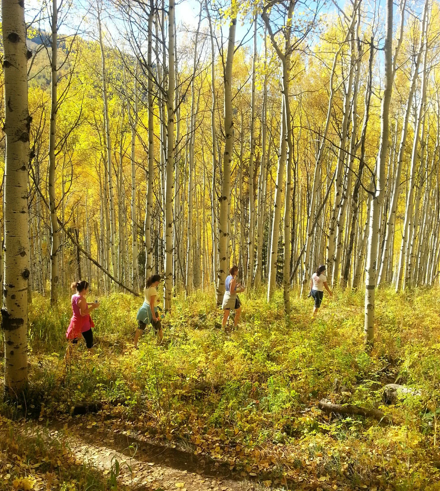
The golden aspen leaves shimmering in the sun make it hard not to stop every few minutes to snap a picture.
The beauty of this trail is truly captivating, and it's a great spot to feel connected to nature.
This moderate trail winds through towering aspen groves and is family-friendly, though the distance may challenge little ones, especially during the first mile, which is an uphill climb. The rocky path is manageable, making it a great option for those seeking a leisurely walk surrounded by stunning fall colors without too much strain.
Trail Share Alert: Keep in mind that this is a shared trail with bikers. While you have the right of way, it's much harder for them to stop or pull over on a downhill. In my experience, most riders are super nice and give you plenty of heads-up when coming down the trail.
Boreas Pass Road near Baker’s Tank trailhead.
Post-Hike Hop: After your adventure, head over to The Shaggy Sheep in nearby Grant, only about a 20-minute drive from the end of Boreas Pass Road. This cozy, mountain-town gem is a local favorite for breakfast and lunch, serving up hearty dishes like their famous green chili. It's the perfect spot to unwind and refuel after your hike with a casual, welcoming vibe.
Pro tip from my 28 years in Colorado
The rocky sections that look intimidating? They're actually the easy part. It's those gorgeous aspen groves that'll slow you down because you can't stop taking pictures!
How to Reach the Trailhead:
From Breckenridge, head west on CO-9 S (Main St), turn left onto CO-10 E (Boreas Pass Rd) after about 3 miles, and follow Boreas Pass Rd for 7 miles until the trailhead appears on your left at 3312-3413 Co Rd 10, Breckenridge, CO 80424.
Ghost Town Hike: Best for Families with Kids
Distance: 2 miles | Time: 1-2 hours | Difficulty: Easy
Why Choose This: Real abandoned mining buildings to explore
Kid-Friendly: Yes, but watch for old nails and holes
Historical Period: 1882-1930s railroad town
Parking: Small lot at marker 9032 (or roadside)


One of our kids' favorite places is the ghost town at the top of Boreas Pass! This is the perfect 20-minute pit stop along the 22-mile scenic drive to stretch your legs and explore a piece of history.
Personal Discovery: A few years ago, we had about an hour to explore Boreas Pass Road. With Gaia map in hand, we pulled off a few miles into the drive at marker 9032 (parking fits about three cars) and started up a steep hill toward Valdero Trail.
As we emerged into a clearing, an entire ghost town unfolded below—weathered structures and an old privy left behind by miners from long ago. It felt like stepping back in time, our imaginations running wild with stories of the past. This 2-ish mile loop has become a family favorite.

Safety Tips if You Bring Kids:
Watch out for old nails and loose boards
Be mindful of holes in the ground
Some buildings are safe to enter (they're marked for preservation), while others have clear signs to stay out
Historical Context: Long before the railroad tracks were laid, the Ute Indians used this area for hunting. Later, miners came in the 1860s, hoping to strike it rich in Breckenridge. By 1882, the Union Pacific Railroad set up shop, and a little town sprang to life to support the workers.
How to Reach the Trailhead: From Breckenridge, head west on CO-9 S (Main St), turn left onto CO-10 E (Boreas Pass Rd) after about 3 miles. Look for Trail Marker 9032 on your left. There will be small sandy lot up a hill to your left. Unless you have a great high clearance 4WD, don’t attempt to park there. Instead, park along the road. If you get to Baker’s Tank, you’ve gone too far. Turn around.
Big Baldy Loop: Best Summit Views
Distance: 4.4 miles | Time: 3 hours | Difficulty: Moderate
Why Choose This: 360° views of Tenmile Range from summit
Above Treeline: Yes, bring layers and sun protection
Best Feature: Lunch bench halfway up with mountain views
Post-Hike Beer: Mother Loaded Tavern, downtown Breckenridge
Boreas Pass Trail along Big Baldy Loop
What to Expect on the Trail
Trail Conditions: The trail is in great shape, with only a few rocky sections and some water from snowmelt in certain areas, but nothing too difficult to navigate. Overall, it's a lovely, doable hike that's mostly on road with some varied terrain.
Midpoint Rest Stop: About halfway through, you'll find a small clearing with a bench—perfect for a lunch break and taking in the breathtaking views! This is the ideal spot to refuel and prepare for the summit push.
Above Treeline Experience: Although you'll be above the treeline for much of the hike, the crisp fall air and the 360-degree views from the summit are worth every step. *Above treeline you will encounter more rocks and scree, so watch your footing.
Summit Rewards: The summit offers sweeping panoramic views of the Tenmile Range, Breckenridge, and beyond, making it a rewarding experience. Even in the absence of aspens, this Boreas Pass trailhead hike captures the spirit of fall with its quiet beauty and solitude.
The Descent: The descent is much easier, offering even more beautiful perspectives as you make your way down. Many hikers find the return journey just as scenic as the climb up.
Trailhead Directions
From Breckenridge:
Head west on CO-9 S (Main St)
Turn left onto CO-10 E (Boreas Pass Rd) after about 3 miles
Follow Boreas Pass Rd for 7 miles
Trailhead appears on your left
GPS Address: 3312-3413 Co Rd 10, Breckenridge, CO 80424
Parking: Free roadside parking available
Facilities: No restrooms at trailhead
Post-Hike Food & Drinks
Downtown Breckenridge Options (15 minutes from trailhead):
Mother Loaded Tavern:Local Favorite
103 S Main St, Breckenridge, CO 80424
Best For: Juicy burgers, crispy fries, and refreshing drinks
Why Go: Perfect post-hike fuel with hearty portions and local atmosphere
Mi Casa Mexican Restaurant and Cantina
600 South Park Avenue, Breckenridge, CO 80424
Best For: Fantastic Tex-Mex and tacos
Why Go: Great for groups, different flavor profile, generous portions that satisfy post-hike hunger
Navigation Tips: Just be sure to keep an eye on your map to stay on track and enjoy the more rugged, remote feel of this trail. The loop nature means you won't retrace your steps, offering constantly changing perspectives.
Black Powder Pass: Best for High-Alpine Views
Trail Quick Facts: Distance: 3.4 miles | Elevation Gain: 1,000 feet | Type: Out and Back
Difficulty: Moderately challenging but short | Time: 2-3 hours | Above Treeline: Yes
Best Views: White River National Forest, Bald Mountain, Tenmile Range
Trailhead Landmark: Historic Section House and old railroad tracks
Winter Access: Road closes, but Section House cabin rentals available
Why Choose Black Powder Pass
If you're looking for a short but rewarding hike with jaw-dropping views, Black Powder Pass is a must. This trail offers a great choice if you're looking for high-altitude views without a full-day trek, making it perfect for those wanting maximum reward with moderate effort.
Historical Starting Point: Look for the historic Section House and the old railroad tracks at the top of Boreas Pass—this is your trailhead. This landmark makes the trailhead easy to identify and adds historical context to your adventure.
What to Expect on the Trail
Trail Terrain: The trail begins at the base of the Section House and quickly gains elevation, leading you through open alpine terrain with a few clusters of pine trees and remnants of old tree stumps. The trail is moderately challenging but short.
Scenic Progression: As you ascend, don't forget to look back—the views of the Tenmile Range are incredible. Above the treeline, the route becomes straightforward, leading to a spectacular summit where you can soak in sweeping views of the White River National Forest and nearby Bald Mountain.
Summit Experience: Pack a snack (or a celebratory summit beer) and enjoy the scenery! The open alpine setting provides 360-degree views that make the elevation gain worthwhile.
Trailhead Directions
From Breckenridge:
Head south on CO-9 S/Main St for about 10 miles
Turn right onto Boreas Pass Rd (County Road 10)
Continue driving for approximately 11 miles to the summit
Look for the historic Section House and railroad tracks
Winter Access Note: NOTE! If you're visiting in winter, note that Boreas Pass Road closes after the first parking lot, but you can still access the area by booking a stay at the Section House cabin.
Parking: Limited parking at summit area
Facilities: Historic Section House (seasonal access)
Trail Strategy Tips
Best Approach: Start early in the day to avoid afternoon thunderstorms common at high elevation. The short distance makes this an excellent add-on to other Boreas Pass activities.
Photo Opportunities: The combination of historic railroad remnants and alpine views creates unique photo opportunities you won't find on other Colorado trails.
Perfect Boreas Pass Day from Denver:
7 AM: Leave Denver (1.5 hours to Breckenridge)
9 AM: Start drive up Boreas Pass Road
10 AM: Ghost town exploration and photos
11 AM: Baker's Tank Trail hike
2 PM: Lunch at The Shaggy Sheep in Grant
4 PM: Drive back to Breckenridge, brewery stop
7 PM: Head back to Denver
Weekend Warriors (2-Day) Option:
Day 1: Drive pass + ghost town + easy hike, stay in Breckenridge
Day 2: Big Baldy Loop + Black Powder Pass, brewery crawl (Check out our favorite Summit County Breweries)
Seasonal Timing Guide:
Mid-September: Aspens start changing at summit
Late September: Peak colors throughout pass
Early October: Lower elevations peak, upper elevations past prime
Mid-October: Season typically ends with first snow
Best Days of Week:
Weekdays: Nearly empty roads, perfect for photos
Weekends: Expect traffic jams, arrive before 9 AM or after 4 PM
Road Conditions:
Summer/Fall: Generally good for any vehicle
Winter: Often closed after first major snow
Check: COTrip.org for current conditions
Emergency Info:
Cell Service: Spotty on pass, works in Breckenridge/Como
Nearest Hospital: Breckenridge Medical Center
Weather Changes: Can drop 30+ degrees, snow possible any day
Where to Stay Near Boreas Pass
Accommodation Quick Guide: Best Base Towns: Breckenridge (closest), Frisco (affordable), Silverthorne (budget-friendly)
Distance to Pass: 0-20 minutes from trailhead | Lodging Types: Cabins, condos, hotels, camping
Peak Season: September-October (book early) | Budget Range: $75-300/night
Best Base Towns for Your Adventure
Breckenridge (Closest to Pass Start):
Distance: 0-10 minutes to Boreas Pass Road
Pros: Most dining options, walkable downtown, closest to trailhead
Best For: Convenience, nightlife, mountain town atmosphere
Lodging: Historic hotels, luxury condos, vacation rentals
Recommended Stay: This log cabin offers stunning mountain views, a spacious and inviting interior, and a prime location just 10 minutes from Breckenridge. Perfect for families or groups wanting mountain luxury with easy pass access.
Frisco (20 Minutes Away):
Distance: 20 minutes to Boreas Pass Road
Pros: More affordable lodging, less crowded, family-friendly
Best For: Budget-conscious travelers, families with kids
Lodging: Chain hotels, vacation rentals, lakeside properties
Recommended Stay: Escape to the Moose Creek Cabin, where cozy mountain living meets adventure—relax in the hot tub under the stars, explore breathtaking trails just minutes away. Great value with resort-style amenities.
Silverthorne (Budget-Friendly Option):
Distance: 25-30 minutes to Boreas Pass Road
Pros: Budget-friendly options, easy highway access, outlet shopping
Best For: Bargain hunters, easy highway access from Denver
Lodging: Budget hotels, modern condos, extended stays
Recommended Stay: Nestled in the heart of downtown Silverthorne, this sleek, newly built condo offers modern luxury with stunning mountain views, a private balcony, and rooftop hot tub. Best bang for your buck in Summit County.
Camping Options Near Boreas Pass
For Outdoor Enthusiasts: Several great campgrounds are detailed at the end of this post, including:
Prospector Campground: Near Dillon Reservoir with mountain views
Heaton Bay Campground: Lakeside camping between Frisco and Dillon
Blue River Campground: Riverside sites along Highway 9
Complete Cost Breakdown
Day Trip from Denver:
Gas: $25-35 (depending on vehicle size)
Drive: Free (just gas)
Parking: Free at all trailheads
Food: $20-45 per person for post-hike meal
Total Day Cost: $40-80 per person
Weekend Adventure Costs:
Lodging: $150-300/night (varies by town and season)
Meals: $50-75 per person per day
Activities: Free hiking, $10-15 for attractions
Total Weekend: $250-400 per person
Money-Saving Tips:
Stay in Silverthorne: Save 30-40% on lodging vs Breckenridge
Pack Lunches: Trail snacks and summit sandwiches save $20+ per person
Weekday Visits: Lower lodging rates Sunday-Thursday
Book Early: September-October fills up fast, early booking saves 20%
Basic Backpack Essentials for Colorado hikes
WHAT TO WEAR AND PACK FOR YOUR HIKE
How do you know what to wear and pack for Colorado hiking trails?
Spend any time in Colorado and you’ll quickly learn to be prepared for any type of weather, no matter the season.
Fall is no exception—layering is key. I’m sharing just a few essentials here, but for the full breakdown of my favorite fall hiker attire and a few of our favorite fall hikes that we do every year, head over to Falling for Fall: My Favorite Hiker Attire for Autumn Adventures in Colorado for all the details.
Here’s what keeps us going on our adventures while hiking in Colorado:
We love the Osprey Sirrus Hiking Daypack for women, or the Osprey Stratos version for men, for carrying water, layers, and snacks on Colorado day hikes
Free Fly’s High Mile Jogger is the perfect hiking pant! Comfy, stylish and durable!
Lightweight, versatile Hiking Poles built for a full day’s send on the trail — hike longer and stronger
2L or 3L Water Reservoir — This affordable reservoir is easy to fill
Patagonia Torrentshell - a true waterproof rain jacket and fantastic layering piece
Nano Puff Jacket - our favorite for 3 seasons in Colorado
Smartwool Glove Liners - the best all season gloves for those high altitude hikes
Salomon hiking shoes - waterproof, comfy and hard working for any type of hike
We’ve got your full checklist of daypack essentials here.

Safety Precautions While Hiking Colorado Trails
Plan Ahead: Let someone know your plans and when you expect to be back. Leave a note in your car with this info just in case.
Pack the Essentials: Bring plenty of water, snacks, layers, a map, compass, first-aid kit, headlamp, and a whistle for everyone.
Stick to Designated Trails: Going off-trail can lead to getting lost and harm the environment. Stay on the path.
Check the Weather: Mountain weather can change fast. Always check the forecast and be ready to adjust your plans.
Know Your Limits: Listen to your body. Know when to turn back, and speak up if you’re hiking with others.
Stay Alert: Keep an eye on wildlife, the weather, trail conditions, and how you’re feeling.

Our 75 full page Ultimate Guide to Camping in Colorado (PDF download) covers the following 23 items with practical checklists and how-tos:
What You Should Know About Camping in Colorado:
Types of Camping in Colorado
Three Types of Campgrounds
When You’d Rather Sleep Off the Ground
Practicing Leave No Trace
What to Do if You See a Bear, Bear Awareness and Safety Tips
Quick Tips for Camping
Where to Camp in Colorado:
How to Book a Campground
Apps to Upgrade Your Camping Game
Our Favorite Scenic Campgrounds with Nearby Hikes
Campsite Set Up and Camp Meals:
Setting up Your Campsite
Setting Up Your Camp Kitchen for Success
Additional Gear Needed for Dispersed Camping
Favorite Camping Recipes - Breakfast, Lunch, Dinner
How to Build a Proper Campfire
Cooking Over a Campfire
Camp Coffee Tips
Extras:
Camping Gear Essential Checklist
Camp Bin Checklists
In Case of Emergency & Plan B
Your Personal Packlist
Know the Signs of Altitude Sickness
Building and Putting Out Campfires
DIY First Aid Medical Kit
