
True Colorado Hiking in Buena Vista and Salida 2026
Buena Vista and Salida sit just 24 miles apart in Chaffee County, offering true Colorado mountain adventures between the Arkansas River and Collegiate Peaks. We share thirteen incredible hikes from easy trails like Agnes Vaille Falls and Narrow Gauge Trail to challenging climbs like Mount Elbert and Midland Hill. Favorites include Browns Creek Waterfall, Barbara Whipple Trail, and St. Elmo Ghost Town. After hiking, soak in Mount Princeton Hot Springs or grab burgers at Buena Viking and craft brews at Eddyline. With twelve nearby fourteeners, whitewater rafting, scenic drives over Cottonwood and Independence Passes, and year-round adventures, this area truly lives up to its motto: "Now this is Colorado!"

This page contains affiliate links. If you make a purchase via a link on this page, we make a small commission at absolutely no extra charge to you.
Discover Pure Mountain Adventures in Chaffee County
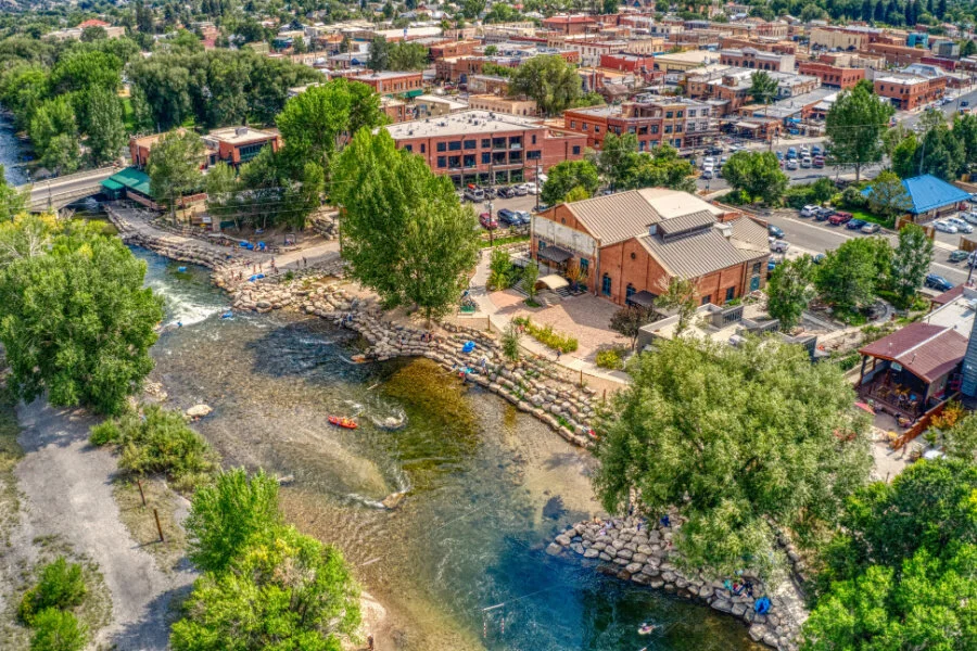
Two of the best mountain towns, Buena vista and Salida Colorado radiate small-town charm while providing many different adventure opportunities between the Arkansas River and the Collegiate Peaks in the Sawatch Range of the Colorado Rockies.
A mere 24 miles separate the two towns, meaning you can tackle all the trails below no matter where you are staying. In fact, we’ve checked off most of the 13 hikes near Buena Vista and Salida listed below, and we keep going back for the others!
During summer, you have access to all kinds of hiking, mountain biking, climbing, fishing, kayaking, and whitewater rafting adventures.
In the winter, Salida and Buena Vista and the surrounding areas are a hit for skiing, snowboarding, snowmobiling, cross country skiing, and snowshoeing. We love skiing at independently owned Monarch Mountain.
Add in soaking in geothermal hot springs and driving scenic byways along Monarch Pass, Cottonwood Pass, and Independence Pass — the latter two only open seasonally — and you’ll see why this area’s motto “Now this is Colorado!” rings true.
Near Buena Vista and Salida, Colorado are twelve mountains that soar over 14,000 feet in elevation. This area boasts the highest number of Colorado’s 54 total fourteeners.
But for those not into bagging fourteeners, below are coolest hikes near Buena Vista and Salida. We also mention our favorite eateries, breweries, and a few other must-try places to check out too.
Salida Hikes We Love
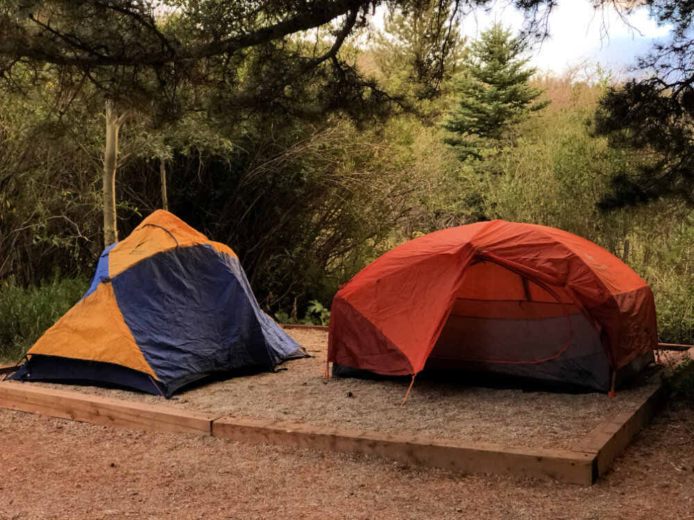
Together with our husbands, Melody and I experienced pretty hikes near Salida, Colorado from the glorious Angel of Shavano Campground, so most of these hikes below start from there.
There are also a few great hiking trails that are found between Salida and Buena Vista, and they are the first three trails listed under the Buena Vista section further below: Browns Creek Waterfall, Agnes Vaille, and Narrow Gauge Trails. Be sure to check them out!
Here are four trails we love in the Salida area.
Shavano Falls
A short drive from Salida, Shavano Falls is near one of our favorite Colorado campgrounds: Angel of Shavano.
For an uphill hike to some gorgeous, soothing waterfalls, begin near the campground and hike up road 240.
You’ll hear the rushing waters of the North Fork South Arkansas River soon enough to the right of the road. Just head towards the sound of rushing water.
You’ll also see folks dispersed camping along the North Fork South Arkansas River. You may have to walk between a couple of campsites to get down to the water.
How to get there: From the junction of Highway 50 and 285 near Salida, travel west on Highway 50 for 6 miles to the town of Maysville. Turn right onto County Road 240 and travel up the road for 3 miles to the trailhead. You will see the Angel of Shavano campground on the left and the trailhead and parking area is located on the right side of the road.
PRO TIP: Road 240 eventually leads to the North Fork Campground and eventually to the North Fork Reservoir. According to local horseback riders we met, the six mile drive up to the reservoir is a slow going bumpy 4X4 drive, but well worth it.

Waterfall hike near Angel of Shavano campground
Colorado Trail Segment 14
What is the Colorado Trail?
According to coloradotrail.org, for the past 30 years, the Colorado Trail has become known as one of the best-of-the-best long-distance trails in the US, loved by passionate hikers, backpackers, mountain bikers and horseback riders from all over the globe.
The Colorado Trail encompasses 567 miles of trail between Denver and Durango and passes through the most gorgeous scenic areas of the Colorado Rockies.
The Angel of Shavano Trailhead serves as major trailhead along the Colorado Trail (#1776). The trailhead is located about 9 miles west of Salida Colorado.
When we camped in the Angel of Shavano campground, we hopped on the lower quarter of this segment of the Colorado Trail and hiked out and back to our heart’s content. Segment 14 totals nearly 20 miles. You can also head north on Colorado Trail’s Segment 14.
RELATED READING: Try glissading down Angel of Shavano.
How to get there: From the junction of Highway 50 and 285, travel west on Highway 50 for 6 miles to the town of Maysville. Turn right onto County Road 240 and travel up the road for 3 miles to the trailhead. You will pass the entrance for the Angel of Shavano Group area on the left and the trailhead for the Colorado Trail is located on the right side of the road.
Colorado Trail Segment 14
North Fork to Blank’s Cabin
On our list, this hike near Salida, Colorado is four miles out and back to Blank’s Cabin at the base of Mount Shavano (14,229 ft.). It begins from the North Fork creek drainage on the Colorado Trail from the Angel of Shavano campground, directions mentioned just above.
According to colorfulcolorado.com, this rewarding trail climbs over 600 feet to the top of a ridge, handing out fabulous views. From the top of the ridge, you’ll descend into a fantastic aspen forest for several miles to the meadows, where you’ll reach Blank’s cabin’s resting place.
Mount Shavano and Tabeguache Peak
We would be remiss to not mention Colorado fourteeners near Salida and Buena Vista.
While Melody and I combined have hiked a handful of fourteeners, we have not tackled Mount Shavano or Tabeguache Peak. But, Tanya has conquered Mount Elbert, which she will talk about later.
Fatmap.com offers great insight into Chaffee County 14ers. They claim that “one of the most easily-accessible trailheads in Chaffee County leads to two of Colorado's famous 14ers.”
RELATED: Tackling Majestic 13ers in Colorado: With towering peaks, breathtaking vistas, and a sense of accomplishment like no other, conquering majestic 13ers in Colorado is a thrilling adventure.

Views from the summit of Mount Ouray, a fabulous 13er to hike just near Salida
Hops after the Hike:
The Arkansas River runs right through Salida and Buena Vista.
Both of these towns offer great places to refuel after your hike and other outdoor adventures.
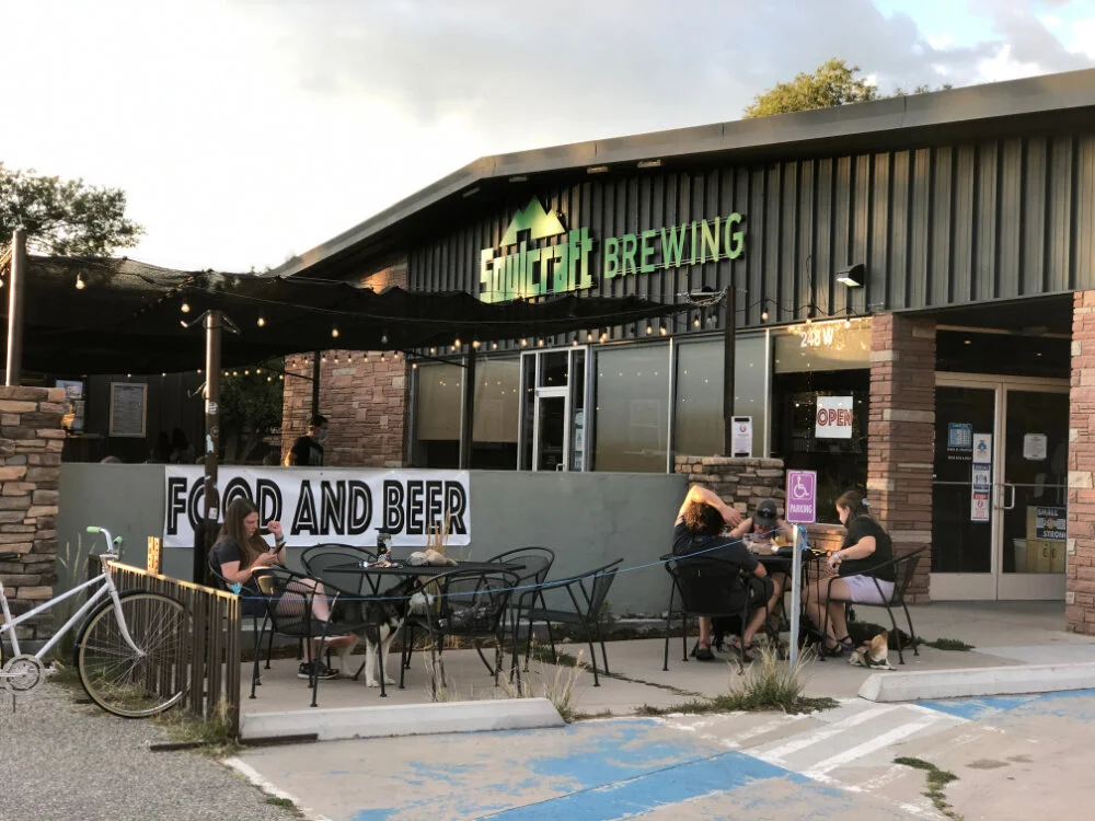
SOUL CRAFT BREWING This Salida Colorado brewery hones in on fresh craft beer in a chill setting, with both indoor and outdoor seating. Featuring 16 beers on tap, try the High and Unstable Dopplebock or the X-Ray IPA. 248 W Rainbow Blvd, Salida, CO 81201
TRES LITROS BEER COMPANY Try the Bourbon Beckerbier or the Electrólima Mexican Lager or grab a flight while you cool off at this brewery in downtown Salida. 118 N E St, Salida, CO 81201
TOTALLY TUBULAR Float down the Arkansas River right through Salida. Rent tubes, boogie boards, mini rafts, SUPs and more at Totally Tubular right by the river. Drop in by the boat ramp. FiBArk Building, 240 N F St, Salida, CO 81201
Where to Stay in Salida Colorado
If you’re not into camping, the AMIGO MOTOR LODGE might catch your eye. Set along Highway 50, this fun, southwestern themed motel isn’t far from the Arkansas Headwaters Recreation Area. Aim for a night in one of their sweet Airstreams. 7350 US-50, Salida, CO 81201
Have a larger group or family? Book a gorgeous mountain home like this one, with spectacular view of Chalk Cliffs and Canyon, just right up the road from Mount Princeton Hot Springs.
Where to Stay in Buena Vista Colorado
We prefer staying in Buena Vista and here are a few of our favorite vacation homes, perfect for your crew:
Spacious cabin on Cottonwood Creek combines the best of both worlds. Just a half mile from Buena Vista’s Main Street. Sit on the deck and listen to the sound of the rushing stream below, weaving it's way to the Arkansas River.
Fabulous Scenic Mountain Home that Sleeps 10 This mountain retreat is built in the Heart of the Colorado Rockies with breath-taking mountain views and the best view of the famous Chalk Cliffs. Very close to two Buena Vista hiking trails and just up the road from Mount Princeton.
Charming Buena Vista Home with Hot Tub and Deck. Breathtaking Collegiate Peak views just a walk from Main Street!
Buena Vista Hikes We Love
The Colorado mountain town of Buena Vista has held my heart ever since I first set foot here in 1988 during a Young Life ski trip to Frontier Ranch up on Mount Princeton. I come back every chance I get for hiking, whitewater, and fishing adventures along the Arkansas River and in the surrounding area.
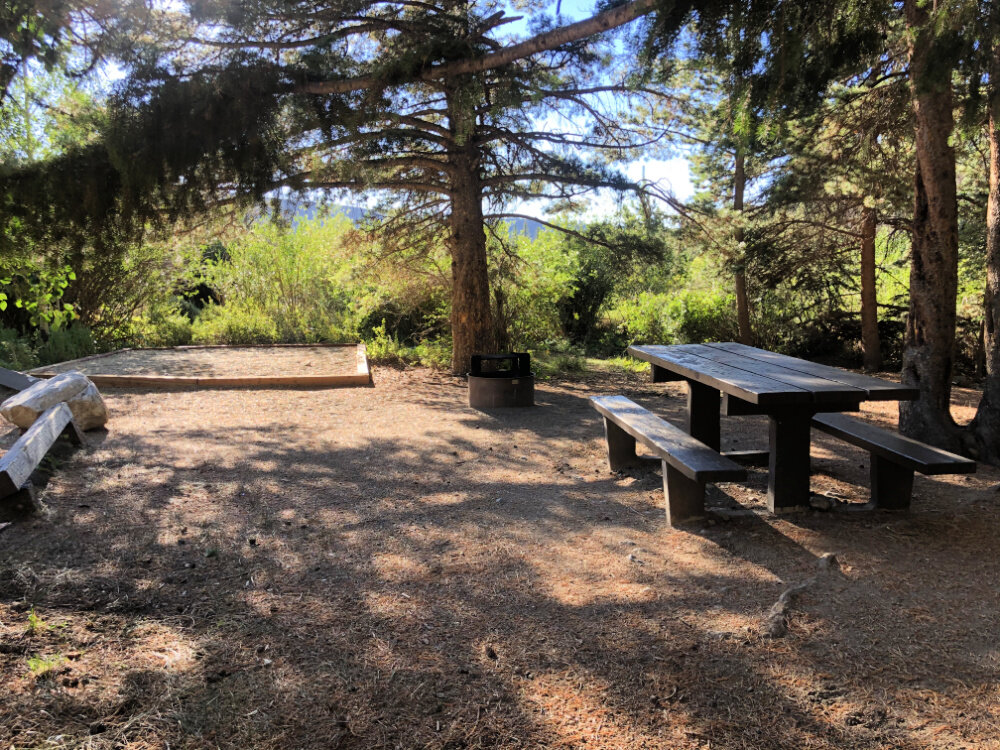
Many campgrounds we feature in 15 Scenic Campgrounds in Colorado are found in this glorious part of the Rockies.
Ranging from easy to challenging, here are the best hiking trails in Buena Vista, Colorado.

Browns Creek Waterfall is one of our favorite hikes in Buena Vista
Browns Creek Waterfall Trail
In closeby Nathrop, this 6 mile out and back rocky hike takes you along various terrain including a sandy start, followed by pine and aspen forests and a meadow crossing before reaching a rejuvenating waterfall.
A moderately challenging hike, start your hike to Browns Creek Waterfall early in the morning to avoid the hot sun in the summer. This hiking trail is exposed in the early half. Be sure to pack a lunch or a filling snack, as well as 2 liters of water per person.
We’ve witnessed couples hiking in flip flops, with only one 16 oz water bottle between them. Don’t hike unprepared. Wear sturdy shoes and each person should have their own full water bottle.
PRO TIP: Pack the right daypack for your hike. We love the Osprey Sirrus 24L - they make some of the world’s best daypacks and overnight backpacks, in our combined 50+ years of hiking and backpacking experience. And they have great customer service.
This hike is also featured in our 17 Best Hikes in Colorado.
Looking for an all day hike near Buena Vista with double the mileage? Just continue hiking to Browns Lake and log 12 miles round trip.
How to get there: Browns Creek Waterfall Trail trailhead is about halfway between Buena Vista and Salida. To reach this trail from Hwy 285, head west on CR 270 (left if coming from Salida; right if coming from Buena Vista). Continue straight through the four-way stop on CR 270 for 2 miles. At the CR 274 junction, turn left and stay on CR 272 for another 1.7 miles to the trailhead. You’ll find bathrooms at the trailhead.
In the winter, you’ll definitely want to bring spikes and poles, and sometimes snow shoes are required. This is super common when hiking in Colorado in winter.

Agnes Vaille Falls in Nathrop near Buena Vista Colorado
Agnes Vaille Falls Trail
Also in Nathrop, this short and sweet hiking trail just up the road from Mount Princeton Hot Springs is not far from Buena Vista, Colorado. Kids will love this 1.2 mile out and back Agnes Vaille Falls Trail to a tall waterfall that freezes over beautifully in winter.
I’ve hiked this with my family at least 3 times, in winter, early spring, and late spring too. You easily may need spikes and poles in winter or spring.
This hike is great with kids and provides fantastic views of two fourteeners: Mount Princeton and Mount Antero.
How to reach the trailhead for Agnes Vaille Falls: drive up Chalk Creek Drive past Mount Princeton Hot Springs and Mount Princeton Camp. You’ll see a parking area and the trailhead on the right, across from Chalk Lake Campground.

Waterfall Hikes in Colorado
Love the idea of hiking to waterfalls in Colorado all over the state? Here 27 Waterfall Hikes to save to your Colorado hiking list.
Narrow Gauge Trail 1432
This easy 4.5 mile without much elevation gain starts around 8600’ and ends at 9000’.
This trail is mostly wide and nearly flat, making it an ideal hike near Buena Vista — perfect with younger children and senior hikers.
An old railroad route, the Narrow Gauge Trail is nestled along a pass right between two Collegiate Peaks 14ers: Mt. Antero and Mt. Princeton.
This relaxing hike along the Narrow Gauge provides fabulous views of the Chalk Cliffs, far-off Agnes Vaille Waterfall, Chalk Creek and Chalk Lake. The trail narrows a couple of times and you may climb over rocks a few times, but it is mostly a flat, wide gravel trail.
Always hike prepared with water and snacks and sunscreen.
To reach the trailhead: From Hwy 285 in Nathrop, drive west on County Road 162 /Chalk Creek Drive and follow signs to the Mt. Princeton Hot Springs Resort. Pass the hot springs and turn left on County Road 290, which will take you straight to the trailhead.

Chalk Lake can be seen from the Narrow Gauge Trail, an easy Buena Vista hike
Arkansas River Trail Hike
The Arkansas River Trail is a must on your first time into the heart of Buena Vista, Colorado.
This easy going walk along the powerful Arkansas River starts at the Buena Vista River Park, just at the far east end of Main Street
Only 1.5 miles in length as an out and back trail, you’ll see picnic tables and benches along the trail so you can stop and take in the beauty of the Arkansas River.
Watch kayakers practice their skills in the Buena Vista Whitewater Park on the river.
The Arkansas River is known for some of the best whitewater rafting and fly fishing in Colorado. For rafting, I highly recommend Noah’s Ark. For fishing tips, head to Ark Anglers for help.

Barbara Whipple Trail is a great hike in Buena Vista along the Arkansas River
Barbara Whipple Trail
Starting off a bit steep, this moderate loop trail take you up 500 feet over a couple of miles, providing stunning views of the collegiate peaks.
The Barbara Whipple Trail is used by hikers and mountain bikers, so keep your eyes and ears alert. Give yourself one to two hours to enjoy this hike. Pack water, as this trail gets plenty of sunshine and can be hot on a mid-summer’s day.
To reach this trail and other nearby hikes in Buena Vista, head to the Riverfront Park at the end of East Main Street in town.

At the top of Midland Hill, above Buena Vista Colorado and the Arkansas River Valley, with a view of the Collegiate Peaks
Midland Hill Trail
A more arduous hike, clocking in at 5.5 miles, the 2,000’ climb to Midland Hill Trail is worth the stellar views of the Collegiate Peaks. Tack on extra miles via the North Broken Boyfriend Trail and more.
From Midland Hill, you will also see a sprawling view of the town of Buena Vista and the Arkansas River Valley, but your eyes will often be drawn back upward to the top of Mount Princeton and her neighboring peaks.
Once you hit the top of Midland Peak, refuel with snacks and water while taking in a 360 view of the entire area.
You can hike this in spring and winter with spikes and poles. This hike is a great option when you don’t have time to tackle something more challenging or further out in the area.
The Midland Hill Trail is part of the same trail system as Barbara Whipple Trail mentioned above. These Buena Vista hiking trails are part of a trail system popular with hikers, bikers, and you can bring dogs on leash.
To reach the trailhead: Access the Midland Hill trail from the Arkansas River footbridge, located at the end of Buena Vista's East Main Street.
NOTE: You can also hike to Midland Hill from Johnson's Village: Drive north on Highway 285 for 4.5 miles to County Road 315. Turn left on 315 for .5 miles to the trailhead.

The steep climb up to Midland Hill, a more challengng hike in Buena Vista.
Mount Elbert
Just 30 minutes from Buena Vista, I bagged Mount Elbert, my first fourteener, while camping at Twin Peaks campground just past Twin Lakes. Friends and I hiked the South Mount Elbert Trail to 14,439 feet.
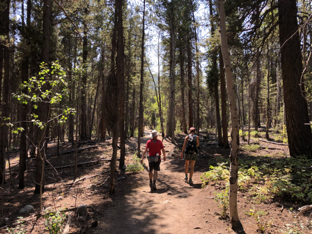
There are other trails to summit this peak as well, but the South Mount Elbert Trail is great for fourteener newbies. You’ll hike through an expansive aspen grove and pine forest during the first half of your hike.
The hike to the top of Mt. Elbert doles out amazing views, especially once you reach the ridge above treeline. You’ll spy alpine lakes from afar and see other fourteeners to hike amid bright blue Colorado skies.
You’ll gain 4800 feet in elevation and is no joke for those coming from lower elevation. You will hike 6.8 miles one way, or 5 miles one way if you have a 4WD vehicle that can get you closer to the trailhead.
NOTE: My Missouri friend spent two days acclimating to altitude, and she still needed canned oxygen and labored to reach the top. Know your body and your limits before you go.
How to reach the South Mount Elbert Trailhead: From US 24, head west on State Hwy 82 for 3.75 miles to Lake County Road 24 and turn right. Go north 1.5 miles to the South Elbert Trailhead. Four-wheel-drive vehicles can travel an additional 1.8 miles on FSR 125.B during the summer season, but this road cannot be driven during the winter months. From the end of FSR 125.B, follow the Colorado Trail, crossing a foot bridge over a stream and passing a pond on your right. Turn left at the Mt. Elbert / Colorado Trail intersection to hop onto the South Elbert Trail.

Stunning views from the top of Mount Ebert, a fourteener hike near Buena Vista Colorado
Hike to the Historical Interlaken Resort
Just 30 minutes from Buena Vista, an easy hike and another favorite while camping up near Twin Lakes, the Interlaken Trail leads to an old historic resort after three miles of hiking along the lake’s shore.
Take Scenic Hwy 82 west from Hwy 24 towards Aspen, Just before Twin Lakes, turn left onto County Road 25, follow the road for 1 mile to a small parking area for the Colorado Trail.
The Interlaken Trail is of our favorite hikes near Buena Vista in all four seasons .
Twin Lakes is also an excellent spot for paddleboarding in Colorado.

St. Elmo Ghost Town
St. Elmo Ghost Town
If you love history and ghost towns, then head to St. Elmo, just 20 miles southwest of Buena Vista. Found at 10,000 feet up in the Sawatch Range, this ghost town is wonderfully preserved and maintained, making it so fun to explore and a fantastic multi-generational day trip from Buena Vista or Salida.
After exploring St. Elmo, you can head out hiking from the ghost town. We hopped on St. Elmo County Road 294 in early November, with snow already blanketing the ground.
Mount Princeton
I’ve spent many summers on Colorado’s Mount Princeton at Young Life’s Frontier Ranch as a teenager, but I’ve yet to tackle this fourteener overlooking Buena Vista.
Best hiked in the summer, the trail to Mount Princeton can be accessed via Forest Road 322 which climbs the east side of the peak from Frontier Ranch - a Young Life Camp. At the end of the road, the trail follows the peak's east ridge.
The trail to Mt. Princeton begins at about the 11,700 foot level. The trail leaves the road on the right and climbs some stone steps and continues up to the ridge. Rock cairns mark the trail to the top.
NOTE: The Mt. Princeton road is closed by heavy snow from November until June.
Hiking in Colorado means you could experience four seasons in a day. Layers and the right gear are key to maximum enjoyment while hiking in the Rocky Mountain.
Here’s our go-to gear for Colorado Hiking Trails in 2026:
We love the Osprey Sirrus Hiking Daypack for women, or the Stratos version for men, for carrying water, layers, and snacks on cool Colorado day hikes
Lightweight, versatile Hiking Poles built for a full day’s send on the trail — hike longer and stronger
2L or 3L Water Reservoir — This affordable reservoir is easy to fill
Patagonia Torrentshell - a true waterproof rain jacket and fantastic layering piece
Nano Puff Jacket - our favorite layering in all the seasons
Lost Lake #1532
We’ve heard great things about the new hiking trail constructed to Lost Lake. This moderate 3.3 out and back hike near Buena Vista is on our list!
Best done in summer and fall, you will be hiking above treeline up above 11,880’. To reach the trailhead, head straight west on Main to State Hwy 306 to Co Rd 348 for about 15+ miles.

Cross country skiing at Mount Massive Golf Course in Leadville Colorado in February
Nearby Hikes in Leadville
Leadville is just 35 minutes north of Buena Vista Colorado and also a popular spot for summer hikes and winter cross country skiing and snow shoeing.
Here are some of the best hikes near Leadville:
Turquoise Lake
Windsor Lakes Trail
Missouri Lakes Trail
Native Lake Trail
Segment 10 of the Colorado Trail
Mount Massive (14er)
After your hike near Leadville or Buena Vista, head over to Leadville’s main street and shop at Melanzana for outdoor clothing, crafted only in Leadville.
Make an appointment two weeks in advance for your chance to purchase colorful, unique, fleece pullovers in the store, right where they sew them. Melanzana sells their clothing by appointment only in Leadville only.
Head next door to the Golden Burro for scrumptious pastries and more.

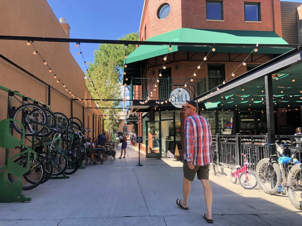
Buena Viking Food Truck in Buena Vista Colorado
Hops after the Hike:
THE BUENA VIKING
With burgers like the Viking and the Berserker, the Buena Viking encourages you to be yourself… unless you can be a viking. Add a boat load of taters or a pile of sweet potato fries next to your burger.
After 7 glorious years of operating out of a food truck, to everyone’s joy, The Buena Viking is now a year-around, permanent, brick and mortar location.
They even offer three suites for rent up above the eatery — aptly named The Even Keel.
WOO HOO! BV never looked so good!
418 East Main Street, Buena Vista Colorado
MOUNT PRINCETON HOT SPRINGS
Open year round and located ideally between Salida and Buena Vista, you’ll pass these historic hot springs on your way to the Agnes Vaille Falls Trail mentioned above. Soak your cares away after the hike. Stay overnight and you have access to the natural hot springs and pools the day you check in and the day you check out. 15870 Co Rd 162, Nathrop, Colorado 81236
CHARLOTTE HOT SPRINGS
Charlotte Hot Springs is found right next to Merrifield’s Greenhouses at 19256 County Road 343. With three soaking pools now open at Charlotte Hot Springs, you can enjoy an indoor botanical garden.
RELATED READING: 23 Colorado Hot Springs You Need to Dip Into

Soaking in the adult pool at Mount Princeton Hot Springs
LOUIE’S ICE CREAM
Also open seasonally, go for a scoop Sleepless if you need a pick-me-up or try a malt, shake, root beer float, or coffee while you relax on the patio in a sweet courtyard shared with The Village next door. 414 East Main Street, Buena Vista, Colorado
EDDYLINE BREWERY at South Main
Serving up craft brews like River Runners Pale Ale, Crank Yanker IPA, Kickn' Back Amber, Jolly Roger Black and much more. Soak it up with a burger, nachos, or pizza. 926 Southmain Street, Buena Vista, Colorado 81211
Where to stay in Buena Vista Colorado
Just a few miles from Mount Princeton hot springs, find mountain retreats like this one: a fabulous scenic home in the heart of the Colorado Rockies with breath-taking views every which way you turn.
RV RENTALS in COLORADO
Looking to try on an RV for size? Consider renting an RV or camper van.
For example, try camping like a pro on a spectacular piece of land near Buena Vista, CO — adjacent to Mt Princeton Hot Springs resort!
Don’t want to drive it? Many RVs can be set up at your destination and they’ll even discount your insurance.
Save $50 off your Outdoorsy RV Rental with promo code “COHH50” when you book here.

Collegiate Peaks Scenic Byway Map
How far is Buena Vista from Salida?
Just 22 miles apart, the small mountain towns of Buena Vista and Salida offer so many hikes and outdoor adventures year-round.
The Colorado Vacation Directory gave us permission to share their Collegiate Peaks Scenic Byway Map to help you see where Salida and Buena Vista sit in Chaffee County and which other points of interests are nearby.
Finally, here are two of our favorite Colorado mountain passes that are gorgeous drives:
COTTONWOOD PASS
The drive along Cottonwood Pass from Buena Vista crosses over the Continental Divide at 12,126’ and takes you towards Crested Butte.
This drive is one for the books.
There are many beautiful campgrounds and fishing spots along the way. Be sure to stop for a picture at the top of the pass.
INDEPENDENCE PASS
Looking for more breathtaking Colorado mountain top views? Drive the hair-raising Independence Pass to reach 12,095 feet atop the Continental Divide.
This jaw-dropping drive through Twin Lakes and all the way to Aspen packs a punch, and more fabulous hikes await:
Maroon Bells: How to See These Beauts
Have you hiked and played in and around Salida and Buena Vista? What are some of your favorite Colorado adventures you’ve had in this part of the Colorado Rockies?
RELATED READING: Love small mountain towns in Colorado? Head to Westcliffe! Read up on alpine Lake Hikes in Westcliffe — A Dark Sky Destination in the Sangre de Cristo Mountains — just a hop over from the Great Sand Dunes.

At the top of Cottonwood Pass in June

Take a hike to Music Pass and Lower Sand Creek Lake in Westcliffe, another small mountain town we love