Best Snowshoe Hikes Near Colorado Springs
This post contains affiliate links, which means if you click through and make a purchase, we make a small commission at no extra charge to you.
Updated for the 2026 to 2027 winter season. New this year: a beginner friendly day trip to Brainard Lake near Nederland, plus current winter road closures, avalanche notes, and where to rent snowshoes in the Pikes Peak region.
New to winter travel? Skim the gear, rentals, and avalanche notes at the bottom before you pick a trail.

11 Best Snowshoe Hikes Near Colorado Springs (2026)
With endless options for snowshoe hikes in Colorado Springs and nearby areas, you can explore the state's most popular warm-weather trails in a winter wonderland. Not only is it a fun way to stay fit in the cold months, but it also provides a magical experience as you trek through snow-covered trails.
There’s no way you'll want to miss these Colorado Springs snowshoeing adventures! And Colorado’s best snowshoeing trails are just minutes from Colorado Springs while snowshoeing in Denver and around surrounding counties is close by.
For easy snowshoeing trails near me in Colorado Springs, I often head 25 minutes south to Teller County, where you’ll find beginner-friendly routes and steeper trails for a bigger challenge.
Some of the best snowshoe hikes near Colorado Springs are less than an hour from downtown, up in Woodland Park, Divide and the Pikes Peak backcountry.
Whether you’re snowshoeing in Denver area or searching for the best snowshoeing trails in Colorado Springs, we’ve rounded up our 11 favorites below.
Quick Picks Snowshoeing Near Colorado Springs
Short on time? Here are the quick picks:
New to snowshoeing? Start with Lovell Gulch or the flat run to Brainard Lake.
Want a real workout? Sentinel Point, 8 miles and over 2,700 feet of gain.
Best views for the least effort? The Crags.
Bringing the dog? Lovell Gulch and Mueller State Park say yes. Brainard Lake says no.
Worth the drive? Brainard Lake near Nederland, about 2.5 hours north.
| Trail | Distance | Gain | Level | Dogs |
|---|---|---|---|---|
| Lovell Gulch | 5.2 mi | 918 ft | Beginner | On leash |
| The Crags | 8 mi | 820 ft | Beginner | On leash |
| Mueller State Park | Varies | Varies | Beginner | On leash |
| Anne-Marie Falls | 3.2 mi | 623 ft | Intermediate | On leash |
| Raspberry Mountain | 6.5 mi | 1,013 ft | Intermediate | On leash |
| Mt. Esther | 4.2 mi | 1,548 ft | Intermediate | On leash |
| Bull Park | 5.5 mi | 1,020 ft | Intermediate | On leash |
| Horsethief Falls | 6.7 mi | 1,837 ft | Intermediate | On leash |
| Rampart Reservoir | 13 mi | 928 ft | Intermediate | On leash |
| Sentinel Point | 8 mi | 2,732 ft | Advanced | On leash |
| Brainard Lake | 6 mi | 500 ft | Beginner | Not allowed |
what is snowshoeing?
Snowshoeing in Colorado is a great way to channel your inner snowbeast and explore the wilderness.
And the best part? No need to buy expensive lift tickets or worry about shredding your knees on steep slopes. Just strap on your snowshoes and trek through the winter wonderland at your own pace.
Plus, if you're lucky, you might even spot some wildlife along the way, like a sneaky snowshoe hare or a majestic elk. On a snowshoe trail near me in Colorado Springs, I spotted several deer enjoying a bite to eat in the forest.

Best Beginner Snowshoe Trails Near Colorado Springs
The best beginner snowshoe trails near Colorado Springs are in Divide, Colorado. Twenty minutes from south Colorado Springs, off Hwy 24 are dozens of long and short hiking trails with beautiful mountain views, towering pine trees and whispering aspens.
Whether this is your first time on a Colorado snowshoeing trail or you’re an expert at managing those snowshoes, each of these hikes promise adventure, peace, and beauty just minutes from Colorado Springs.
An easy day trip, check out these free beginner short hikes to all day intermediate treks in Teller County.

The Snowshoe Trails
Snowshoe Trails Near Woodland Park

Lovell Gulch Trail
Distance: 5.2 miles
Elevation Gain: 918 feet
Route: Loop
Dogs on leash
Winter access: The trailhead sits next to the Woodland Park public works yard on Baldwin Street, so the access road gets plowed regularly even after a storm. The small lot itself may not be cleared right away, and Rampart Range Road past this point is closed and unplowed for the season. Expect packed snow and ice on the trail, so bring snowshoes or microspikes.
The trailhead sign says dogs can be off leash if they have strong recall. Be aware that people have differences of opinions regarding their dog’s ability to respond off leash.
If your pet is skittish, leave them home on this hike.This meandering pine laden loop hike takes you into the mountains with the feel of remoteness without the actuality of being remote. Consider taking the trail counterclockwise, giving you a great downhill for the way back.
A favorite snowshoe near me and one I’m on often, experience the beautiful quiet of the forest with an unexpected grand view of Pikes Peak mountain.
GETTING THERE: Take I 25 to US-24 Hwy through Woodland Park. Continue to Co Rd 22, turning right on S. Baldwin Street. Continue on CO Rd 22/Rampart Range Rd for 1.5 miles. The TH will be on the left.
Rampart Reservoir
Distance: Trail apps vary from 13.2 - 15 miles
Elevation Gain: 928 elevation gain
Route: Loop
Dogs on leash
Winter access: This one takes commitment in winter. Rampart Range Road is closed to vehicles and left unplowed once the snow flies, so the easy summer drive-up is gone and the approach gets long. The reservoir is a protected drinking water source, so dogs are welcome on the trail but cannot go in or near the water.
This trail is long but has relatively low elevation gain and losses. You hike around the entire Rampart Reservoir. Created in 1969, this body of water is created by a 230 feet high, 3400-foot-long dam storing 13 billion gallons of Colorado Springs water.
Stocked with fish, fishing via a permit is allowed as is wakeless boating.
The lake was formed where 12 different streams flowed into West Monument Creek. There are hills at each of these junctions on the trail, making for a kinetic experience. Touted as one of the best snowshoeing trails in Colorado simply due to length alone, Pikes Peak views make it 100x better!
PRO TIP! Bikers tend to go clockwise. Hike counterclockwise. Make sure to find trail 700 at north end of dam to continue around the lake.
GETTING THERE: Take Hwy24W, turning right at McDonalds (Baldwin Road) in Woodland Park. This becomes Rampart Range Road. Follow signs to Rampart Reservoir.
INSIDER TIP! Did you know that Colorado’s running community hosts the Pony Express race each fall, taking the runners on this entire loop. Instead of a medal, you get a horseshoe at the end!
Hops After the Hike
Warm up at BierWerks Brewery right in Woodland Park, and do not skip the Donut Mill, a local institution since 1983. Coffee, a maple bar the size of your hand, and a fireplace to thaw out by.
BierWerks Brewery
121 E Midland Ave, Woodland Park, CO 80863
Interested in a cold brew after taking on the best snowshoe trails? Check out BierWerks Brewery. Several European beers on tap as well as a full food menu.
RELATED LINK: Colorado Springs breweries are like the X-Men of the beer world - each one has its unique superpower. From the hoppy heroics of Bristol Brewing Company to the malt madness of Phantom Canyon, you'll find no shortage of suds to sample. Our Colorado Springs Brewery Guide tells you where to go to get the best local craft beers in the area!
Donut Mill
310 W Midland Ave, Woodland Park, CO 80863 719-687-9793
Some like sweets after a hike. We say any time is a good time for a donut. The Donut Mill is a Woodland Park landmark since 1983.
Just off Hwy 24, stop by for donuts to go. We are partial to the cinnamon roll, which is the size of your head. Starting at just under a $1`, pick out a few and take them with you snowshoeing!

Snowshoe Trails Near Divide (Highway 67)

The Crags
Distance: 4.8 miles
Elevation Gain: 820 feet
Route: Out and back
Dogs on Leash
Worth knowing before you load the car: in summer you can drive to the upper trailhead, but in winter Teller County Road 62 closes at the Mennonite camp. You park there and walk the road in, which adds about 3 miles each way. That is why the winter trip runs closer to 8 miles instead of the usual 4.8. Still gentle, still worth it, just plan for the extra distance and daylight.
A relatively up and down trail, this beginner trail boasts giant rock formations alongside the trails. A wide-open meadow about a ½ mile into the hike helps the snowshoe newbie get the hang of a wider leg stride. One of the best snowshoe trails in the area, expect a bit of up and down hills.
The trails tends to be well loved and used by locals. However, it’s always good to download a map to have just in case you’re trailblazing. NOTE! This area often has no service.
GETTING THERE: Take Hwy 24 to CO- 67 S. Turn off for Crags Campground. Follow road to Mennonite Camp where you turn right. Parking is off the Crags road to your left.
PRO TIP! Park just beyond the Rocky Mountain Mennonite Camp before the gate.

Horsethief Falls
Distance: 6.7 miles
Elevation Gain: 1837 feet
Route: Out and back
Dogs on leash
Winter access: Off Highway 67 about 9 miles south of Divide, plowed year round. Park by the blocked off railroad tunnel. The first half mile climbs hard and ices over once it packs down, so gear up at the car. Your reward at the top is the falls frozen into a wall of ice.
The first half mile climbs hard and ices over once it packs down, so gear up at the car. Your reward at the top is the falls frozen into a wall of ice.
As the name claims, this is a waterfall hike, flowing in warmer months and frozen in winter.
You’ll start with a relatively steep first mile. Just when you are done with the hill, you arrive at a small intersection in the woods with a sign and split trail. Straight ahead is the falls. Head to the right (north), and in about two miles you’ll arrive at Pancake Rocks.
Extend the hike and trek to Pancake Rocks before backtracking to visit Horsethief Falls.
GETTING THERE: The trailhead is located off Hwy 67 between Cripple Creek and Divide. When you see an old railroad blocked off tunnel, you’re almost there.

Sentinel Point
Distance: 8 miles
Elevation Gain: 2,732 feet
Route: Out and back
Dogs on leash
*Summit is 12,527 feet
Winter access: The hardest trip on this list, and the one that asks for the most respect. The route climbs more than 2,700 feet to a summit above 12,500 feet and crosses avalanche terrain on the way. Save it for a stable snowpack, check the forecast at the Colorado Avalanche Information Center first, and bring the gear and the know how to match.
The hike starts at Horsethief Park Trailhead off CO Route 67. As with Horsethief Falls trail, you’ll have a steady uphill hike for the first mile or so.
When you arrive at the split trail, head LEFT, following Forest Trail 704. At the edge of the long meadow, follow a cairned trail uphill to a boulder field.
The cairns (rocks stacked on top of each other) are visible on this forest trail. Once you arrive in the boulder field you’ll most likely will need to break your own trail. Keep you downloaded map close as you scramble up the summit of this mountain.
Breathtaking 360 views of Telluride and El Paso County await you.
GETTING THERE: Take Hwy-24 W to Divide. Turn south on Hwy-67. Around 9 miles, the road will pass an old tunnel. Parking is just past the tunnel. It comes up quick so slow down around the curve.

Raspberry Mountain via Ring the Peak Trail
Distance: 5.2 miles
Elevation Gain: 1,013 feet
Route: Out and Back
Dogs on leash
Winter access: The gate on the access road near the Rocky Mountain Mennonite Camp closes for winter, usually November through March. When it is shut, you park in the small plowed area by the closure and walk the road in, adding about 0.65 miles each way to the trailhead. No water on this one, so pack plenty for you and the dog.
At just under 6 miles, this snowshoe trek takes you through the Pike National Forest. You’ll start the hike with steep switchbacks. Go slow and steady. You’ll be climbing for a fair bit.
Once you arrive at the meadow, you’ll be shaded by forest for a bit. Turn right on the forest road after crossing a creek. Turn left, getting off Ring the Peak Trail. It is a steady uphill to the summit.
You're rewarded with views of The Crags, Pikes Peak and Catamount Reservoirs at the top! Budget some extra time hanging out at the summit.
GETTING THERE: Take Hwy 24 to CO- 67 S. Turn off for Crags Campground. Follow road to Mennonite Camp where you turn right. Parking is off the Crags road to your left.
PRO TIP! When it comes to snowshoeing in Colorado, there are two things you can count on: amazing views and freezing temperatures. So, why not warm yourself up with a thermos of hot tea? Fill your favorite insulated water bottle with a hot beverage. Not only will it give you a boost of warmth, but it will also give you an excuse to stop and take in those picture-perfect summit views.
Bull Park Trail
Round Trip Distance: 5.5 miles
Elevation Gain: 1,020 feet
Route: Out and Back
Dogs on leash
Winter access: The trailhead is right off Colorado Highway 67, plowed and open year round, so getting there is rarely the issue. Park in the pullout by the old railroad tunnel, where snowbanks pile up after a storm. This is active bear and mountain lion country, so keep the dog close and leashed.
GETTING THERE: Begin at Old Stage road (west of Broadmoor). Start your odometer at 0 and drive 19.6 miles. 4WD recommended. At the intersection by cabins, turn right onto forest road 376. Drive 3.2 miles to gate. Park before the gate. Hike the jeep road that goes left across a stream.
While summer hiking isn't ideal on this ATV and dirt bike road, winter snowshoeing is where it's at. Jeeps are prohibited on this trail during the snowy season. The trail is named after the meadow where bull elk congregate each year.
Looking for a snowshoe trail with picturesque views of aspen trees? Elk Meadow to Peak View is the hike to do. This 2.2-mile trail is a winter wonderland that is perfect for snowshoeing. Although the trail doesn't have a summit view, the valley view is worth the trek.
Rock Pond trail is a 7.4-mile snowshoeing trail that offers stunning views of the Rocky Mountains. The trail winds through dense forests and open meadows, making it a great spot for wildlife viewing. The trailhead starts at the Grouse Mountain parking lot and is a great option for those looking for a longer snowshoeing adventure.
Hops After the Hike
Paradox Beer Company
10 Buffalo Court, Divide, Colorado 80814
After a cold morning on the west side of Pikes Peak, pull into Paradox Brewery in Divide. It sits right on the way back toward Woodland Park and the Springs, and the sours and barrel aged beers are a fitting reward for breaking trail all morning.
Ute Pass Snowshoe Trails

Anne-Marie Falls
Distance: 3.2 miles
Elevation Gain: 623 feet
Route: Loop
Dogs on leash
Winter access: Short does not mean easy. The trail climbs steadily and the steeper pitches turn slick once they ice over, so put traction on early. There is water along the route, a plus if the dog is with you.You’ll start at the same TH as the Crags hike. This hike’s trail starts at very end of Crags road.
This short but steep destination hike offers stunning views at the top of the trail. Start at the small parking lot area with trail marker 704 to your right. With two options for snowshoeing, you can stay on the familiar Ring the Peak trail or follow old roads on former private property.
On descent, backtrack to valley to get back to main trail. Go downhill (right) until you come to a metal gate. Go left to main road.
GETTING THERE: Take I 25 to US24W. Continue on CO-67 S towards Divide, turning left on CO-67 S to stay on CO-67 S. Turn left on Teller Co Rd 62, arriving at the trailhead.
PRO TIP! Either route requires focused attention to the trail. Downloading the trail map on an app such as All Trails Pro or COTREX (Colorado Trail Explorer) allows for a smooth and stress free snowshoe hike.
COTREX has area trails for free. Downside of the app, in our opinion, is the lack of elevation lines.

Mt Esther
Distance: 4.2 miles
Elevation Gain: 1,548 feet
Route: Out and back
Dogs on leash
Winter access: Parking is the catch here. The pullout holds only 3 or 4 cars, so arrive early or have a backup trail in mind. The climb is steep and steady, and at this elevation keep an eye on yourself and your dog for signs of altitude or fatigue.
Getting there: Take US-24 W, exiting at the traffic light at Cascade. Take Fountain Ave, keeping right at Pikes Peak Hwy. Drive 1 ½ miles on Chipita Park road. Turn left Picabo Rd., keeping left on mountain road. Trail head is on the right at the intersection of Mtn Rd and Picabo Rd.
The hike starts from Chipita Park with a steady uphill switchback climb. You’ll pop out at a mountain meadow. Turn right and continue to Crystal Creek Reservoir.
The marker for Mt Esther is an embedded plaque in a boulder on the ground surrounded by trees. Only about 5 people fit comfortably at the summit
This is a great hike for getting in a challenging vertical feet workout.
PRO TIP! To get to summit, at the high point of the dirt path, take the social trail to the left.
Hops After the Hike
manitou Brewing Company
725 Manitou Ave, Manitou Springs, CO
Coming back down Ute Pass, Manitou Springs sits right on your way home. Pull in at Manitou Brewing Company for a pint and a warm meal before the last few miles into town.
Mueller State Park Snowshoeing Trails
Winter access: Mueller is your reliable choice when the weather turns. The main park roads are plowed and a network of trails gets packed down for snowshoeing and cross country skiing. You will need a $9 daily park pass. The loops near the visitor center stay easy to reach, while the farther backcountry loops hold deeper, unbroken snow, so match your route to how much trail breaking you feel like doing.
Getting there: Take Hwy 24 to CO67 at Divide. Turn left and follow to the park entrance.
Cost: $9/car day pass
Mueller State Park is like a winter wonderland filled with countless trails perfect for snowshoeing in Colorado. When I’m looking for easy snowshoeing trails near me, Mueller Park is my go to drive. It takes less than an hour to get there with countless trail options to explore. Plus, you can always count on more snow in this area.
CoHH Best Snowshoe Trails in Mueller
Outlook Ridge (4.3 miles)
Elk Meadow to Peak View (2.2 miles)
Rock Pond (7.4 miles)
PRO TIP! Colorado car registration just got even better! It now includes a state park annual pass, giving you access to 42 state parks for a year from the date of purchase.
Check out Colorado’s interactive map of all parks available with your state park annual pass.
Worth the drive: Brainard Lake Snowshoe
Brainard Lake, near Nederland
Round trip: 6 miles from the Gateway winter trailhead
Elevation gain: 452 feet, gentle the whole way
Level: Beginner, in good conditions
Drive time: about 2.5 hours north of Colorado Springs
Dogs: Not allowed anywhere in the Brainard Lake Recreation Area
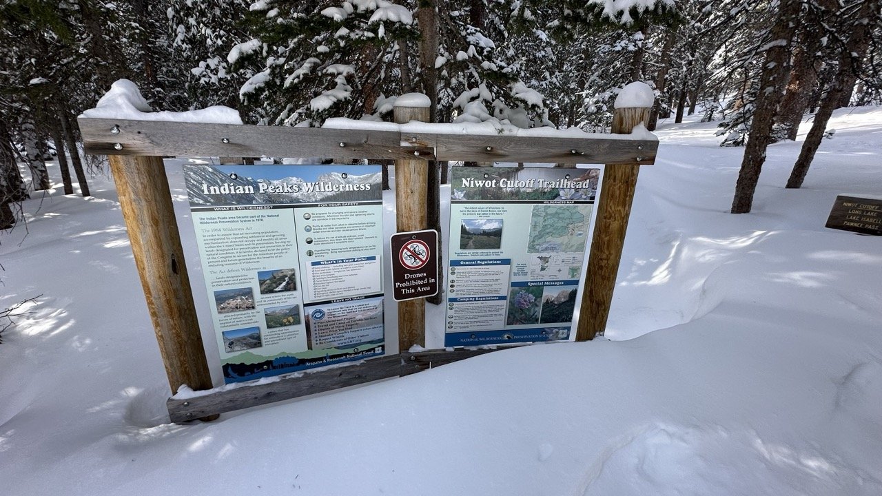
This is the one worth setting an alarm for. Brainard Lake sits in a bowl under the Indian Peaks, and on a clear winter morning the view of Navajo, Apache, and Shoshoni rising straight out of the snow is the kind of thing you drive two and a half hours for and never regret.
Here is the part first timers get wrong. In winter the road gate closes, usually by mid October, and stays shut into late June.
You cannot drive to the lake.
You park at the Brainard Gateway winter lot and travel the last few miles on foot, which is exactly what makes it such a good snowshoe.
The grade is almost flat, the route is well traveled and easy to follow, and you are moving through quiet pine forest the whole way in.
From the winter lot, follow the Waldrop or CMC trails toward the lake. The grade is gentle the whole way, only about 452 feet of gain across roughly 6 miles out and back, and the whole route sits above 10,000 feet, so the air is thin but the climbing never bites. Most people take three to four hours with photo stops. Strong beginners handle it in good conditions.
Now a little honesty from our day up there.
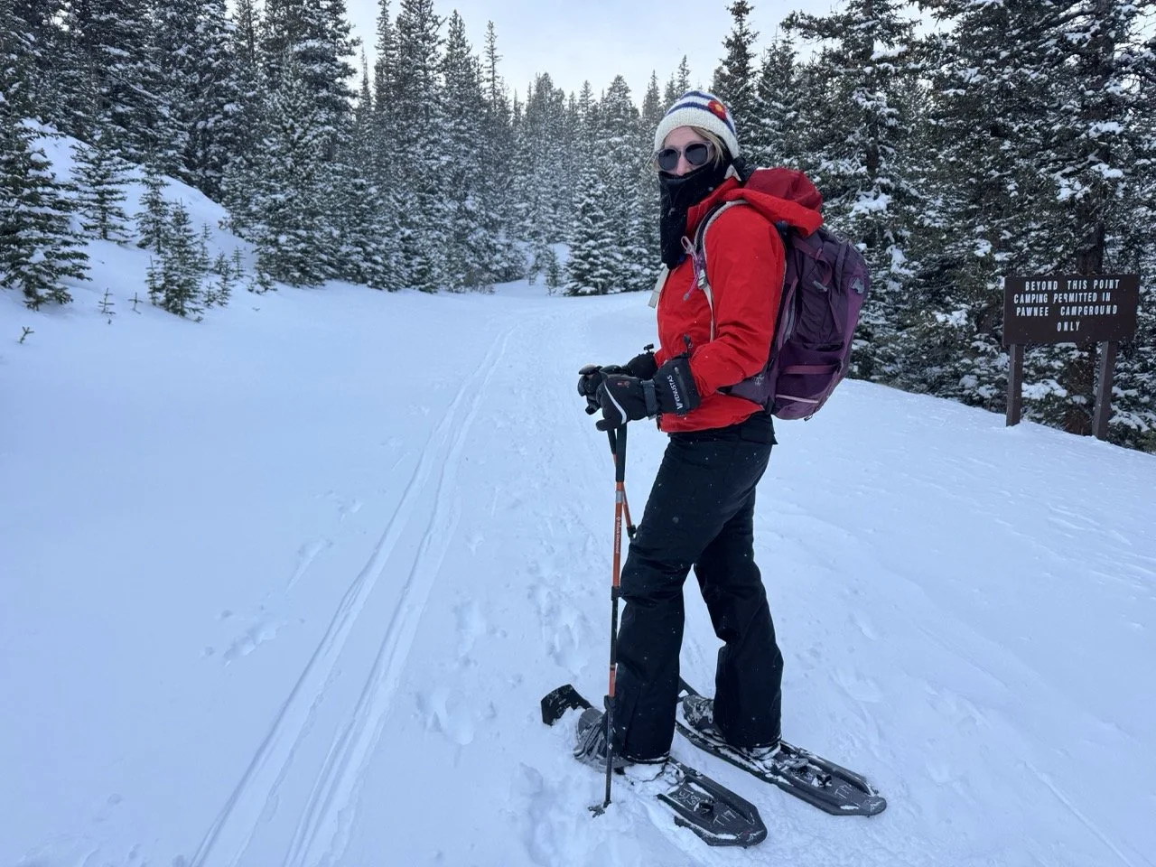
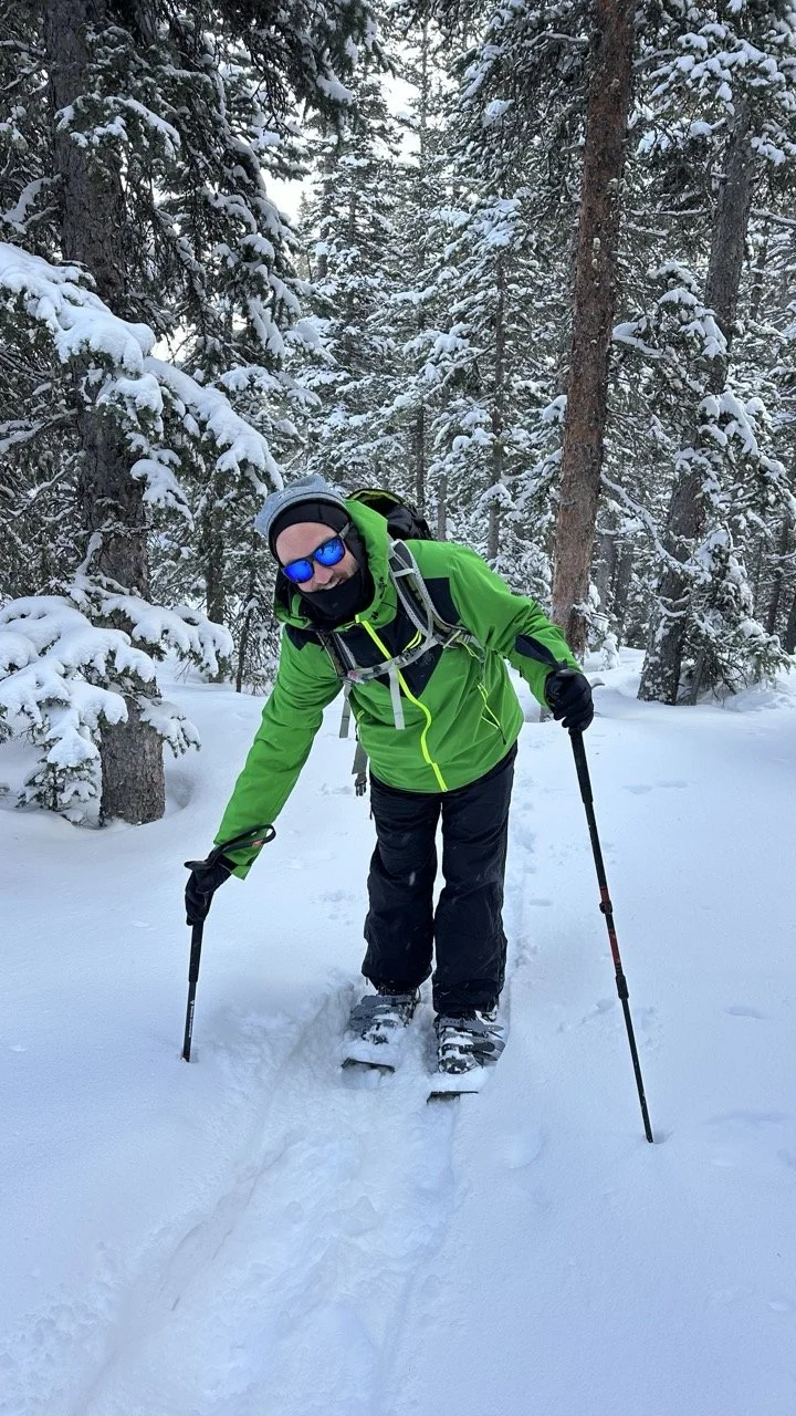
We went right after a heavy snow, before the trail had been packed down, and the last stretch had us postholing to our thighs. We turned back before the lake rather than fight it. That is the trade off at this elevation.
Fresh deep snow is beautiful and brutal in the same breath. If you want the easier version, go a day or two after a storm once boots and snowshoes have set a track, or bring good flotation and plan on a workout when the snow is fresh.
The lot also fills on weekends, and the afternoon wind off the peaks is no joke.
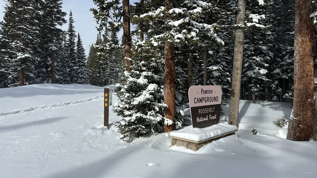
Good to know:
Winter parking at the Gateway lot runs $10 per day, or use an America the Beautiful pass. You can also park free along the road shoulder, though those county roads get icy, so bring traction or four wheel drive.
No dogs. The recreation area bans them year round, so leave the pup at home for this one.
Stop at the lake. Continuing toward Lake Isabelle or Mitchell Lake takes you into avalanche terrain, which is a different trip with different gear and knowledge.
Getting there: head north through Nederland, up the Peak to Peak Highway toward Ward, then west on Brainard Lake Road to the winter lot.
Hops After the Hike
Knotted Root Brewing
250 Caribou St, Nederland, CO 80466
On the way home through Nederland, stop in at Knotted Root Brewing. We have not made it there ourselves yet, but friends who know their beer rave about the place, and it is an easy pull off on the drive back south. If the kids are along, the Carousel of Happiness in town is worth the five dollars just to say you did it.
Know Before You Go
WHen To Go and Where the Snow is Best
Not sure where the snow is? Early season, roughly November into December, the lower trails near Woodland Park and Divide can be patchy or bare while the higher country holds a solid base. If town is brown and you still want to strap in, aim high: Sentinel Point, the upper Crags, or the drive up to Brainard Lake, which sits above 10,000 feet and usually has snow when nothing else does.
Late season, March into April, flips the script. The low trails melt out and turn to mud and postholes, while the high shady routes stay packed with snow well into spring.
When in doubt, check a recent trip report on AllTrails before you load the car.
Is there enough snow in Colorado Springs to Snowshoe?
Usually not. Most of Colorado Springs sits below 8,000 feet, and the snow in town rarely gets deep enough for snowshoes. In heavy snow years, a few higher trails close to town can hold enough, like the Palmer Lake Reservoirs and Mount Herman in Monument.
Find them in our guide to the best winter hikes in Colorado Springs, but don't count on deep snow. For reliable snowshoeing near Colorado Springs, head up Highway 24 to Woodland Park, Divide and Mueller State Park. That's where you'll find most of the trails in this guide.
Where to Rent Snowshoes near Colorado Springs
You do not have to own a pair to give this a try. A day rental runs about $20 to $50 depending on the shop.
Mountain Chalet, downtown Colorado Springs at 15 N. Nevada Avenue. A local institution with a full rental and demo counter and staff who actually snowshoe these trails.
REI Colorado Springs. Rents to members and nonmembers, and you can reserve online so your size is waiting when you arrive.
Routes Outfitter, just up I-25 in Monument. $20 for a 24 hour rental, $5 each additional day, on Tubbs snowshoes. Reserve ahead, and note they are closed Mondays.
Heading up toward Woodland Park and Divide instead? Mueller State Park runs ranger led snowshoe hikes through the winter and often has loaner snowshoes for those programs, so call the visitor center before you go.
Reserve by Thursday or Friday for a weekend trip. Sizes and the bigger models go fast after the first real storm.
Once you’ve honed in on your favorite snowshoe, purchase them out of season for the best winter clearance price. Most winter gear is marked down in March/early April.
COHH REC! At COHH, we are fans of the MSR EVO snowshoe. It’s a durable shoe, highly rated by amataur hikers, has a long hiking life and a reasonable purchase price of $180.
Whether snowshoeing in Denver outdoor parks or tackling Rocky Mountain National Park’s pristine trails, check out these snowshoe options and reviews.

Safety and Avalanche Awareness
search and rescue’s Essentials

Search and Rescue (SAR) recommends these items are always in your pack, no matter the season. Even if you plan a quick 2-hour hike, don’t be caught without the basics.
Lightweight, space efficient items like a fire starter, mylar emergency blanket and first aid kit are lightweight add peace of mind to the just in case moments. We carry the a recyclable emergency blanket in our daypacks at all times. These very lightweight blankets save on environmental waste for those just in case moments.
Weather Check | Avalanche Conditions
Any basic weather app can show you radar for the area you plan to hike. Look for incoming storms, snowfall and shifts in temperature. If you are planning a more remote Colorado snowshoe hike, always check for avalanche danger. Knowing where you can go snowshoeing safely is just as important as having the right gear.
Frequent changes in weather and irregular snowfall can make any mountainous area susceptible to avalanches. A simple check on the weather, glance at radar and basic knowledge of the area could make all the difference for your hike.
Know which trails touch avalanche terrain. Most of the routes on this list are low angle and safe in a normal snow year. A few are not. Sentinel Point, the upper slopes of Horsethief Falls, Raspberry Mountain, and Mt. Esther cross or sit below steeper terrain that can slide after a big storm or a wind event. The walk to Brainard Lake itself is flat and safe, but continuing past the lake toward Lake Isabelle or Mitchell Lake puts you under avalanche paths. Before you head into any of these, check the forecast at the Colorado Avalanche Information Center at avalanche.state.co.us.
Trails
When it comes to sharing the trail with cross country skiers during your Colorado snowshoeing adventure, remember: don't be a snow-hog!
Here's your guide to the best Colorado snowshoeing etiquette.
Step Aside for Skiers: When you see a skier approaching from behind, step off to the side of the trail and let them pass. This will prevent any collisions and keep everyone happy.
Stay in Control: Make sure you are always in control of your snowshoes and stay on the designated trail. This will help you avoid accidentally colliding with any skiers or fellow snowshoers.
Keep it Down: If you're listening to music or chatting with friends, keep the volume low so you can hear approaching skiers and give them ample time to pass.
Share the Trail: Remember that cross country skiers and snowshoers share the trail, so be courteous and respectful. A smile or wave can go a long way in making everyone's day a little brighter.
Dogs
Don't let your furry friend leave a "surprise" for the next snowshoer - pack some bags and pick up after your pup. And make sure to check if your four-legged companion is allowed on the trail beforehand. A day of snowshoeing should be memorable for the right reasons, not because Fido left a present for the next hiker!
Leave a trace
This is the one exception to the “leave no trace” clause.
Make sure someone knows where you are headed.
In the case of an unexpected turned ankle, wildlife encounter or a simple navigational error, you want to make sure someone knows where you are.
CoHH Tip! When hiking, leave a printed copy of your route under your car seat. Make sure at least one person knows your hiking plans and expected time home.
What to Take on a Snowshoe Hike

Trekking Poles
No matter the hike, trekking poles hold you up. When walking in snow, trekking poles are non negotiable, pushing you uphill or keeping you upright for those downhill portions. Hiking poles are the perfect versatile year round piece of gear.
I am a big fan of MER Dynalock Carbon poles. Black Diamond has many options for lightweight, durable adjustable poles.
PRO TIP! Don’t forget to keep the baskets on your poles! These are the round attachments near the base of your poles, and while they might seem small, they make a big impact by preventing your poles from sinking too deeply into the snow.
Gaiters

Snow pants are the mullet of winter fashion - all business up top and a party down below. And while they may keep your legs warm, they can make you feel like you're walking in a sauna. That's why when it comes to snowshoeing, gaiters are where it's at.
Not only do they keep snow out of your boots, but they also allow your legs to breathe so you can stay cool and comfortable. Plus, they make you look like a total snowshoeing pro.
Outdoor Research (OR) makes a knee length waterproof gaiter that velcros in front with a under boot strap, creating a waterfree no slip zone.
Hiking Boots

Waterproof boots are key to a warm and problem free snowshoe hike. Melody wears her TOPO traverse shoe, a low-rise water-resistant lightweight hiking shoe with great traction.
Or like Tanya, lace up your high top Asolo waterproof boots, stabilizing your ankles.
No matter the type of snowshoe you buy or rent, it’s an easy and quick process to insert your hiking boots into the snowshoes, getting you on the trail in minutes.
RELATED LINK: Hiking Shoes or Boots? Use this step by step guide to determine what hiking shoes or boots are perfect for you.

Day Pack
Get ready to layer up, folks! The weather in Colorado can be as unpredictable as your ex's behavior. One moment you're basking in the warm sun, and the next you're shivering in the cold wind. But fear not, we've got you covered!
We've written a whole guide on how to pack the perfect day pack for snowshoeing Colorado. So grab your pack and let's hit the trails!
Download your FREE Daypack Hiking Checklist for a stress free day!
FINDING THE BEST DAY PACK
Need to find the ideal daypack for your upcoming Colorado escapade? Don't sweat it, just take the Osprey PackFinder quiz! It's like a Buzzfeed quiz, but instead of telling you which Disney Princess you are, it helps you find the best backpack based on your answers to a few simple questions.
And let's be real, having the right daypack is way more important than knowing whether you're more of a Belle or a Jasmine. So take the quiz, get the pack, and hit the trails with confidence!
We love our Osprey Stratos daypacks, taking them on hikes year round. Melody uses hers as a carry on for those On the Road trips to destinations in the USA and abroad.
Snacks and Water
When you strap on your snowshoes, you're in for a wild ride. The miles feel longer, the terrain is unpredictable, and the trails can be harder to follow than a cryptic crossword puzzle.
And don't even get us started on the importance of electrolytes when hiking at altitude! You'll expend more energy and need to replenish regularly.
That's why we recommend carrying a water reservoir, like the Camelbak insulated reservoir. It keeps your hands free for trekking poles while also providing easy access to hydration, so you can focus on the stunning winter wonderland around you.
Of course wearing the right winter gear makes all the difference for maintaining comfort on long snowshoe hikes. Crack the code on winter hiking andsnowshoeing withthese Colorado winter hiking tips. From the warmest mittens to wearing heated vests, don’t suffer. Read up and stay warm!
FAQ
Do you need special boots to snowshoe?
No. Any warm, waterproof hiking boot works. Pair it with gaiters and wool socks to keep snow out and your feet dry.
Can I use my trekking poles for snowshoeing?
I do. My MSR DynaLock Ascent Carbon poles have removable baskets, and for most of my hiking I leave the baskets off. Come winter, it takes about a second to screw them back on before I head out on the snowshoe trail.
Tanya swears by her Black Diamond FLZ Carbon poles for how light and versatile they are. If you want the full rundown on what to look for, here is my guide to the best hiking poles for every season.
WINTER HIKING TIPS are key to making a fun day a safe day!
How hard is snowshoeing?
If you can walk, you can snowshoe. Flat, packed trails feel like a normal hike. Deep snow and steep grades are a serious workout, so match the trail to your fitness.
When is the best time to snowshoe near Colorado Springs?
Mid December through March is the sweet spot for reliable snow. Early season, go high where the base is deeper. Late season, the high shady trails hold snow long after town melts out.
Do you need a permit or pass?
It depends on the trail. Mueller State Park charges a $9 day pass. Brainard Lake charges $10 for winter parking at the Gateway lot. Most national forest trailheads on this list are free.
Can you bring a dog snowshoeing?
On many of these trails, yes, on leash and with a plan for the cold. Not at Brainard Lake, which bans dogs year round. Always pack out waste, even frozen.
Can I bring my dog snowshoeing at Mueller State Park?
No. Mueller State Park doesn't allow dogs on its trails, including in winter. Service dogs are the exception, but you should let park staff know ahead of time. If your pup is coming along, try Lovell Gulch in Woodland Park or Rampart Reservoir instead.
Do I need 4WD to reach the trailheads?
Most of the time, no. Highway 24 and Highway 67 are plowed, and good snow tires will get you to most trailheads in this guide.
TWO NEED A PLAN:
The Crags: Forest Road 383 closes from December 1 to June 1, so in deep winter you'll snowshoe the closed road to reach the trailhead. Plan on extra miles.
Raspberry Mountain: 4WD is recommended for the access road. Check road conditions on COtrip.org before you leave town.
Nearby Leadville & Rocky Mountain National Park Snowshoeing Adventures
If you’re looking for some more snowshoeing in Denver and surrounding areas check out the best winter hikes in Leadville and snowshoeing in Rocky Mountain National Park.
Leadville boasts breathtaking views of the mountains and some of the best powder for snowshoeing. And in Rocky Mountain National Park, you'll find endless opportunities to explore snowy landscapes and wildlife.
When I’m searching for trails to snowshoe near me in central Colorado, All Trails is my go-to. Looking for snowshoeing in Denver? These 9 beautiful trails are perfect—just add snow! And for snowshoeing near Denver, head an hour north to the mountains for deep powder and endless adventures.
If you’re coming to Colorado in winter, snowshoe near me and my favorite trails. I promise, you’ll experience what us locals love about getting out in nature.
