
Scaling New Heights in 2024: Our Favorite Fourteeners to Summit in Colorado
From Zero to Summit Hero: Hiking Colorado's Fourteeners in 2024
This page contains affiliate links. If you make a purchase via a link on this page, we make a small commission at absolutely no extra charge to you. Thank you for your support of this small women-led business.
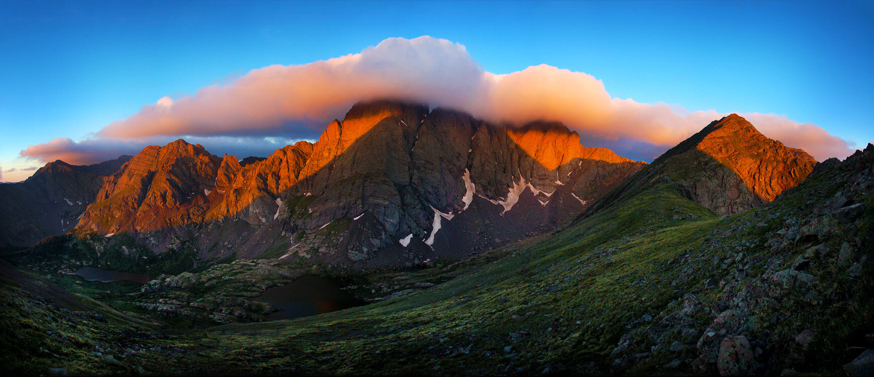
Crestone Needle and Crestone Peak taken from Humboldt Peak Ridge. photo cred: co14k
Ah, Colorado! Known for its craft beer, four national parks, Rocky Mountains, and hot springs, but let's not forget about the Fourteener - this majestic mountain is in a league of its own.
How many 14ers Colorado has depends on who you ask. For the new hiker looking to bag their first 14er, the answer would be a dozen or so.
For professional climbers and mountaineers, a 14er has a specific definition. A mountain must have at least 300 feet of prominence, or vertical rise from its surrounding terrain, to be considered a true 14er.
According to the Colorado Geological Survey, there are officially 53 "fourteeners" in Colorado. These peaks range from popular day hikes like Mount Bierstadt and Quandary Peak to technical climbs such as Capitol Peak and Little Bear Peak.
Is there such a thing as an easy 14er to climb? Sure, we all dream of bagging a peak without breaking a sweat, but are there any 14,000-foot mountains that are within driving distance of cities like Denver or Colorado Springs? And how much time does it take? Which fourteener is the easiest? Do we need to train for it?
Let's be honest, summiting a 14er is not your average day hike for most people. It takes some serious grit, determination, and a little bit of training to make it to the top. But with the right mindset, gear, and preparation, hiking Colorado's fourteeners can be an unforgettable experience that will leave you feeling on top of the world.
What’s the easiest 14er to hike in Colorado?
Pikes Peak is the easiest to climb because of its simple route and fewer challenges.
There are several routes up Pikes Peak, Colorado Springs most famous 14er!
Table of Contents
WHat makes a mountain a 14er?
Planning, Training, and what to wear hiking in Colorado
Quandary Peak *Easy
Mount Elbert *Easy
Mount Bierstadt *Easy
Pikes Peak Mountain *Moderate
The Decalibron *Moderate
The Trifecta - Little Bear, Blanca, and Ellingwood *Hard
Maroon Peak *Hard
TIps for Hiking Colorado 14ers with Kids

Let’s Talk.
Bagging fourteeners or camping nearby, let us help you have the best Colorado vacation.
There's no denying that hiking Colorado 14ers is a top priority for hiking and mountain climbing enthusiasts from all around the globe. These magnificent mountains are ranked from Class 1-day hikes to Class 4 climbs with ropes, making them accessible for anyone seeking an adventure, iconic mountain views, and that coveted 14er completion status.
With some focused training, a well-packed daypack, a defined route plan, decent weather, and some snacks to keep you fueled, hiking a 14er is the perfect way to spend a summer day in Colorado.
Hiking a Colorado 14er is no ordinary trek. You'll be heading up a mountain, sucking in gulps of thin air, and feeling the burn in your legs. But trust us, the view from the top is absolutely worth it.
PRO TIP: Don’t own a good hiking daypack? We love Osprey’s Packfinder Tool. Osprey makes some of the world’s best daypacks and overnight backpacks, in our combined 50+ years of experience hiking and backpacking. And they have great customer service.
Can a beginner hiker do a 14er?
Absolutely! The main distinction between hiking a 14er and other trails is their length and elevation. Taking it slow, tuning in to your body, and taking breaks are key practices for any hike.
When is the best time for hiking Colorado 14ers?
While you can hike most of the 14ers year-round, the average person plans their hikes from July to September when the mountains have the least amount of snow. While you’ll still be cold at the summit, the weather is more predictable than in winter months.
Check out our four favorite 14ers for the average hiker. Knock out four in one hike by tackling the Decalibron.
If your goal is bagging the hardest ones, 14er expert (and completer of all 53) Daron Short shares his top two Class 4 favorites.
Pyramid Peak looking towards Maroon Bells with Snowmass Mountain and Capitol Peak in the distance. photo cred: co14k
Ranking Criteria for How Many 14ers Colorado Has and Their Difficulty
Ranking
Class
There are four class rankings for the 14er. Experts use the Yosemite Decimal System (YDS) to rate terrain difficulty.
Class 1 Smooth trail. Easy hiking.
Class 2 Some off trail hiking. May include hiking on scree or snow.
Class 3 Portions of steep terrain, using your hands for most of the climb. No ropes necessary.
Class 4 Vertical climbing sometimes with ropes. Extreme terrain that can result in fatal falls.
*Class 5 is technical climbing with ropes and belays. There are no Class 5 Fourteeners.
Elevation Gain
Typically measured in feet, this is the total amount you will climb on a hike. Elevation loss is the total amount you will descend, or hike down, on a hike.
Don’t be fooled into thinking distance matters when hiking Colorado 14ers. Elevation gain is one of the most important numbers to consider. A gain of 4,000 feet could take you all day to complete, even if the mileage is a whole lot less.
Distance
This is the mileage you go from trailhead to summit.
Route Finding
If you decide to hike a Class 3 14er, you’ll need to download a map and pay close attention to it. The harder it is to find a route due to the terrain, the harder the 14er is ranked.
Note! For specific information on each 14er, including trail routes, trailhead directions, trail conditions, weather, checklists and more, visit 14ers.com.
The Osprey Sirrus daypack is our favorite hiking tool for hiking Colorado’s 14ers!
How long does it take to climb a 14er?
Hiking a Colorado 14er is not like strolling through the park with a latte in hand. Your fitness level and the altitude adjustment are like the referee and the coach, respectively, dictating how long you'll be on the field.
If you're in tip-top shape, you might make it to the top of a shorter route in a brisk 3 hours. But if you're a little less sporty and need to catch your breath every once in a while, expect to add a few hours to your hike. And if you're feeling ambitious and taking on one of the more challenging routes, well, be prepared to make it an all-day affair.
Some brave souls decide to spend the night on the mountain, breaking their hike into two days. They get to enjoy a cozy night under the stars and take their sweet time conquering that peak.
No matter how long it takes you, remember that the journey is the destination, my friends.
Early morning on Mt Bierstadt
How do you train for hiking Colorado 14ers?
Spend a few minutes searching and you’ll find dozens of hiking fitness plans. We will save the training plans to the experts. However, here’s a few tried and true things we do to get ready for Colorado 14er hiking.
consistent exercise
Don’t expect to feel good or reach the summit of one of these mountains without putting in a little bit of work ahead of time. Daily walks or jogs help build endurance.
Strength train
You don’t need a fancy gym or weights to build muscle. You need your legs to power you up the mountain. Work on your core with sit ups. Better yet, practice yoga daily. Youtube provides thousands of in home strength training sessions for free.
Practice hydrating while working out
Many people don’t drink water while exercising. You need to practice regular hydration, seeing how your body responds to small sips of water.
NOTE! If you don’t reach the summit, don’t beat yourself up. Any hiking done at altitude is cause for celebration! You don’t know what you’re body will do at altitude until you get there.
RELATED LINK: How to Stay Hydrated on Colorado Trails
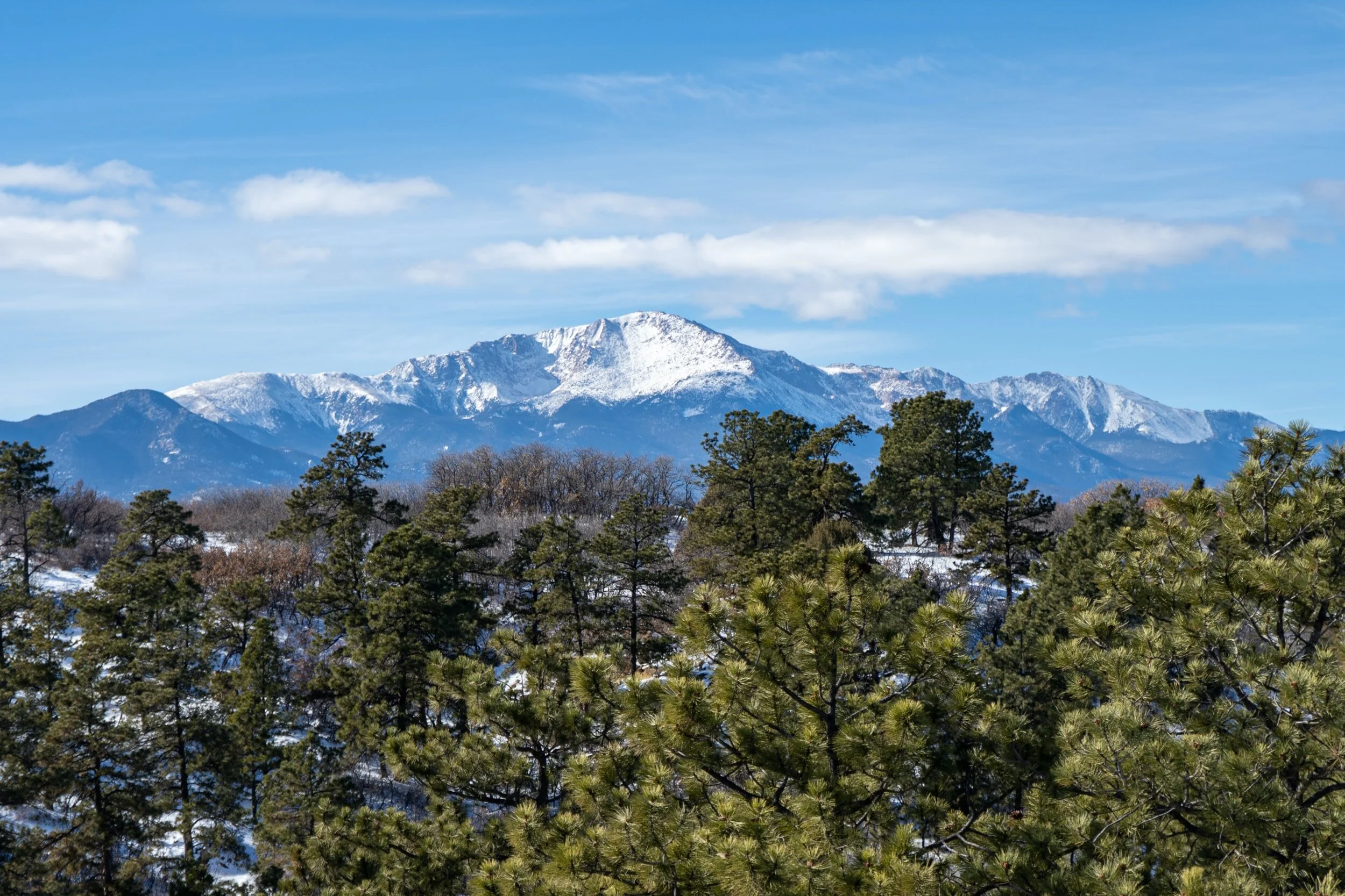
Hiking Colorado 14ers in Colorado Springs - Pikes Peak Mountain
What to Wear Hiking Colorado 14ers
You will see a myriad of clothes on a Colorado 14er hike from jeans and Vans to sandals and cutoffs.
What to wear hiking in Colorado is a whole thing. So much so that we devoted an entire post to this very topic! We’ve learned some hard lessons over the years, forgetting key pieces of gear. Not only do we share what to wear for every season of Colorado hiking, we created the Colorado Capsule Wardrobe checklist.
This FREE download helps you never forget the ONE THING you wish you had on that hike!
OUR GO-TO GEAR FOR COLORADO HIKING TRAILS IN 2024:
We love the Osprey Sirrus Hiking Daypack for women, or the Stratos version for men, for carrying water, layers, and snacks on Colorado day hikes
Lightweight, versatile Hiking Poles built for a full day’s send on the trail — hike longer and stronger
2L or 3L Water Reservoir — This affordable reservoir is easy to fill
Patagonia Torrentshell - a true waterproof rain jacket and fantastic layering piece
Nano Puff Jacket - our favorite for 3 seasons in Colorado
Smartwool Glove Liners - the best all season gloves for those high altitude hikes
Salomon hiking shoes - waterproof, comfy and hard working for any type of hike
THINGS TO CONSIDER….
Time of year
For most hikers, summer is the time for hiking a 14er. Our clothing recommendations are based on that assumption. If you decide to trek up in the winter months, add more layers and God be with you!
Weather
You will experience all four seasons while on this hike. Starting in the early morning hours, you’ll want long layers, hat and gloves.
Midway through the hike you’ll be taking off most of those items, finding yourself in shorts and a tank. The last push to summit is usually extremely windy and cold.
Convertible hiking pants (fancy pants name for zip on/zip off shorts) are great for hiking 14ers. Melody owns a pair of Kuhl pants that have been part of most of her 14er summits along with one heck of a hike on Mt Kilimanjaro in Africa.
Summit Conditions
When you finally reach the summit of a 14,000-foot peak, it can feel like you're on top of the world. But don't let that sense of euphoria make you forget the reality of summit conditions! The wind can be fierce up there, and the temperature can drop dramatically in a matter of minutes.
Even though you'll probably be sweating buckets on the way up, don't forget to pack all the layers - and we mean ALL the layers. Think hats, gloves, jackets, and anything else that can keep you warm and dry.
If you're hiking in the summer, don't be fooled by those blue skies - rain and snow can come out of nowhere at high elevations. Pack your rain gear, because you never know when you'll need it. Embrace the unpredictability of summit conditions.
RELATED LINKS:

Trekking down Quandary Peak after summiting
Colorado Hiking 14er Gear Essentials
While we always have day hike backpack essentials in our Osprey Sirrus packs, here are some added 14er must have items!
Extra food
Pack dense, easy-to-carry, high calorie foods like nuts, energy bars, jerky and cheese.
PRO TIP! Stock your car with a favorite candy bar or candy. It will taste amazing after your hiking trek.
Water
Use a water reservoir or bladder. It’s much easier to take small sips throughout your hike than taking out a water bottle, drinking and putting it back in. Bring an extra bottle of water to replenish your reservoir for the descent.
Often hiking Colorado 14ers means starting in the dark and ending mid morning.
Headlamp
You’ll be starting in the dark. Headlamps keep your hands free to use those valuable trekking poles. We are partial to the Black Diamond rechargeable headlamp, at around $40 it’s low cost and high reward with bright light and USB rechargeable. In a pinch, power it up in your car on the way to the hike.
Resources
Cell reception, even with the greatest data plan, tends to be sparse at best. Download your trail map using an app.
Consider printing the route map as well, folding the paper and storing it in a easy to reach pocket of your backpack. The best route map, we’ve found, is on 14ers.com
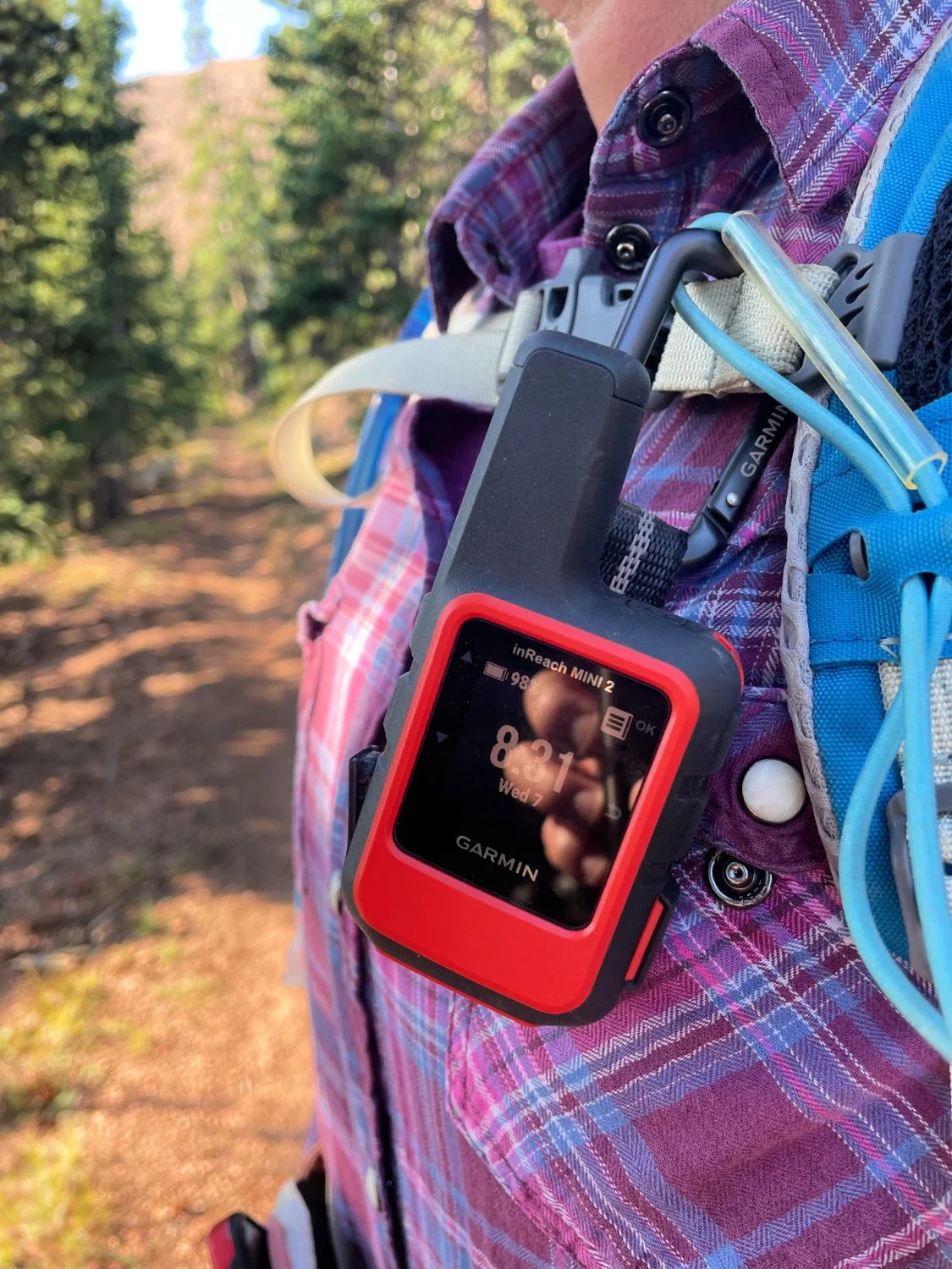
STAYING IN TOUCH WITH LOVED ONES:
We carry the Garmin inReach mini on all our hikes. While most of the time hiking Colorado 14ers is done with a few dozen or more of your new bests friends, you just might find yourself solo on a few routes.
A twisted ankle, sudden fall, crazy weather or any other sort of trial might fall your way. With one touch of the button, you can access help.
We have the basic plan, spending $15/month for piece of mind. *And our husbands love knowing when we’re off the trail, safe and sound with the handy text message options.
Clothing layers
Wear a synthetic or wool t-shirt. Add a light base layer. Next up, add a fleece or lightweight mid-layer, followed by a compressible puffy jacket.
Wear wool socks, gaiters and hiking boots for your feet. You’ll see people in shorts and pants. We love hiking pants that zip off to shorts.
In a compression sack, bring a windproof rain or wind shell. Add in gloves and winter hat.
Tanya’s trekking poles came in clutch on Mount Bierstadt
Sun Protection
As you approach summit, your eyes and your skin are closer to the sun. Even on a cloudy day you can get a wicked sunburn. A hat is a great way to add extra protection. Sunglasses keep those bright rays from hurting your eyes, as well as give you some pretty awesome shaded views!
PRO TIP! While fancy shades are all the rage, I opt for less expensive polarized lenses like my Knockarounds. On my hike up Kilimanjaro, the tallest mountain in Africa, I discovered these $25 glasses. Fashionable, durable, and functional, Knockarounds have been my BFF on all subsequent Colorado hiking days.
Trekking Poles *Optional but really help
Trekking poles are like the Swiss Army Knife of hiking, especially when it comes to tackling Colorado 14ers. Hiking poles are your trailside power. They will save your knees, help you keep your balance, and even double as a selfie stick for those summit pics.
Plus, you can use them to point out all the wildlife and stunning vistas you'll encounter along the way. We love our Black Diamond carbon poles - easy to store on our daypacks, lightweight and functional.

“I climbed…” 14er sign
You know you've truly conquered a Colorado 14er when you've got a photo of yourself at the summit holding a sign with a cheesy pun or inspirational quote. Make sure to pack your sign-making supplies along with your snacks and water.
PRO TIP! There are usually plenty of signs at the summit to borrow.
From Couch to Colorado Hiking 14ers *FOR THE NEWBIE
Start your 14er journey with class 1 mountains. While beginner-friendly, don't let that fool you - hiking these Colorado 14ers will test your limits.
Class 1 14ers range in mileage, but include significant elevation gains. Fear not, as the views from the summit will make every grueling step worth it. You'll feel like you're on top of the world as you take in the sweeping vistas of the surrounding mountains and valleys. And the wildlife you'll often encounter will make the experience even more unforgettable.
Picture this - you're hiking along the trail and suddenly, a family of mountain goats appears out of nowhere, posing for a photo with you. Talk about a once-in-a-lifetime experience!

Approaching the summit on Quandary Peak
QUANDARY PEAK - CLASS 1/EASY
Class 1
Rank 13 of 53
Elevation 14,265 feet
Nearby towns Breckenridge, Alma, Fairplay, Leadville
Route East Ridge
Elevation Gain 3,450 feet
Distance 6.75 miles
Because of its close proximity to Denver and relative easy trail, this 14er gets crowded fast in the summer. Consider getting to the trailhead by 4:45 am and hiking no later than 5 am. You’ll get a parking spot and avoid the majority of crowds. There’s no such thing as starting too early.
NOTE! PARKING UPDATE
Due to Quandary Peaks popularity, Summit County piloted a parking program in 2022.
Visitors can make either full day or 3.5-hour parking reservations at the Quandary Peak Trailhead to access either Quandary Peak or McCullough Gulch from June 1 to September 30.
There are a number of ways up Quandary, but the East Ridge approach is the standard route for most hikers. You’ll start in a beautiful high alpine forest that winds its way up the eastern slope of Quandary.

As you come out of the forest, you’ll eye that false summit. Don’t be fooled, a lot more of it is ahead. As you gain elevation, you’ll have McCullough Gulch on your right (north) side, and the Blue Lakes to your left, (south).
Ascending out of the forest, the terrain turns from dirt path to mostly rocks for the remainder of your climb. The well-worn path is easy to follow. If you leave early enough, the sun will be at your back for most of the climb. Once you are above tree line, the terrain is open and can be quite windy.

On the way up, you’ll get better views of the Ten Mile range and the peaks beyond. If you’re lucky, you’ll spot a few mountain goats as well.
You’ll want layers for this hike, because even if sunny, the wind can be fierce and make for a colder climb than expected.
Any body heat you’re generating on the way up won’t be there on the way down, so keep those layers handy.
Hiking Quandary Peak is one of the most straightforward hikes and ascents you can possibly do.
TRAIL WINNERS
Kid Friendly
Well-marked trail
Prolific mountain goat spotting
Relatively easy ascent
“The easiest 14er I’ve done.” Caroline (daughter and 14er enthusiast)
TRAIL BUMMERS
Majority of the hike is done above tree line
Lots of sun and exposure
Very popular 14er so lots of people
Trash has become an issue on this trail
Limited parking
RELATED LINK: Hiking in Breckenridge is one our favorite things to do. If you don’t feel like tackling a 14er (or you didn’t get that reservation!), choose one of these dozen or so hikes to do instead.

Mount Elbert Summit View
The largest concentration of 14ers is in Chaffee County, where Buena Vista resides. All 14 Sawatch Range 14ers are an easy distance from downtown BV. Snag “Nolan’s 14” taking 2 ½ days to hike all fourteen 14ers in a 100-mile distance.
MOUNT ELBERT *CLASS 1/EASY
Class 1
Rank 1 of 53
Elevation 14,433 feet
Nearby towns Buena Vista, Twin Lakes, Aspen
Route Northwest Ridge and East Ridge
Distance NW Ridge: 9.5 miles
Elevation Gain 4,700 feet
East Ridge 10.5 miles
This towering 14er offers five different routes to the summit, the highest point in Colorado at 14,439’.
Don't be fooled - this hike is no walk in the park. You'll be logging some serious miles, covering 6.8 miles one way (or 5 miles if you have a rugged 4WD vehicle to get you closer to the trailhead). But trust us, the views along the way are worth every blister and sore muscle.
From the vibrant aspen groves to the sprawling pine forests, you'll be treated to a variety of landscapes that will take your breath away. When you reach tree line, prepare to be awed by the sight of an alpine lake in the distance.
Did you know that Mount Elbert was named after Samuel Hitt Elbert, the governor of Colorado from 1873 to 1874? Don't let the name fool you - this peak is anything but stuffy.
The South Mount Elbert Trail, a great option for first-time hikers, is a veritable feast for the eyes, with breathtaking views around every turn. You'll hike through aspen groves that look like they were plucked straight from a postcard, and pine forests that seem to stretch on forever.
The sense of accomplishment summiting a 14er puts a smile on every face!
Hiking Elbert is a challenge - with an elevation gain of over 4,700 feet, you'll definitely feel the burn. However, the feeling of accomplishment you'll get when you reach the summit is worth every drop of sweat.
TRAIL WINNERS
Kid Friendly
Well-marked trail
Easy grade
Starts in a beautiful aspen forest
TRAIL BUMMERS
3 false summits. Be mentally prepared.
Lots of hikers
Small summit area
PRO TIP! Trailhead directions on google and apple maps is wrong. Stick to 14ers.com for TH details. Or consider starting at the South Elbert Trailhead. Dispersed camping is allowed though there is a super small trailhead for challenging parking. There are less people on this route.
LOCAL HOP! Eddyline Brewery offers a cold brew for that post hike refreshment.
RELATED LINK: HIKE IN BUENA VISTA AND SALIDA

Bierstadt Mountain Summit View
MT BIERSTADT *CLASS 2/EASY
Class 2
Rank 38 of 53
Elevation 14,060 feet
Nearby towns Idaho Springs, Grant
Route West Slope
Trailhead Guanella Pass
Elevation Gain 2,664 feet
Distance 7 miles

Bierstadt Mt. meadows near trailhead start
Looking for a Class 2 climb that's similar to Quandary Peak but with its own unique charms? Bierstadt Mountain is your gal! This mountain has not one, but TWO trailheads on the West Slope, which means there's plenty of parking for all those early morning summit seekers.
You'll want to start early - not just to beat the crowds, but to take in the stunning sunrise you’re sure to see!
PRO TIP! Bring some water shoes to avoid soggy socks and blisters for a river crossing in the first third of hiking.
Once you make it across the river, get ready for some serious rock scrambling and jumping. But don't worry, the trail is well-marked and the switchbacks are steady (if not always easy). And the payoff is totally worth it - those wildflower meadows in the first 2/3 of the hike are just the appetizer for the jaw-dropping summit views.

Contemplating how to cross the river at 5 am.
Speaking of the summit, make sure to find a cozy crevice to sit in and enjoy your snacks - and maybe make some new 14er friends while you're at it.
As for the mountain’s name - German-American painter Albert Bierstadt, who famously captured the beauty of the American West in his landscape paintings. The mountain's namesake would no doubt have been awed by the stunning vistas visible from its summit, which include nearby peaks like Evans and Grays as well as the distant Front Range.
Enjoying the stunning wildflowers on Mt. Bierstadt
TRAIL WINNERS
Beautiful meadows
Abundant wildflowers
Well-marked trail with recent renovations
TRAIL BUMMERS
Popular route = lots of people
Trailhead parking fills fast. Get there early
Water crossing early on is challenging
Pikes Peak Mountain
PIKES PEAK *CLASS 1 or 2/MODERATE
Class 1 and 2 depending on route
Rank 30 of 53
Elevation 14,110 feet
Nearby towns Colorado Springs, Manitou Springs
Route East Slopes
Trailhead Manitou Springs
Elevation Gain 7,400 feet
Distance 24 miles
Barr Trailhead Parking. Parking meter located to right.
Hiking Colorado 14ers is no easy feat, but when it comes to tackling Pikes Peak, there are a few tricks to make the experience a little more manageable. For starters, it's worth noting that this towering peak has the longest distance from base to summit of any 14er in Colorado - so if you're planning on tackling the whole thing, make sure you're in for the long haul!
Each August, the Pikes Peak Ascent and Marathon are held on this mountain, attracting elite and amateur runners.

Barr Camp cabin
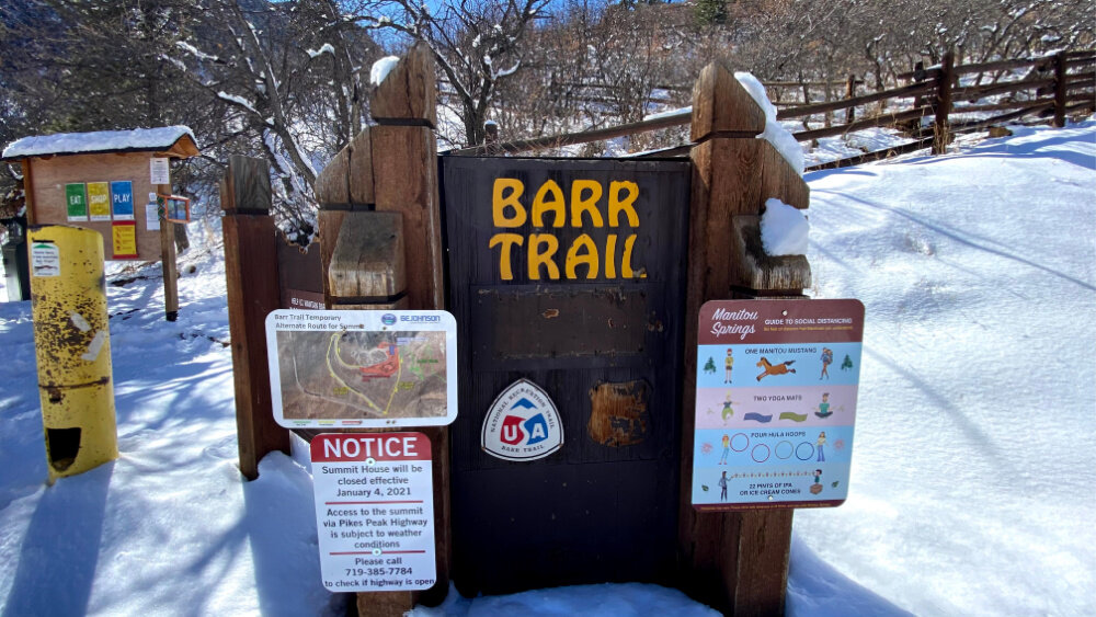
It is one of two 14ers that allow you to drive to the top. Because of that, the summit has a lot of tourists and bikers. We think hiking Barr Trail is the best way to see this famous mountain, mostly because that’s how we’ve always done it!
Starting at Barr Trailhead, you'll want to make sure you're well-prepared for the journey ahead. That means taking a quick pit stop at one of the trailhead's flushable toilets (a luxury you won't find on every 14er!), paying for your parking pass ($10 per day), and getting ready for the adventure of a lifetime.
NOTE! There is regular security monitoring of this parking lot.
The bottom third of the hike has plenty of switchbacks. Aside from the first 2 miles and last 3 miles of the trail, you’ll be in shade for the majority of this hike. Beautiful tall pine trees, scrub oak and rock formations line the trail as you wind your way up the mountain.
Once you arrived at Barr camp, stop for a quick hydration refill and sign the guestbook.

Summit on a stormy August day
PRO TIP! You can camp at Barr Camp. Water filters are available for rent. You can rent space outdoors (lean to) for your own camp set up. OR you can reserve a bunk in the main cabin. Pancake breakfast and spaghetti dinner available for a small fee with reservations.
Heading out from Barr Camp, stay on the well marked trail to A Frame. This is treeline. Reapply your sunscreen and start trekking.
Start early in order to avoid the afternoon storms that roll in around 2 pm. At summit, you’ll have spectacular views of the Continental Divide and Garden of the Gods.
On a clear day, you can see the Great Plains towards the east and southern views of the Sangre de Cristo mountain range.
This mountain has so many amazing trails to bike, ride, hike and even train up! This Colorado 14er is in our backyard and one we are on often! We tell you all the tricks, tips, and ways to enjoy America’s Mountain!

Barr Trail is flanked by beautiful trees and wide paths
TRAIL WINNERS
Well-marked trail
Shade for most of the mileage, except for last 3 miles at A Frame
Barr Camp *halfway stop for water replenishment
TRAIL BUMMERS
Long hike *Takes 6-10 hours to summit. Many do this hike in two days.
First third of Barr Trail has steady stream of Manitou Incline traffic. Watch out for runners!
Summit can be driven to so there a lot of people up top. It can feel congested and anticlimactic.
Lightning storms are almost daily in the summer. Get off the mountain before noon.
Paid Parking *Budget $10/day for TH parking.
PRO TIP! Avoid the weekend of Pikes Peak Marathon and Ascent. You could cash in on some free snacks along the way. However, there are hundreds of runners on Barr trail for those two days.
ALTERNATE ROUTES UP PIKES PEAK
Barr Trail is the most popular route to summit. However, consider the Northwest Route for less people, less mileage (13.6 mile) and a bit more challenge (Class 2). Starting at the Crags Trailhead, this route takes you through Devil’s Playground, a stunning patch of rocks that attract summer lighting storms. Avoid being in this area in the afternoon or you could be playing tag with lightning.

Descending Mt. Bross with Kite Lake in background
DECALIBRON LOOP: DEMOCRAT, LINCOLN, CAMERON, BROSS *CLASS 2/MODERATE
2024 UPDATE!
Access to Mount Democrat and Mount Lincoln was opened to the public as of December 2023. After a long disputed court battle, the U.S. Department of Agriculture’s Forest Service acquired nearly 300 acres leading to Mount Democrat in Colorado’s Mosquito Range.
The Decalibron comes from the first letters of each of the four peaks: Mts DEmocrat, CAmeron, LIncoln, BROss.
Class 2
Elevation
Mt Democrat: 14,148 feet
Mt Cameron: 14,286 feet
Mt. Lincoln: 14,286 feet
Mt. Bross: 14,172 feet
Nearby towns Alma, Breckenridge
Route Kit Lake Route
Trailhead Kite Lake ($3 parking fee)
Elevation Gain 3,700 feet
Distance 7.7 miles roundtrip

Summit of Democrat Mountain
Hiking Colorado 14ers is a rite of passage for any adventurous hiker, and four mountains in particular are conveniently situated just two hours from Denver. Among them is a hard but doable day hike that requires hiking along ridges and bagging each summit before a steep and technical descent down Bross.
However, the real challenge lies in the trek up Mt. Democrat and the extremely steep descent down Mt. Bross. Be prepared for some heart-pumping moments as you conquer these peaks!

Summit of Mt. Lincoln
As you tackle each summit, you often find yourself with the same people. It makes for great unintentional community and repeated congratulations. If solo summiting, you have built in photographers for stunning summit self-portraits.
PRO TIP! Don’t forget to look to your left on Mt Lincoln for stunning views of Quandary Peak.

Summit of Mt Cameron
Descending Mt. Bross, no matter where you begin, is tricky. Known for a steep decline and loose, sharp scree (small rocks and pebbles), you could find yourself pseudo glissading down the mountain. For a true glissade, you’d be on your bum sliding down the hill.
Trekking poles help greatly with keeping your hands scratch free for those quick catches you make to keep upright.
Some prefer summiting Bross first with your descent on Democrat. From our experience, the slide down Bross, while tricky, is much easier than trying to summit on loose scree.
NOTE! It is currently illegal to summit Mt. Bross and . The land surrounding the summit is privately owned. It’s been an ongoing hot button topic with good intentions on both sides. To stay legal, stick to the bypass trail below Mt Bross summit.
TRAIL WINNERS
Ability to bag four 14ers in one day hike
All 4 share the same ridgeline creating a simple loop trail
Spectacular views of the Mosquito Range, including Quandary Peak
Views of Kite Lake from each summit
Pass several historic mining structures *New warning signs posted. Stay off!
TRAIL BUMMERS
Mt Bross’ summit is on private land – stay off the summit
Steep and treacherous descent on Mt. Bross
Prone to brutal winds
A few years ago, my husband and eldest daughter tackled the Decalibron. While the trail still is closed to some summits, enjoy the views vicariously. AND cross your fingers and toes that private land/public legislation disputes resolve soon so we can ALL once again enjoy this amazing loop!
TOP TWO CLASS 4 FAVORITES!

Daron Short, Pyramid Peak Summit Photo cred: https://www.co14k.com/
What you need to know to hike Class 4 14ers
Hiking a Class 4 14er is like trying to solve a Rubik's Cube blindfolded - challenging, yet rewarding if you can pull it off. These beasts are not for the faint of heart. They require precision, skill, and a little bit of luck. You need to have the mental and physical fortitude to navigate steep and exposed terrain, often with just a few hand and footholds to cling onto.
With proper preparation and a sense of humor, you can conquer these formidable peaks. Only experienced climbers should attempt these hikes, and they should be in top physical shape and have a good sense of balance and coordination.
To prepare, start with Class 1 and 2 hikes, work your way up to Class 3, and then proceed to Class 4. Make sure you have the right gear, including a helmet, climbing shoes, and a harness. And don't forget to bring a sense of humor and a willingness to embrace the unexpected.
DISCLAIMER! Please do extensive research on these climbs, study trip reports, watch the weather, and always climb with a trusted and experienced friend.
And don’t forget the gummy bears.
To get super cool 14er swag like the shirt Daron designed and is wearing, click the button below for CO 14er gear. Also sold in Scheels and downtown Colorado Springs stores. *But you can’t use your discount there. Wink!
USE DISCOUNT CODE: HIKESANDHOPS

Little Bear > Blanca > Ellingwood 14er Trifecta. photo cred: co14k.com
TRIFECTA: LITTLE BEAR, BLANCA, ELLINGWOOD POINT *CLASS 2/4/DIFFICULT
Class Little Bear is Class 4. Mts Blanca and Ellingwood Point are Difficult Class 2.
Elevation
Little Bear: 14,037 feet
Mt Blanca: 14,345 feet
Ellingwood Mountain: 14,042 feet
Nearby towns Alamosa and Blanca
Trailhead Lake Como / 8,000’ (higher if you have a capable 4WD vehicle)
Distance 15.6 miles
Elevation Gain 7,300 feet

Hourglass on Little Bear photo cred: co14k.com
In the realm of hiking Colorado 14ers, there are Four Great Traverses: El Diente to Mt. Wilson, Crestone Peak to Crestone Needle, the Maroon Bells traverse, and Little Bear to Blanca.
It is debatable as to which holds the greatest degree of difficulty, but the traverse between Little Bear and Blanca is undeniably the longest, most exposed, and thus most dangerous traverse.
You begin with a climb of Little Bear Peak, which is arguably the most difficult standard route to the summit of a 14er. It requires a lengthy, 11-mile approach to Lake Como, followed by a scramble to the Hour Glass feature – a steep, narrow, Class 4 chute that leads to the summit.

Traversing from Little Bear photo cred: co14k.com
The climbing is difficult in its own right, but the added danger of rockfall through the chute is what causes even advanced climber’s palms to sweat.
Upon reaching the summit is when the real “fun” begins with a downclimb onto the mile long ridge that connects to Blanca Peak. Once you begin, the easiest path is across, so the decision to advance is a committing one.
There are several features along this route to help you track your progress including Captain Bivwacko, The Highway, The Catwalk, and The Three Towers that require skillful navigation, technical expertise, and a healthy dose of ice coursing through your veins.
Due to the sheer length and horizontal nature of the traverse, it is actually not advisable to climb in the traditional sense with a harness and rope which would greatly increase the time it would take to cross, adding to your exposure time on the ridge.
Once the summit of Blanca Peak is reached, Ellingwood Peak appears as an attainable target to complete the Trifecta cirque before descending back to Lake Como and the slog back to your vehicle.
Check out THE CATWALK traverse below. Then let out a breath!

Maroon Peak Summit. From L to R. Snowmass. Capital Peak. North Maroon. Pyramid Peak. Castle Peak. photo cred: co14k.com
MAROON PEAK *CLASS 3/DIFFICULT
Class 3
Elevation 14,145 feet
Nearby towns Aspen and Snowmass
Trailhead Maroon Lake / 9,590 feet
Distance 10 miles
Elevation Gain 4,600 feet

Maroon Peak after ascending East Slope. photo cred: co14k.com
Not many 14ers hold more awe than the most photographed mountains in Colorado – the Maroon Bells.
Due to the proximity to Aspen, the paved parking lot, and high tourist traffic, accessing the TH only adds to the difficulty and planning required to attempt one of ‘The Bells.’
Though Maroon Peak appears slightly smaller from the trailhead than its sister peak North Maroon due to the perspective at which it’s viewed, it is actually over 140 feet taller.
After navigating around Maroon Lake and Crater Lake (and the tourists), the slog up the east slope will take mental and physical strength.

Maroon Peak Summit. photo cred: co14k.com
Once on the ridge, hiking this Colorado 14er route increases in difficulty and the potential of loose, rotten rock make for an extreme hike.
After navigating terrain that includes a series of complex ledges, gullies, chimneys, notches, and rock bands (no, not the Aerosmith or Eagles variety), you will eventually gain a view seldom seen looking back towards Maroon Lake, where you began, with the rest of the Elk Range 14ers in a 360º panorama – Snowmass and Capitol to the West, Pyramid and Castle to the East, and North Maroon directly before and below you.
ALTERNATE HIKE
Maroon Bell’s iconic Four Pass Loop should be on everyone’s Colorado hike list
BACKPACKING MAROON BELLS BEST HIKE - FOUR PASS LOOP
If the thought of hiking Colorado 14ers most difficult summits is not for you, consider another favorite option - hiking around Maroon Pass along Four Pass Loop.
While the logistics from Aspen can create some heartburn moments, consider starting in Crested Butte. This 3 day, 2 night backpacking trip is one of the best Colorado hikes you could ever tackle!
RELATED LINKS: BACKPACKING FOUR PASS LOOP, HIKING IN NEARBY ASPEN FOR MATCHLESS VIEWS
Melody with her two eldest hiking Colorado 14ers - Quandary Peak
TIPS FOR HIKING 14ERS WITH KIDS
Quandary Peak was our kids first 14er. They were 13 and 16 at the time, and I have to admit, I was a bit nervous about taking them. But hey, they're born and raised in Colorado and participate in sports regularly, so how hard could it be?
My husband and I made sure to pack extra water, snacks, and layers, because you never know when the weather might turn on you. Our kids carried small packs with hydration bladders and a few layers.
They did not train for this hike. And they definitely didn't seem to take it as seriously as their parents. We were puffing and panting up that mountain, while our kids were bouncing around like mountain goats in their hiking boots.
In the end, we made it to the summit, and I swear those kids had more energy than I did! They were already planning their next 14er conquest, while I was just trying to catch my breath.
Moral of the story? Don't underestimate the power of youth, and always pack snacks - lots and lots of snacks.
Melody’s daughter taking in Quandary summit views on a much deserved rest break
Rest Breaks on repeat
Kids have shorter legs. While our daughter, a soccer player, flew to the front of our hiking pack, her younger brother hung back. We stopped regularly, particularly as we neared the summit.
Water reminders
If your kids are unaccustomed to taking sips of water throughout a hike, you must stop and remind them. They might not feel thirsty. However, an altitude headache is hard to get rid of once it creeps in. Flavor water can entice them to drink more. We love Ultima hydration mix. It tastes like lemonade without all the added sugar AND it is a great hydration aid while staying all the frees - gluten, allergy, meat, dairy…you get the point!
Fun Snacks
Sprout’s natural gummy bears and peanut butter M&Ms are our kids favorite hiking treats. Throw in a few Rx bars, some salami and cheese with crackers and you are winning in the salt and protein category.
Mark the occasion
We made sure to take pictures with a “First 14er” sign for summit. Thankfully on our first summit, someone had a sign we could borrow which required just a little photoshop action post hike.

Melody’s daughter finding a few mountain goats on Quandary Peak
Watch for wildlife
Our daughter’s favorite 14er picture is with a group of mountain goats eating right by the trail on our descent. We spent almost 20 minutes watching them and resting. It was a rewarding memory moment!
YOGA breathing for the win
Kids aren’t much for warming up before hiking. Our kids usually start chatting once we’ve stopped for our first snack break which typically comprises of sugar and chocolate no matter the time of day! Add in a few yoga stretches to help their backs (and yours). As you near the summit and it’s VERY THIN air, yoga breathing can help keep you moving.
5 REASONS WHY HIKING AND YOGA ARE A GOOD PAIR
Reward the Hike
Getting up early and starting a hike in the cold and dark is tough. Celebrate the summit win and bagging a 14er by a meal out. Our family rule for that celebratory meal - you can order anything you want!
Hiking with kids is a ton of fun, IF you are prepared. We do a deep dive into tons of great Colorado trails for families along with the best MOM INSIDER TIPS for making the actual hike fun and memorable and maybe even whine free!
RELATED LINKS: TAKING KIDS HIKING ON COLORADO TRAILS

Alright folks, it's time to lace up those hiking boots and hit the trails! Colorado 14ers are waiting for you to conquer them, but don't forget to pack your sense of humor and patience along with your gear. These mountains have personalities of their own and can be a bit fickle at times, so be prepared for anything!
And remember, even if you don't make it to the summit, celebrate the journey and the fact that you're out there doing something amazing.
So, what are you waiting for? Get out there and start climbing!
And don't forget to leave a comment below with your favorite 14er and any tips you have for conquering it!
