
3 Ways to Hike Mount Rosa in Colorado Springs
Enjoy killer 360 views of Pikes Peak, Rosemount Reservoir, and the Sangre de Cristos when you climb up to Mount Rosa in Colorado Springs. We spill all the details and very important tips for hiking each route. Learn which way is best for you. Route 1: Cheyenne Canyon to Mount Rosa is a long route with huge elevation gain — excellent for 14er training. Route 2: Mount Rosa Trail via Frosty's Park is shorter, but needs 4WD to reach the trailhead. Route 3: a fantastic loop route, taking you past wonderful waterfalls.

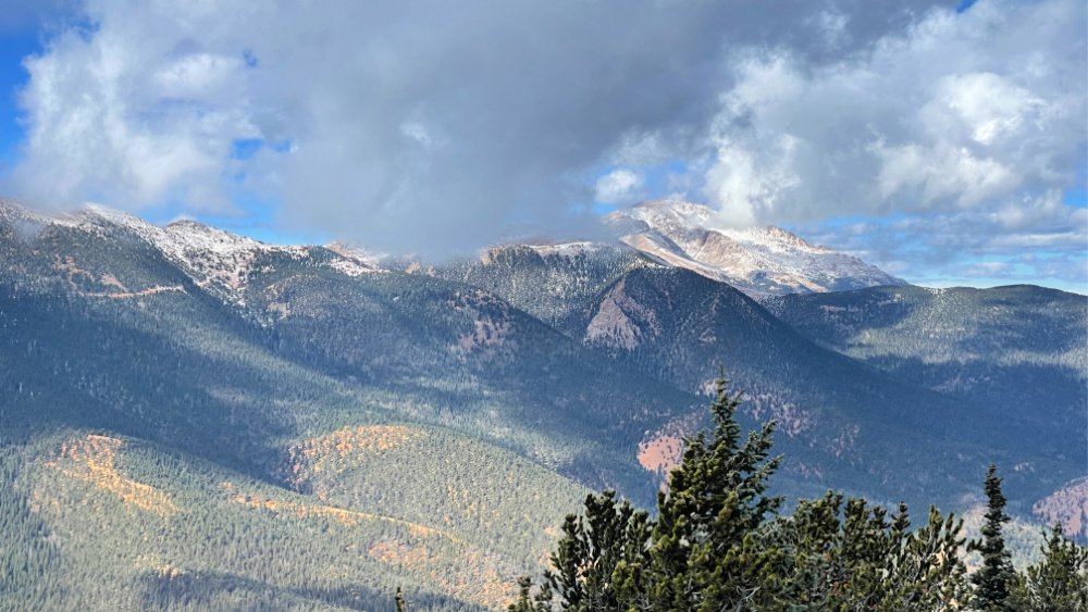
View of Pikes Peak on the way up to Mount Rosa
This page contains affiliate links. If you make a purchase via a link on this page, we make a small commission at absolutely no extra charge to you. Thank you!
How to Summit Mount Rosa in Colorado
These more challenging Cheyenne Canyon Trails with 360 degree views are tough to beat.
Here we tell you about three different routes to choose from so you can enjoy the top of Mt. Rosa.
What can I see from Mount Rosa in Colorado Springs?
From the summit of Mt. Rosa, you can see Rosemount Reservoir, Pikes Peak, Almagre Mountain, Cheyenne Mountain, and the Sangre de Cristo mountain range to the southwest.
Where is Mount Rosa, Colorado?
Mount Rosa is the pointy shaped mountain in Colorado Springs just south of famous fourteener, Pikes Peak.
Mount Rosa is found in the Pike National Forest and can be seen from the east side of I-25 as a prominent point to the left of our city’s solo fourteener.
This hike is also featured in our 17 Best Hikes in Colorado.
We also dish about different romantic getaways and hikes in Colorado Springs.
A quick history lesson:
Mt. Rosa is now thought to be the mountain accidentally climbed by Zebulon Pike in November 1806 when he was actually setting out to summit Pikes Peak.
Pike was likely bombarded by weather, causing him to climb askew and camp in a cave just on the east side of Mt. Rosa underneath her summit. Hiking through deep snow, he finally reached the top of Mt. Rosa — and then saw Pikes Peak still 8 miles away — with more mountain tops in between.
Mount Rosa was named for Rose Kingsley, the first woman to climb this mountain and an aristocratic young English woman who came to Colorado Springs in 1871, where she opened a library. Rose was an author, teacher, avid botanist, hiker and mountain climber.

Rosemount Reservoir and the Sangre de Cristo Mountain Range can be seen from Mount Rosa in Colorado Springs

Fabulous cabins and homes to stay in near North Cheyenne Canyon
There are so many fun things to do in Colorado Springs and so many history lessons here. You could easily spend a week in Colorado Springs exploring outdoors and downtown.
Best places to stay near North Cheyenne Canyon in Colorado Springs
We love these vacation homes, ideal for outdoorsy adventurers:
Enjoy this cozy cabin right on Cheyenne Creek.
Captain Jack’s Cottage in Beautiful Cheyenne Cañon 2 blocks from Broadmoor.
Charming Cheyenne Canyon Cottage near the Broadmoor and Seven Falls.
3 Different Routes to Summit Mount Rosa in Colorado Springs
The first and third trails are accessed via North Cheyenne Canyon Road, while the second option requires some 4X4 driving.
Cheyenne Canyon to Mount Rosa (long out-and-back)
Mount Rosa Trail via Frosty’s Park (out-and-back)
Mount Rosa via Pipeline Trail (Long loop)

You can hike Mount Rosa via Cheyenne Canyon past St. Mary Falls
1. Cheyenne Canyon to Mount Rosa
Trail Length: 14 miles Elevation Gain: 4,200 feet Route Type: Out and back Difficulty: Hard Time Needed: 7+ hours
Time and Energy Needed: We hiked it in 7 miles and burned over 3,000 calories
The longer, more challenging route, this is the way we hiked after learning the road we needed to drive to the Mount Rosa Trailhead in Frosty’s Park was closed off for the time being.
Hiking Cheyenne Canyon to Mount Rosa out and back is excellent training for hiking Colorado 14ers. Here’s my verified completed route on All Trails.
Trail Overview
This trail begins in North Cheyenne Canyon Park. You may see backpackers on this trail and it’s likely you will see other hikers, at least up until you reach St. Mary’s Falls.
This trail is best hiked in March through October, although some brave it in winter wearing the proper hiking gear. May need spikes.
We hiked it at the end of October and there was a light layer of snow. Mount Rosa tops out at 11,533’ with fantastic views of Pikes Peak.

You will pass the Seven Bridges Trailhead on your way to Mount Rosa via St. Mary’s Falls on this particular hike. Hike the Loop Trail (#3 below) if you want to hike this portion too.
Points Along the Way
Pass the Seven Bridges Trailhead on your right while hiking along Gold Camp Road
See a fenced off cave on your right as you round the bend to begin your hike on St. Mary’s Falls Trail #624
At 1.3 miles in you will reach an intersection, stay to the right, following Buffalo Creek.
At 2.8 miles in, reach the intersection for the short spur to St. Mary’s Falls before continuing on the trail to Mount Rosa. You will have climbed 1160’ at this point. Or save St. Mary’s on the way down.
At the St. Mary’s Falls intersection, turn to the right and take FSR (Forest Service Road) 381 to the trailhead of Nelson's Trail (#672)
COHH TIP: Here’s what we love about this hike: the soothing sounds of Buffalo Creek on your way towards St. Mary’s Falls before heading to Mount Rosa, and again on the way down.
Prepare for plenty of steep switchbacks on this hike.
Once you’ve hiked 5 miles towards Mt. Rosa, you will keep going on Nelson’s Trail #672.
At about 6.2 miles up, you will hop on Mount Rosa Trail #673 for another 3/4 mile to the summit of Mount Rosa. The 360 views are stunning and worth the extra effort.
Take a picture with the sign in the box on the summit and enjoy a snack before your descent.
Good to Know ABOUT CHEYENNE CANYON TO MOUNT ROSA
Pack enough water for the entire hike, at least 3-4 liters, more if hiking on a warm day. Water from the Buffalo Creek and St. Mary’s Falls should be treated before use. The Epic Water Filter or Katadyn Water Filter are ideal.
You will burn 3,000 calories or more, so plan plenty of salty snacks to refuel. Fruit, nuts, protein bars, and good ole’ sandwich are ideal too.
Here’s what we like to pack for day hikes on Colorado trails in 2026.
Good hiking boots or shoes are a must on this trail as you will encounter loose scree, big rock, tree roots, and more. Here are some of our faves our family has worn.
You will encounter some very steep and loose areas on the trails. Hiking poles like these are advantageous, saving your knees and helping you move more assuredly over large rocks and roots.
Parts of this loop trail is not marked well, according to many hikers. Follow a GPS map on AllTrails or GAIA. Pack your Garmin InReach Mini if you have one.
After your hike, head to one of these Taprooms for a local Colorado brew.
Pocket Pals Trail Maps are also super helpful in planning these Cheyenne Canyon hikes. You will need both maps #2 and #3 to see all of the trails used on the three routes below.

Gold Camp Area Trails are adjacent to North Cheyenne Canyon Trails

North Cheyenne Canyon Park Trail Map
We love these waterfproof, tear-resistant North Cheyenne Canyon maps that fit in your pocket. Pocket Pals also offers immediate digital downloads if you prefer.
Receive 10% OFF any of Pocket Pals digital and waterproof paper maps when you use our promo code “10%OFF”. Tap on each map below to purchase.
How to Reach Mt Rosa Trailhead
Parking is available at 4415 Lower Gold Camp Road in Colorado Springs, Colorado. From here, you will start your hike at the north end of the Parking Lot 18 and stay to the left on Gold Camp Road, passing the trailhead for Seven Bridges Hike on your right.
Once you see the fenced off cave, you will climb up and to the right to continue on the trail. NOTE: You can also park at the Helen Hunt Falls parking lot and walk up the hill to the trailhead.
2. Mount Rosa Trail
Trail Length: 6.9 miles Elevation Gain: 1,729 feet Route Type: Out and back Difficulty: Moderate Time Needed: 3.5 - 4 hours
This is the easier, shorter route up to Mount Rosa via Frosty’s Park if you don’t mind driving in 4 wheel drive and you have a high clearance vehicle*.
COHH TIP: Those without high clearance SUVs can park after the turnoff onto 379 and hike one mile to Frosty Park and then hop on Nelsons Trail #672 to start your hike to Mount Rosa. This adds 2 more miles round trip to your original 6.9 mile hike.
Frosty Park sits west of the summit of Mount Rosa and you will be climing up the northern ridge to the summit.
This option is half the distance of the other two routes, BUT your tradeoff will be more time driving to a different trailhead for less time on your legs.
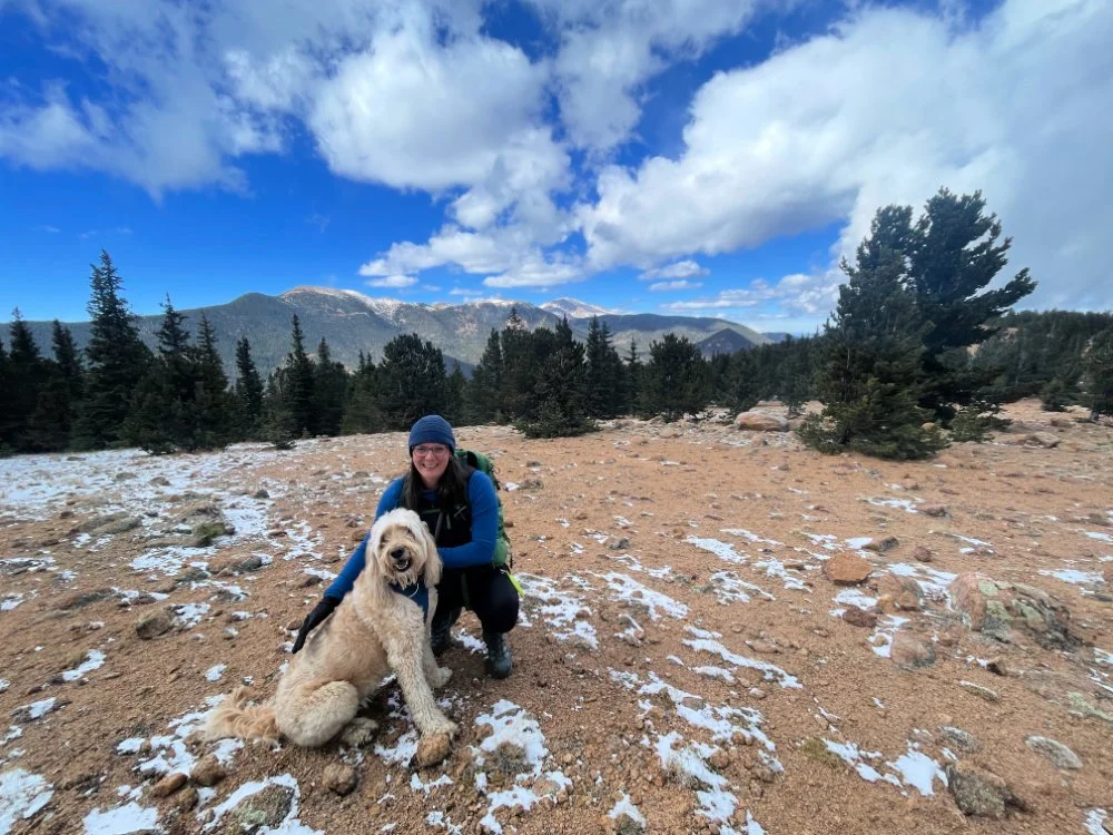
The opportunities for wonderful photographs are abundant on this hike. This hike starts out much higher than the other two, beginning around 9,800 feet. You will summit Mt Rosa at 11,533 ft.
The view as you ascend Mt. Rosa
Points Along the Way
From Nelson’s #672 Trailhead, head north. You will enter a forest; look for cairns (man-made pile/stack of stones) on the right leading you into the forest. Turn at a new trail marker for Trail #672 that will start your climb up to Mt. Rosa.
Hike up the north side of the mountain - don’t forget to check out the views of Pikes Peak behind you.
As you enter a clearing, keep a look out on the right for a few cairns where Nelson’s Trail hits a wide junction with Mt. Rosa Trail #673. This final trail leads you up the ridge to Rosa's summit.
While there is a signpost, an early snow made the trail hard to see in this wide clearing, so just be on the lookout for the cairns to point you up the trail. GPS maps help tremendously here.
Climb up to a fantastic ridge where through a few trees you can start to see Colorado Springs on the left and a beautiful overlook of mountains (including Pikes Peak) on the right.
Your hike continues through the forest and you will come to a false summit. You are getting close!
Enjoy the last bit of the quiet ascent through some very old ponderosa pines and turn the bend to a crop of rocks at 11,533’ on top of Mount Rosa.
Enjoy the 360 views, some water and a snack. From the summit of Mount Rosa, you can see Rosemount Reservoir, Pikes Peak, Almagre Mountain, Cheyenne Mountain, and the Sangre de Cristo mountain range to the southwest.

Using hiking poles and spike on snow. Check out our winter hiking tips.
Good to Know about the Mount Rosa Trail
Your drive to and from this Mount Rosa trailhead will take up a chunk of your day; potentially adding 3 hours or more in addition to your hike time. Plan accordingly.
Pack enough water for the entire hike, at least 2-3 liters, more if hiking on a warm day.
You will burn 1,500 calories or more, so pack plenty of salty snacks to refuel. Fruit, nuts and protein bars are ideal too.
You will hike some steep sections and possibly through loose scree or snow if it’s late fall or early spring or winter. Hiking poles like these help A LOT.
Parts of this loop trail is not marked well, according to many hikers. Follow a GPS map on AllTrails or GAIA. Pack your Garmin inReach Mini 2 for added peace of mind.
Head to one of these Downtown Colorado Springs Breweries after your hike. My personal favorites include Goat Patch Brewery, Cerberus Brewing Company, and Bristol Brewing Company.

Soar high and long above Seven Falls on the best Colorado Springs Ziplines!
More fantastic views around Pikes Peak
What better way to experience this city's stunning panoramic vistas than through the exhilarating Seven Falls ziplines? Whether you're an adrenaline junkie seeking adventure or a nature lover looking for unique ways to see the views, here are the best Colorado Springs ziplines. Soar above treetops, glide across canyons with your crew, and leave with an unforgettable experience under Pikes Peak.
When you book this or most other Broadmoor outdoor adventures online and you enter our exclusive reader promo code "COHIKES", you save 10% OFF that experience!

Know where you are going, ahead of time. Map your hike, either with paper maps or GPS maps on your phone.
Pocket Pals Trail Maps are also super helpful in planning these hikes on Cheyenne Canyon Trails. You will need both maps #2 and #3 — these are fantastic waterfproof, tear-resistant maps. They also offer immediate digital downloads if you prefer.
Receive 10% OFF any of Pocket Pals digital and waterproof paper maps when you use our promo code “10%OFF” here.
How to Reach this Mt Rosa Trailhead
From Colorado Springs take Old Stage/Gold Camp Road approximately 12.5 miles to 379 (near Penrose-Rosemont Reservoir). Turn north on FSR (Forest Service Road) #379 and drive another 1.5 miles on this 4WD road to Frosty Park. You will reach a large clearing on the right without signage. Find the trailhead for the start of your hike on Nelson’s Trail #672 on the north side of this clearing.
Plan for a drive time of at least and hour from the time you exit I-25 (see directions below) or longer, if this is your first time navigating Old Stage and Gold Camp Roads.
Near where Nelson’s Trail #672 meets up with Mt. Rosa Trail #673
3. Mount Rosa via the Pipeline Trail
Trail Length: 14.8 miles Elevation Gain: 3,980 feet Route Type: Loop Difficulty: Challenging Time Needed: 8 hours
This trail begins in North Cheyenne Canyon Park. It’s a fun, yet long and challenging, loop offering 360 views and two different sets of waterfalls.
Experienced hikers will especially enjoy this Cheyenne Canyon hiking trail. Camping is permitted at undeveloped sites along the route.
Trekking along Mount Rosa via Pipeline Trail easily makes the list of cool hikes in Colorado Springs. Start early and pack strategically.
NOTE! For this almost 14 mile hike, bring at least 3 liters of water. Carry a water filter and replenish along the way. This route has plenty of water sources throughout the hike.
For a detailed map of the trail, check out the route Melody took. A loop hike, heading clockwise allows you to tackle most of the elevation the first half of the trail.
Since this Cheyenne Canyon hike is a loop trail, you could also hike it counter clockwise. However, heading clockwise allows you to tackle most of the elevation the first half of the trail. Would be great to hike this in the early fall or late spring.
RELATED: More Trails to Love in North Cheyenne Canyon
While you’re admiring Pikes Peak from Mount Rosa, why not summit America’s Mountain next? Read our complete Pikes Peak hiking guide.

On the final section to summit Mt. Rosa
Points along the way
Once you’ve parked at the renewed parking lot (with porta-potties) at High Drive and Gold Camp Road, you will walk down Gold Camp Road to hop on the Seven Bridges Trail #622.
Enjoy hiking along North Cheyenne Creek and cascading waterfalls as you cross seven sturdy bridges. You will have hiked 1.5 miles to the seventh bridge.
At 1.8 miles in, climb through a scree field on the underside of Kineo Mountain. Turn around and catch fantastic views of Colorado Springs.

Views from the top of Mount Kineo, which you could add on this route
COHH TIP: For the super ambitious, add on summiting Kineo Mountain before Mount Rosa. At about 2.5 miles in, you will hit a junction between Seven Bridges Trail #622 and #622A. Go right on #622A for 0.3 miles. Here you will make a hard right up for a steep 0.5 climb up Kineo Mountain. NOTE: If you get to Jones Park Trail #701, you missed the trail up Kineo, but you’re not far off! Use GPS or Pocket Pals Maps #3 adjacent to map #2 to plan this. This adds about 1.6 miles, or another hour to this long day hike loop.
At 2.1 miles in you will see a large boulder on the right, go left here, crossing over the creek.
At nearly 2.2 miles in, you will come to an intersection where you want to stay left on #622 leading you to the Pipeline Trail #668.
Bear left on the Pipeline Trail #668. In the summer, enjoy Colorado wildflowers while crossing the creek several times.
After a good incline, you’ll trek through the forest to Foresters Trail #701, where you’ll turn left.
Spend just 1/3 mile on Foresters Trail to FSR (Forest Service Road) 379, where you will just walk along the Frosty’s Park parking area before joining up with Nelson’s Trail #672 on the east side. Frosty’s Park sits at 9,800 feet.
You will find little water on Nelson’s Trail and it climbs quickly for 1.3 miles.
COHH TIP: Pack 3-4 Liters of water and a water purifier just in case.

View of Rosemount Reservoir from Mount Rosa
Reach the trailhead for Mt. Rosa #673. Turn right and make your final ascent to 11,533’. Take in the rewarding 360 views and congratulate yourself.
Now go back down to Nelson’s Trail #672 where you will continue your loop hike toward FSR #381 and head right. You will only be on FSR #381 for a quick second!
Quickly find the unmarked junction for St. Mary’s Falls Trail #624. (Look for fencing on the left side of the open area.)
At the sign, be sure to take the St. Mary Falls Spur Trail out to the falls. A great photo opportunity and snack break!
From St. Mary’s Falls, the trail descends slowly along Buffalo Canyon Creek and finally down and around to the left to Gold Camp Rd., past Seven Bridges Trailhead, and then to your parking lot.

Once a the top, find the box with the log book and add your name to the list of those who have summited Mount Rosa.
NOTE: Of course you can hike this loop route clockwise by beginning hiking Gold Camp road to St. Mary’s Falls Trail #624, then following FSR #381 very briefly to hop on Nelson’s Trail #672, summit Mount Rosa via trail #673, then left to Nelson’s #672, right on Forester’s Trail #701 briefly after Frosty’s Park, right on Pipeline Trail #668, right on Seven Bridges Trail #622, and finally back to your car.
After your hike, head to one of these Old Colorado City or south Colorado Springs Breweries.
We love hiking in Colorado Springs! We cover all of our favorite hiking trails in Colorado Springs.
Good to Know about Mount Rosa via the Pipeline Trail
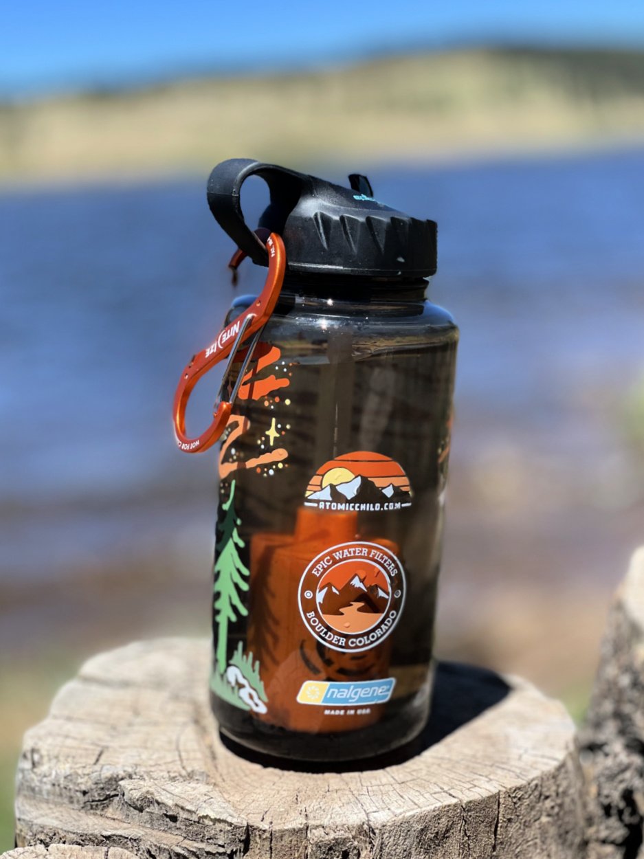
Pack enough water for the entire hike, at least 3-4 liters, more if hiking on a warm day. Water from streams should be treated before use. The Epic Water Filter or Katadyn Water Filter are ideal.
You will burn 3,000 calories or more, so plan plenty of salty snacks to refuel. Fruit, nuts and protein bars are ideal too.
You will hike up some steep ascents and through loose scree. Hiking poles like these will save your knees and help keep you from slipping.
Don sturdy hiking boots or shoes as you will encounter loose scree, big rock, tree roots, stream crossings, and more. Here are some of our faves our two families wear.
Parts of this loop trail is not marked well, according to many hikers. Follow a GPS map on AllTrails or GAIA. For added safety and peace of mind, use your Garmin inReach Mini 2.
Pocket Pals Trail Maps are helpful in planning these hikes on Cheyenne Canyon Trails. You will need both maps #2 and #3 — these are fantastic waterfproof, tear-resistant maps. They also offer immediate digital downloads if you prefer.
Receive 10% OFF any of Pocket Pals digital and waterproof paper maps when you use our promo code “10%OFF” here.
How to Reach this Mt Rosa Trailhead
Navigate to the parking lot at 4415 Lower Gold Camp Road in Colorado Springs, Colorado. High Drive and Gold Camp Road junction here.
From here, you will start your hike at the north end of the Parking Lot 18 and head towards the trailhead for Seven Bridges Hike on your right.
Hiking gear We love for Colorado in 2026:
We love the Osprey Sirrus Hiking Daypack for women, or the Stratos version for men, for carrying water, layers, and snacks on Colorado day hikes
2L or 3L Water Reservoir — This affordable reservoir is easy to fill
Patagonia Torrentshell - a true waterproof rain jacket and fantastic layering piece
Nano Puff Jacket - our favorite for 3 seasons in Colorado
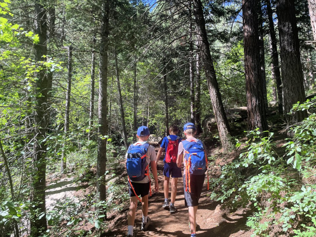
Boys hiking to Loud’s Cabin in North Cheyenne Canyon
More Cheyenne Canyon Hikes
As you can already tell by the Mount Rosa hiking routes, North Cheyenne Canyon’s 1,626 acre park promises exciting views and lots of nature bathing amidst pine trees and aspen groves.
Find some of the best Colorado Springs hikes within minutes of parking at the top of North Cheyenne Canyon Road.
Admission is always free and is this hiking area is open 365 days a year from 5 am to 9 pm. Walkers, hikers, bikers, equestrians and pet owners alike can explore these wonderful Colorado trails.
Read about our favorite North Cheyenne Canyon hikes, of which many begin from Seven Bridges Trail.
We dish about all of our best breweries in Colorado Springs in a complete separate post.

Can I Backpack on the Cheyenne Canyon Trails?
Yes you can!
Hop on the Mount Rosa Loop via Barr Camp for a 26.6-mile loop trail in Colorado Springs. This is challenging trail is used for backpacking overnight or a really long day hike.
That 26.6 mile long trail is a humdinger and would be ideal training for the famous Grand Canyon Rim to Rim trek. We’ve hiked it! We can show you how via the South Kaibab to North Kaibab trails.
Looking to Backpack the Iconic Four Pass Loop in the Maroon Bells? Melody unpacks how to successfully complete this must-do Colorado hiking adventure!