
5 Easy Hikes Colorado Springs Locals Love (Plus 1 Local Challenge)
This page contains affiliate links. If you make a purchase via a link on this page, we make a small commission at absolutely no extra charge to you. Thank you for your support of this small women-led business.
5 Easy Colorado Springs Hikes Locals Love *and You Will Too!
Five easy Colorado Springs hikes under 4 miles deliver stunning Pikes Peak views, Garden of the Gods red rocks, and perfect sunrise or sunset spots. Ideal for beginners, families, and locals looking for quick outdoor escapes. Then, when you are ready to level up, there is a sixth hike: a true local Colorado Springs challenge to earn.
While high adventure, adrenaline thrilling outdoor adventures can be fun, there is something comforting about the reliable but beautiful and easy hike.
With over 20 years of living in Colorado Springs under my belt, I have a few tried and true dependable trails I hike repeatedly.
Just like my Starbucks latte (no frills, just milk and espresso please!), these easy hikes Colorado Springs has satisfy that outdoors craving with mountain views, sunset watching hangouts, and perfect resting spots without adding too many miles to your feet.
Colorado Springs is full of chill trails that make for a super fun and easy outing! Whether you're chasing epic mountain views or hunting for the perfect sunset spot, these six hikes are some of the most reliable and enjoyable in the area—perfect for the outdoor explorer looking for easy hikes in Colorado Springs.
Here is how this guide works. The first five are genuinely easy. Short, well marked, family and beginner friendly. They are the hikes locals send visitors on and the ones we hike ourselves on a regular weekday.
The sixth is different. Section 16 is the local challenge. It is the hike to do after you have explored the easy ones and want to earn a bigger view. Consider it your graduation hike.
Whether visiting for a day or relocating permanently, use this guide to find a hike near you and create your own tranquil sanctuary.
No matter what, these easy Colorado Springs hikes need to be on your to do nature list.
Table of Contents
Pulpit Rock *Center COS
Ute Valley Park *West side COS
Garden of the Gods *Center to South COS
Palmer Park *Center to East Side COS
Painted Mines *East of COS
THe Local Challenge Section 16
FREEBIE!
Want these hikes as an easy to print PDF?
Just hit the red button. By signing up to download the PDF you agree to receive emails from Colorado Hikes and Hops about all the cool stuff we blog about. Like being outdoors, finding great beer, and reading awesome books. We’re not into spam, just mountains.
Pulpit Rock in the center of the city is one of our favorite easy hikes in Colorado Springs.
Pulpit Rock
Pulpit Rock in the center of the city is one of our favorite easy hikes in Colorado Springs.
Easy Hiking Trail in Colorado Springs For Sunrise & Sunset
The Colorado sky is immense and in a quick 1 mile hike and an easy 250 feet of elevation gain, you can hike to one of the highest points in the city to watch the sunset (or sunrise) overlooking Pikes Peak Mountain.
That makes this Colorado Springs hike double easy—you can be a morning person or a night owl and enjoy the sunrise or sunset.
Your pick.
Pulpit Rock at sunrise
2026 UPDATE! Trailhead Closures and a New Trail
Big changes are underway at Pulpit Rock (part of Austin Bluffs Open Space). As of June 1, 2026, the main southern parking lot off Nevada Avenue is closed for construction.
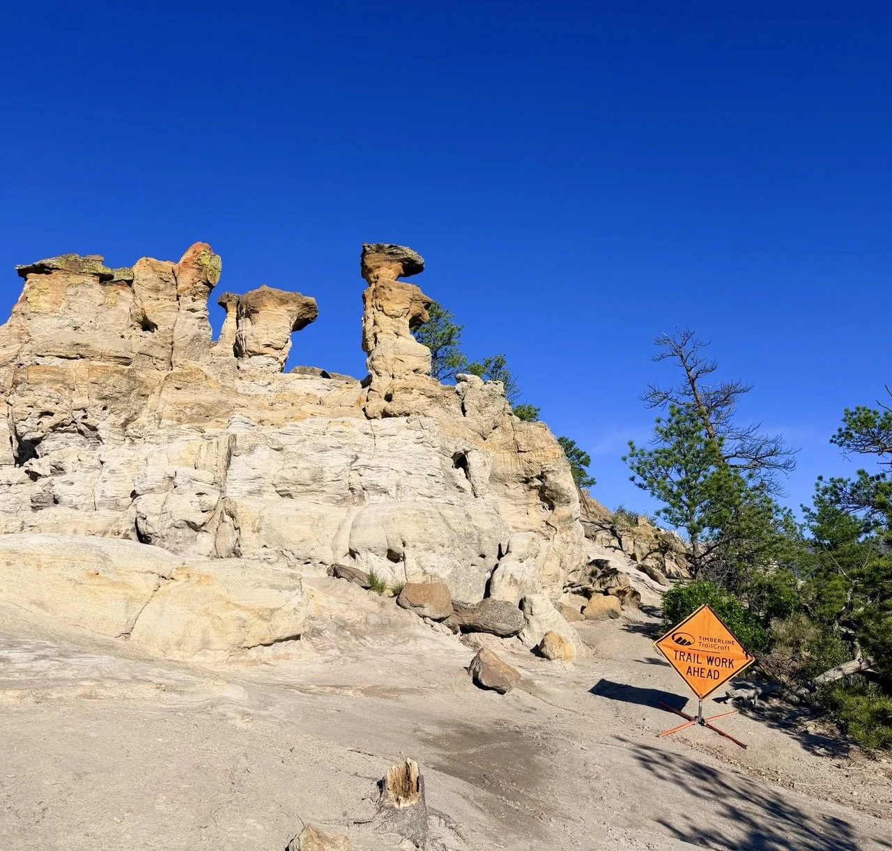
Pulpit Rock construction as of June 2026
Here is the good news. You can still hike Pulpit Rock. The park is still open and reachable through trailheads in the surrounding neighborhoods, and the Summit Trail still takes you to the top. You just need to plan your access point before you go.
The city is also building a brand new hiking only route to the top, a set of stone steps that locals are already calling a mini incline. Coverage has referred to it as both the Enlightenment Trail and the Inspiration Trail, so the final name may still be settling. Either way, it adds over 400 steps straight up to the summit. Think of it as a pocket sized version of the Manitou Incline right in the heart of the city.
Construction is expected to run through summer 2026, and an exact opening date has not been set. Because closures and access points are shifting during construction, check the City of Colorado Springs Parks page for Austin Bluffs Open Space before you head out. That is where you will find current trailhead access, closure maps, and timing details.
LOCAL TIP! Until the new stair trail opens, the easy summit route is still the move for sunrise and sunset. Just give yourself extra time to find open neighborhood parking and the open trailhead.

Directions and Parking Information
Off I-25, take exit 148 for North Nevada Avenue, toward University Village Shopping Center. At the light by the UCHealth facility, turn left (see brown signs for Pulpit Rock). Follow to dirt parking lot on the right.
Trail details
This gray and white rock formation can be seen from I-25 as you drive through Colorado Springs. Because you are in the heart of Colorado Springs, you have spectacular views of Pikes Peak, the fourteener known as America’s Mountain.
A relatively easy path to hike up, now well marked thanks to trail maintenance by our city, this is one of the best short and easy hiking trails in Colorado Springs for that any time of the day escape into nature!
In just .8 miles, you’re at the top of some pretty cool rocks with spectacular Pikes Peak views!
Follow the wide path past the map to the trail veering right up the meadow; we spotted a sign for the summit trail posted by a buck-and-rail fence.
More signs marked the way as the trail switchbacks up and around the north face of Pulpit Rock, quickly reaching views of Pikes Peak and the range from Cheyenne Mountain to Mount Herman.
Around the half-mile mark, a bike-optimized trail drops to the left. The summit trail continues right, up through the woods toward the lesser-viewed backside of Pulpit Rock.
No rocks to navigate now; the trail seamlessly stretches to the rock and the breathtaking panorama.
SEE MAP BELOW FOR NEW TRAIL DIRECTIONS
While there are still many social trails to meander, the one below is the official way up!
No matter which of the many short hikes in Colorado Springs Pulpit Rock park you might take, spend a minute to sit and watch the glorious colors light up this majestic fourteener, breathe and soak in all the brilliant glory of a Colorado sunset (or sunrise).


Trail Downside?
You’ll probably be sharing that spot with others because it’s one of the most accessible short and easy hikes Colorado Springs city has. Don’t let that deter you!
Park at the trailhead just off Nevada Avenue and hike yourself up to the top of Pulpit Rock. The city of Colorado Springs recently created a well defined trail to the top of Pulpit Rock.
LOCAL TIP! This all weather hiking trail gives you sunset/sunrise views no matter the season. Sunset in Colorado in the winter is around 5ish pm. If you want to get to the top before then, plan on starting out at 4:15p-4:30p depending on your speed.
POST HIKE HOPS!
Head across the street to University Village for a meal. From quick and affordable to a sit down steak dinner, there is something here for every appetite and budget.
Hacienda Colorado
Mexican flavors with Rocky Mountain style. 5246 N Nevada Ave 80918 719 418 7999
Il Vicino Wood OVen PIzza
Want something easy on the wallet after your hike? Il Vicino is right here in University Village. Wood fired pizzas, fresh ingredients, and a casual vibe make this a local favorite. Build your own pie or grab a salad and a craft beer. 5214 N Nevada Ave 80918 719 590 8633
Cowboy Star
Traditional Steakhouse with seafood specialities for all palates. They have a pretty amazing happy hour with a stout menu filled with dinner hour portions. 5198 N Nevada Ave 80928 719 639 7440

Visit Colorado when you want, how you want, and where you want.
Spring, Summer, Fall, or Winter — RV rentals in Colorado are a fabulous way to soak in all the natural hot springs, hiking, biking, fishing, climbing, paddling, skiing, and more with the ones you love the most.
EXCLUSIVE PROMO OFFER
Save $50 OFF your next Outdoorsy RV Rental when you use our exclusive Colorado Hikes and Hops promo code “COHH50” on your next booking.

Ute Valley Park
This sprawling urban park in the middle of the Rockrimmon neighborhood is one of the best parks in Colorado Springs. Ute Valley Park offers hiking, walking and biking trails as well as a gentle incline that will take you to some fantastic Colorado mountain viewing.
For easy hikes Colorado Springs has with views, Ute Valley Park is your place! Look for the Ute Valley Park Loop located at the trailhead just off Vindicator Drive.

Public property of Coloradosprings.gov/parks
Directions and Parking Information
I-25 to exit 149 (Woodmen Road). Keep right at fork. Turn Right at Vindicator. Park will be on left side about a mile up the street.
Trailhead parking accommodates around 20 cars. You may park on the side streets of neighborhoods directly across the street from the park. Park has only two porta-potties. Consider using the bathroom down the street at the local grocery store before hiking.
Rest on benches along the trail, taking in incredible views of Pikes Peak Mountain!
Ute Valley Park Loop Trail
Mileage: 3.4 miles. Elevation: under 500’
NOTE! With over 20 easy hiking trails in Colorado Springs visitors have to choose from, Ute Valley Loop shares many with bikers! Keep to the right and leash your dog.

This is the Ute Valley Park Loop Trail Map via Melody’s hike on All Trails
For the Ute Valley Park Loop trail, stay to the west side of the loop (west = mountain side). If you want more climbing and hills, you can easily hike along the top of the ridge, stopping to watch the sunset (or sunrise) before heading back to your vehicle.
If you feel better with a map downloaded, click on the map above for the All Trails link. These short hikes in Colorado Springs are well marked, so having a map is not necessary.
The hiking trails offer both shade and exposed rock, giving you a desert-like feel. Benches and large flat rocks offer a comfortable space to sit and think. Wildlife including many birds, make this Colorado park their home.
Most of the park’s terrain is rocky and sandy making these easy hikes near Colorado Springs fun for all types of adventure!
LOCAL TIP! Colorado Springs recently added acreage to the park, giving you more places to hike. In the summer months, keep an eye out for rattlesnakes.
If you do see a rattlesnake, give them space—stay 5 feet back, move away slowly, and never touch or provoke them.


POST HIKE HOPS!
After the hike, you are in the heart of Rockrimmon… Nakhon Luang Thai and Salsa Brava are close by neighborhood restaurant options for your meal plans.
Nakhon Luang Thai Kitchen
In the spot where Narai Thai used to be, this family run kitchen serves up authentic Thai with real care. Tell them the flavors you are craving, spicy, sweet, savory, and they will steer you right. Curries, drunken noodles, and made in house crab rangoon. 805 Village Center Dr 80919 719 531 5175
Miguel’s Mexican Bar and Grill
A newer addition to Rockrimmon and a welcome one. Reasonably priced fajitas, fresh guac, and enchiladas verdes that locals are already raving about. A frosted mug and a salted rim never hurt after a hike either. 802 Village Center Dr 80919 719 559 0877
Salsa Brava
A family-owned business since 2002, Mexican at its best. Different nights feature cocktail specials. Call ahead for Patron night - you won’t be disappointed. 802 Village Center Drive 80919 719 266 9244
3.14 Sweet and Savory Pi
Owned by an ultrarunner, this is the perfect place to head after heading on easy hikes Colorado Springs locals and visitors love! Sweet pies are made daily. Savory favorites include the Veg Out and Mojo Cuban Pork. Don’t discount the Go Greek salad. 5152 Centennial Blvd 719-314-6172

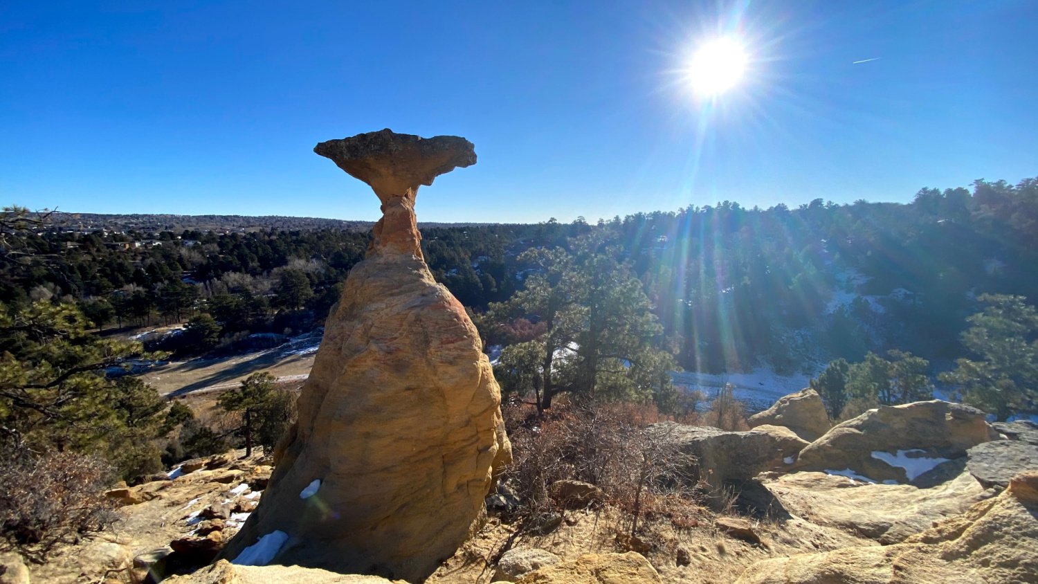
Garden of the Gods
Hands down, Garden of the Gods is the best park in Colorado. Every trail in the park is easy, accessible, fun, and packed with views. Some of the best easy hikes in Colorado Springs are in the Central Garden!
I, Melody, avoided Garden of the Gods for several years, convinced this number one visited park in Colorado Springs had too many people. Fortunately, I found the outer loop trail and fell in love with this majestic park.
How many other cities have blades of red rocks exploding up into the air in front of a fourteener like Pikes Peak? For easy hikes Colorado Springs visitors can enjoy without too much altitude difficulty, we have our favorite ones below!
One of the best sunrise spots *a local secret!
This is seriously easy hiking with postcard views. Admission to Garden of the Gods is FREE!.
On the hunt for easy hikes in Colorado Springs with prime sunset/sunrise views? Garden of the Gods is your place! It’d be a crime to choose just ONE place in the Garden of the Gods to enjoy a sunrise or sunset so we have a few favorites!

Siamese Twins Rock Formations
Siamese Twin TRAIL DETAILS
*One of many easy Colorado Springs hikes in Garden of the Gods!
SIAMESE TWINS TRAIL DETAILS:
Mileage: 1/2 mile Elevation Gain: 104’
From the parking lot, a large trail sign marks the beginning of this short and easy hike in Colorado Springs. While the initial hike begins with an uphill, it doesn’t climb too much. Watch for trail signs that take you to the LEFT to see the rock formations.
You’ll do a little bit of walking over rocks and sandy gravel so closed in shoes are preferred. However, a short and easy hike means you can wear most anything and be okay.
Plan on time to enjoy climbing over the rock formations, taking pictures in the keyhole and enjoying the panoramic views in this area.
Melody’s favorite hikes to take family and friends on is exploring the Siamese Twins Rock formations. This half mile loop hike is doable for almost every hiking level.

DIRECTIONS TO SIAMESE TWINS TRAILHEAD
Take exit 146 off I25. Continue on N 30th street to traffic circle. Take first exit to Gateway Rd. Take right onto Juniper Way Loop. Continue to Garden drive (slight right) and take right onto Spring Canyon Height drive. There is a small parking lot for Siamese Twin Trail.
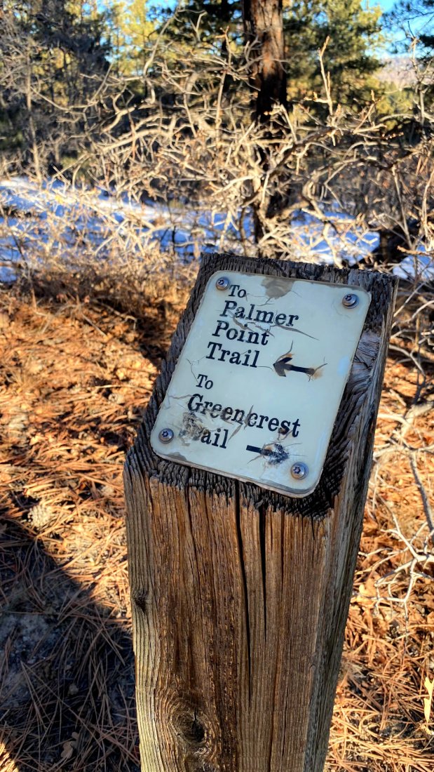
To access more easy trails Colorado Springs Garden of the Gods has, park at the main parking lot and take one of many well marked trails. Trail signs, like this one, are accurate and easy to navigate.

LOCAL TIP! Take a picture of the map on your phone and sync of trail signs with your map as you enjoy these short hikes in Colorado Springs.
Directions/Parking Information To Garden of the Gods
The Main Parking lot is just off Juniper Way Loop. From 30th street, turn west (toward Pike’s Peak) onto Gateway Way. At the junction turn right onto Juniper Way Loop. The lot will be on your left. There are several other areas to park. Check out the GOG parking and trail map.
Where to go in the Garden of the Gods?
While most people hit the trails closest to the parking lots, I recommend starting your hike on the Outer Loop where there are less people—but just as awesome views. It’s really nonstop views on any hiking trail you pick in the park.
With millions of visitors each year, the Garden of the Gods in Colorado Springs is one of the most visited places in the state… and one of the most photographed.
Garden of the Gods Audio Tour: A Local’s Take for Under $10!
Hike for Life founder Bruce helps you see Garden of the Gods in a whole new way—for under $10! This audio tour reveals hidden trails, stunning views, and the park’s untold stories.
Sunrise with Dutch Bros Coffee and Pikes Peak!
SHORT AND EASY OPTIONS to explore GARDEN OF THE GODS
A no-hike option is the overlook on Ridge Rd. Drive. (647 Ridge Rd, Colorado Springs, CO 80904)
LOCAL TIP! Remember that Garden of the Gods is lower, therefore the sun sets BEFORE 5:30pm in the winter, you’ll want to get there around 4:30pm.
A drive-only option is the Garden of the Gods loop, starting at Gateway Road opposite the visitor center. Keep right on one-way Juniper Way Loop to make a 2.4-mile loop around the central Garden zone.
Two large parking areas and several smaller lots let you stop to admire the views and take some selfies.
The perfect short and sweet option for easy hikes near Colorado Springs is Siamese Twins.
OTHER OPTIONS: Park at main parking lot in the park and hop out for a quick hike. You can choose 1, 2 or even 11 mile options. Garden of the Gods is free. Grab a full color map at the visitor center on your way in.
With many trail options to choose, you can make this park your own. Check out this all exclusive post about the Garden of Gods, including trail mileage, maps and estimate hiking times.


POST HIKE HOPS!
After you’ve spent some time at the Garden of the Gods, head over to Old Colorado City to eat at TAPAteria or Ristorante de Sopra!
TAPAteria
Spanish style tapas with wine flights and cocktails 2607 W. Colorado Ave. 80904 719 471 8272
Ristorante de Sopra
Authentic Upscale Italian. In the summer, head to their rooftop seating for a glass of wine with a view.
4 S 28th St, Colorado Springs, CO 80904 719 344 8119

Here’s our go-to gear for Colorado Hiking Trails in 2026:
We love the Osprey Sirrus Hiking Daypack for women, or the Stratos version for men, for carrying water, layers, and snacks on Colorado day hikes
Lightweight, versatile Hiking Poles built for a full day’s send on the trail — hike longer and stronger
2L or 3L Water Reservoir — This affordable reservoir is easy to fill
Patagonia Torrentshell - a true waterproof rain jacket and fantastic layering piece
Nano Puff Jacket - our favorite for 3 seasons in Colorado
Our favorite hiking pants for Colorado trails. Lightweight, stretchy, and bult for everything from a quick Pulpit Rock sunset to a full day on Section 16.
Warm days call for the right hiking shorts. We break down our go to picks for staying cool and comfortable on the trail.
Where to Stay in Colorado Springs
VRBO Mountain Home for Rent
Are you inspired to plan a Colorado Springs trip or perhaps you’re thinking about relocating to Colorado Springs?
Reserve a vacation home for your crew while checking out the housing market and trails. Add in a few days to visit the Cheyenne Mountain Zoo built into a mountain. Or race with Olympic sprinters at the Olympic and Paralympic museum.
FAVORITE THINGS TO DO IN COLORADO SPRINGS!
We made a list of our top 50 things to do in Colorado Springs with kids and visitors alike! Many of the things are free or almost free. Having lived in this city for over 25 years, check out my favorite local only spots that will make your stay extra special too!

More fantastic views around Pikes Peak
What better way to experience this city's stunning panoramic vistas than through the exhilarating Seven Falls ziplines? Whether you're an adrenaline junkie seeking adventure or a nature lover looking for unique ways to see the views, here are the best Colorado Springs ziplines. Soar above treetops, glide across canyons with your crew, and leave with an unforgettable experience under Pikes Peak.
When you book this or most other Broadmoor outdoor adventures online and you enter our exclusive reader promo code "COHIKES", you save 10% OFF that experience!
Palmer Park
Located in the heart of Colorado Springs, this Colorado Springs park is easy to access. It has not one but two large dog parks.
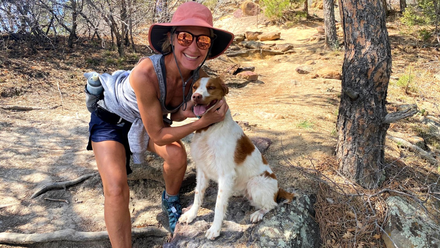
ALERT DOG LOVERS! We often bring our dog, Annie, with us. Our first stop is always the dog park to let her burn off all that Brittany Spaniel energy before hitting one of 26 trails within the park.
For great city and mountain views, I recommend hiking the easy trails Colorado Springs Palmer Park has an ample amount of. This large park sits in the center of the city, offering easy hikes inside.
There are many routes to pick. Most of them take you to the top, giving you wide space to explore and see the sights of Colorado Springs. Maps are located throughout the park on trail placards. Well marked trail signs follow routes, winding around the park. It’s hard to get lost in this park as most of the trails eventually merge to the main paved road.
Pikes Peak views from Palmer Park
There is a large area at the summit, giving you wide berth to sit and reflect while taking in Colorado Springs city views and Pikes Peak’s majesty.
One of our favorite easy hiking trails in Colorado Springs is the Edna Mae Trail.
NORTH CANON, EDNA MAE BENNETT AND TEMPLETON TRAIL
Mileage: 2.5 miles Elevation Gain: 314’
Directions and Parking Information
N. Union Blvd to N Circle Blvd. Turn left onto N Circle Drive. Turn Left onto Paseo Road. Destination will be on left (Grandview Trail)

TRAIL DETAILS
A very well marked trail (see map above), make sure to wear closed in shoes. This tends to be quite rocky with a little bit of scrambling. The first half mile of this trail has you climbing a bit.
The rest of the hike takes you on rolling hills, giving you incredible views of Pikes Peak and Colorado Springs.
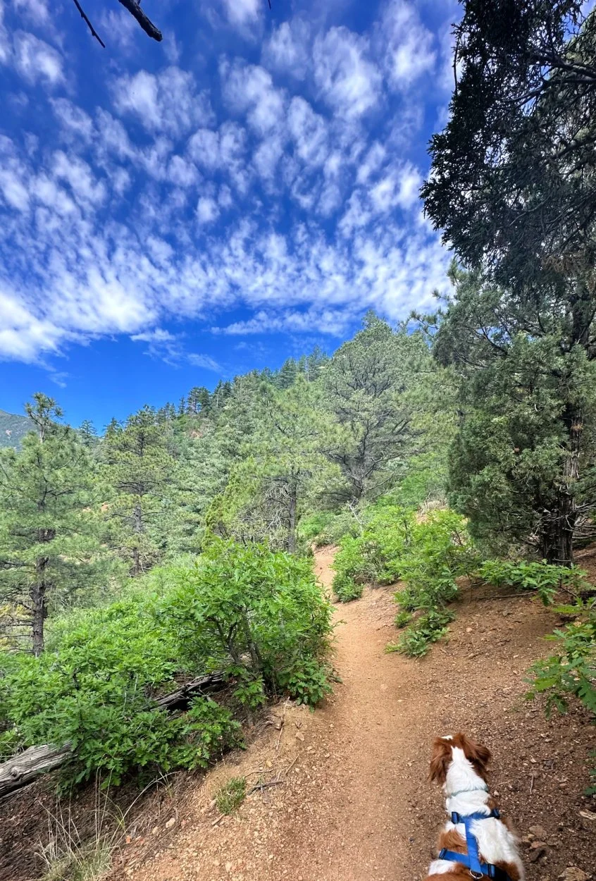
NOTE! While dogs are required on leash, many do not follow this rule. Be prepared to run into many locals whose dogs are friendly but off leash!
There are many ways to access this park.
Most parking options and dog park locations are found at the park near the intersection of North Academy and Maizeland Road.

MORE Easy Hikes in Colorado Springs Palmer Park HERE!
There are so many options for short and easy hikes in Palmer Park. Well marked signs with easy access to the main paved road, pick a spot and head out! Most hikes are around 1-2 miles in length.
Some favorite short hikes in Colorado Springs Palmer Park include:
Sentinel Point via Grandview and Cheyenne Trail Loop | 3 miles | 290’ elevation gain
Cheyenne and Grandview Trail Loop | 1.7 miles | 180’ elevation gain
TRY OUT THESE 26 trails of varying lengths and elevations FOR EVEN MORE COLORADO HIKING FUN!
FUN FACT! Each year Colorado’s Search and Rescue hosts a January 1 Rescue Run. It carries on no matter the weather with options for 5K and 10K runners. This is a great way to support our local first responders while burning off holiday indulgences.
Consider taking a daypack with you and spend the morning exploring this city park. Load up with some good ‘ole candy and water for an extra special time. There are many places to sit and reflect along the trail!
POST HIKE HOPS
We love a steamy cup of coffee after a great hike. Because Palmer Park is in the heart of Colorado Springs, there are so many fun options for food. Here’s a few of our favorites.
Hold Fast Coffee
2360 Montebello Square Dr Suite H1, Colorado Springs, CO 80918
Homemade pastries from local chefs combined with some of the best coffee you’ll find in Colorado Springs, Hold Fast Coffee is one of Melody’s favorite post hike stops!
Heart of Jerusalem
4587 Austin Bluffs Pkwy, Colorado Springs, CO 80918
Heart of Jerusalem Cafe is known for having the tastiest hummus in town, and they also serve affordable Mediterranean food that includes fresh ingredients like olive oil, grains, fruits, veggies, and lean proteins. Their menu has yummy dishes that are good for you and full of great flavors from around the Mediterranean.

Painted Mines
Photo Cred CO14K
2026 UPDATE! El Paso County has now completed its Master Plan for Paint Mines Interpretive Park. After years of rising visitation wore on the trails and fragile clay formations, the county finished a long range plan to protect the hoodoos and archaeological sites while keeping the park open to the public. Expect to see ongoing improvements aimed at preserving this one of a kind place.
GOOD TO KNOW! No pets allowed, not even on leash. The park is free and open dawn to dusk year round. Stay on the designated trails. The clay formations are thousands of years old and fragile, and protecting them is exactly why the Master Plan exists.
Directions and Trailhead Information
From US-24 E, pass by NAPA Auto Parts-M3 Inc (on the right). Take Paint Mine Road to your destination.
This is one of the best easy hikes near Colorado Springs in Calhan, 35 miles northeast of the Springs. While off the beaten path, the beauty of this open space is worthy of repeated visits. I recommend visiting Painted Mines at sunrise or sunset as the sunlight really brings out the unique colors of this very easy and fun hike.
The Painted Mines are an underrated geological treasure of our area. The clay rocks were mined for thousands of years by the Native Americans. Hues of pink, peach and yellow adorn the gray clay, creating a beautiful backdrop to the 4 miles of park trails.
These rocks, known as “hoodoos,” are fragile so follow the rules: no climbing, souvenir “rock shopping” or rock hopping please. Colorado’s mud season (spring months) makes this park challenging to navigate.

Map from El Paso County Website. Public Property
Consider visiting other times for the best hiking conditions. The best time to visit this park for hiking is in the summer months at sunrise or sunset.
The serene calm of thousands of years old rocks sitting in the middle of a prairie creates space to think, listen and be curious.
This park evokes wonder and awe, a place to rest your mind and heart.
TRAIL DETAILS
This park has 4 miles of trails to hike and explore. You can’t get lost here. Download the map if you like or just wing it, exploring this truy one of a kind Colorado park! Our favorite way to to explore this park is 3.4 miles outer loop that starts and ends in the parking lot. Going counter clockwise will get the hills out of the way first. With elevation gain of around 200’, this is one of those easy hikes near Colorado Springs all levels can enjoy!
Summit views from Section 16
The Local Challenge: Summit Views from Section 16
This is the true local Colorado Springs hike to earn after the easy ones!
Mileage: 5.7 miles Elevation Gain: 1,293’ Route: Loop
Here it is, the challenge hike. The five hikes above are the easy, reliable ones. Section 16 is the one you graduate to. This is a true local Colorado Springs hike, the trail you do once you have explored the city’s short and easy options and you are ready to earn a bigger view and a real quad burn.
I discovered this hiking trail while training for my first marathon in 2008. Each week we’d meet for long runs, plodding through inches of snow or mud depending on the season.
NOTE! The first 1.5 miles of this hike is tough as it’s mostly uphill. This is not an easy hike like the other five. That is the point. Most of the back half is downhill with stunning forested trail and mountain views. Take it slow, enjoy the stunning views AND tell yourself - the rest of the hike is downhill!
Directions and Trailhead Parking
I 25 to Lower Gold Camp Road. Head up Gold Camp Road. Parking will be along right and left sides of road. Be aware of bikers and runners. This is a locals running and hiking trail.
INSIDER TIP! In the summer months, expect the parking lot to be filled by 6:30 am.
Park in one of two lots along Gold Camp Road. It’s a steady uphill my friends. Although this hike is still on the easy side, for just over a mile you weave and wander, avoiding rocks and risking a turned ankle until you get to the top. However, this hike is done mostly in forest with views of Garden of the Gods to your right as you hike.


From that point on, you’re hiking down through switchbacks on a dirt track. Stunning mountain views with large pine trees make this a shaded hike. Hiking poles sure do help but aren’t essential.
Towards the end of your hike (around mile 4) there is a stream with a small waterfall.
Stop and take in the quiet hush of running water. I often find a rock, sit and drink in nature and all her spectacular glory - truly a happy place to breath deep.
Enjoy the views from the top and then take the loop trail down. You’ll head a bit more uphill before descending the rest of the loop trail down. going counterclockwise is a great way to avoid most bikers.
There is a sweet little stream (and sometimes waterfall in early summer) along the way. In January 2024, Colorado Springs did some major renovations in this area, including at the Section 16 trailhead!
A gravel road and flowers greet you at the base of the hike.
DID YOU KNOW? TOPS is a special tax program in our city that helps take care of our trails, parks, and open spaces. It started in 1997 when people in Colorado Springs voted for it. Then in 2003, they voted again to keep it going until 2025. It's a 0.10% tax, which means it's like paying 1 penny for every $10 you spend.
CoHH TIP! There is a connector trail to Red Rocks Canyon called Intemann Trail. It’ll be on your right about a 1/2 mile or so up the trail from the first trailhead. It’s a steep downhill with ice in the winter months. Wear spikes or you’ll land on your behind a few times! This trail takes you right into the many easy Colorado Springs hikes Red Rocks Canyon boasts!
INTEMANN TRAIL AND MORE: CHECK OUT THIS LINK for connector trails in this area.


Once you get to Manitou Springs, you could connect and combine with the Ute Pass Trail, the Barr Trail, or even the Manitou Incline.
POST HIKE HOPS
Downtown Colorado Springs is a treasure of breweries, coffee shops and amazing food. Post hike food for us means a good brew and burger.
The Wild Goose Meeting House
401 N Tejon St, Colorado Springs, CO 80903
Surrounded by books with tables of every size, Wild Goode Meeting House is just that - a place to hang with people. From coffee to sandwiches to a good brew, your appetite and heart will be filled to the brim here!
Goat Patch Brewing company
2727 N Cascade Ave #123, Colorado Springs, CO 80907
Hands down our absolute favorite brewery in town. Housed in a former elementary school, hang out in the beer garden out back or sit inside. Food trucks always on site along with one of our city’s best bakeries, Nightingale Bread!
New to hiking and need a few things?

We are lifelong members of REI, the one stop shop for outdoor gear, new and used.
Did you know? REI’s one time membership fee of $30 never expires! Sign up your whole family for all the benefits!
Free Shipping, no minimum purchase amount required
Access to 20% off coupons throughout the year.
Member Collection: Early access to limited editions, special offers, on-of-a-kind colabs
20% off bike and show shop services
10% back in rewards annually. Aka The Dividend!
Buy and Trade in Used Gear
Easy Hikes Can Create that Ahhh… Feeling
These easy hikes Colorado Springs offers one of nature’s best gifts: a place to be still. Each park has quiet spots to sit, reflect, dream and perhaps sing.
Each of these hikes is dog friendly and packed with mountain views. The first five are easy enough for any beginner or family. The sixth, Section 16, is there when you want to push a little. You can be an expert hiker or a total beginner. No matter who you are, hike a sunrise or sunset in Colorado Springs and you will never see the same thing twice.
I’ve lived here over 25 years, and every day the light is different on the mountains.
Today, get outside, hike an easy mile or two, sit and watch the sunset over Pikes Peak or simply look up and enjoy all this world has to give!
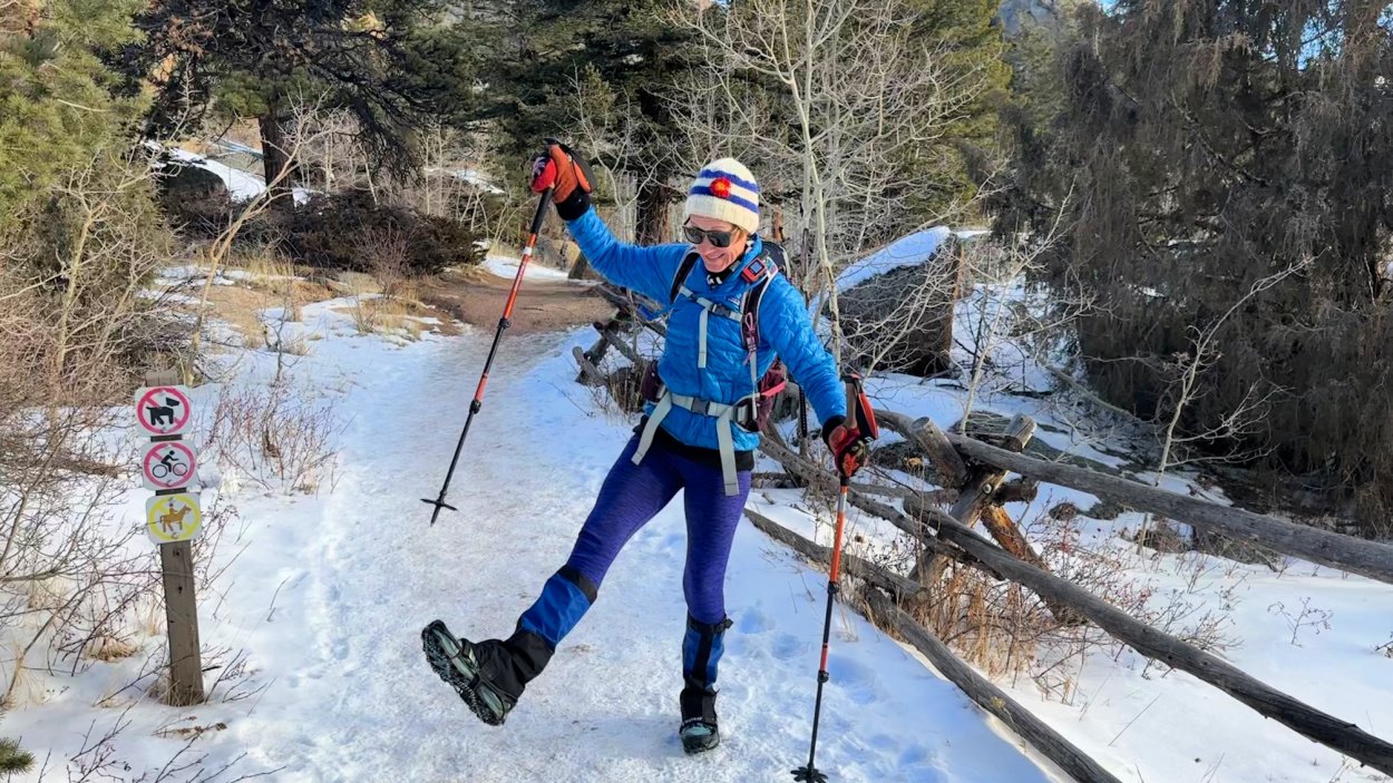
Looking for more easy hikes Colorado Springs locals enjoy? Melody’s favorite 6 are perfect for winter!
BEST WINTER HIKES COLORADO OFFERS - A LOCAL’S FAV 6!
Melody is a huge fan of solo hiking, finding spots in her beloved Colorado Springs that are perfect for any time of year. These 6 hikes are especially amazing in winter, with less people and more outdoor beauty. Ranging from around 4 miles to over 12 miles, consider adding these to your Colorado Springs hiking repertoire.
